Browse / Tunisia / Bizerte / Bizerte
Bizerte
Bizertecity

Bizerte
Total population
136,917
Demographic figures from INS Tunisia. Overview below cites Wikipedia and may reference a different year.
City facts
Sister cities
Facts from Wikidata (CC0).
Overview
Bizerte or Bizerta is the capital and largest city of Bizerte Governorate in northern Tunisia. It is the northernmost city in Africa, located 65 km (40 mi) north of the capital Tunis. It is also known as the last town to remain under French control after the rest of the country won its independence from France. The city had 162,053 inhabitants in 2014.
Read more on WikipediaHistory & geography
History
Arab armies took Bizerte in 647 in their first invasion of the area, but the city reverted to control from Constantinople until the Byzantines were defeated and finally driven from North Africa in 695–98. The troops of Charles V of the Holy Roman Empire captured the city in 1535; the Turks took it in 1574. The city then became a corsair harbour associated to the Ottoman Tunisia and struggled against the French, the Venetians and the Spanish viceroyalty of Sicily. With its occupation of Tunisia in 1881, France gained control of Bizerte and built a large naval harbour in the city. In 1924, after the French government officially recognized the Soviet Union (USSR), the western military fleet of White Russia that had been kept in the port of Bizerte was returned to the Soviet government. The ships were never moved from the port and finally were sold there as scrap metal. In March 1939, towards the end of the Spanish Civil War, Spanish Republican Navy Commander Miguel Buiza ordered the evacuation of the bulk of the Republican fleet. Three cruisers, eight destroyers and two submarines left Cartagena harbor and reached Bizerte, where the French authorities impounded them. During the Second World War, the German and Italian armies occupied Bizerte until Allied troops defeated them on 7 May 1943. During the fighting between the Allied forces and the German Army, many of the city's inhabitants fled to the countryside or to Tunis. The city suffered significant damage during the battle. Due to Bizerte's strategic location on the Mediterranean, France retained control of the city and their naval base after Tunisian independence in 1956. In 1961 Tunisian forces blockaded the area of Bizerte and demanded French withdrawal. The face-off escalated when a French helicopter took off…
Geography
File:Circonscription de Bizerte.png|Circonsciption of Bizerte. Bizerte is on a section of widened inlet and east-facing coast of the north coast of Tunisia, 15 kilometres from Ras ben Sakka (the northernmost point in Africa on the Mediterranean Sea), 20 kilometers northeast of the Ichkeul lake (a World Heritage Site), north of the archaeological site of Utica and 65 kilometers north of Tunis. West of the city there are coastal hills forming an outcrop of the Tell Atlas with well-conserved woods and vantage points. Its associated beaches include Sidi Salem, La Grotte, Rasenjela, and Al Rimel. It is on a section of Mediterranean climate coastline, close to Sardinia and Sicily, as opposed to coasts in the south of the country which have a year-round dry desert climate. The city is centered on the north shore of the canal of Bizerte linking the Mediterranean Sea to a tidal lake, the Lac de Bizerte which is larger than all parts of the town combined, to the immediate south. Built-up areas are in three directions: *South-west along the widening canal with jetties at Pecherie and Jarrouba, the latter associated with Bizerte-Sidi Ahmed Air Base adjoining the opening of the lake and military/rescue heliport. *North are Sidi Salam and Corniche. They are within meters of the coast and on coast-facing slopes of the Ain Berda, a range of hills toward Cap Blanc, a small headland in the Ain Damou Plage natural conservation area. *Zarzouna, Menzel Jemil and Menzel Abderrahmane are on the south shore of the canal, formed by the locality of Zarzouna and the towns of Menzel Jemil and Menzel Abderrahmane, by a moveable bridge and both Menzels face the lake itself. The rest of the isthmus on which they stand is the gently rising Foret de Remel, reaching a high point east of its…
Excerpted from the corresponding Wikipedia article (CC BY-SA).
Geography
Coordinates & boundaries from the US Census TIGER/Line shapefiles.
Climate
Air quality
Walkability
Amenities nearby
Wildlife & biodiversity
Earthquake history
Photos
Sights & places nearby
Notable people from here


People born within ~10 km, from Wikidata (CC0). Click any name for their Wikipedia article.
Nearby places in Bizerte
Geography & sun
Elevation, sunrise/sunset and daylight from Open-Meteo. Solar climatology from NASA POWER.
Nearby airports
Public attention
Pageview totals from the Wikimedia Pageviews API.
Books about Bizerte
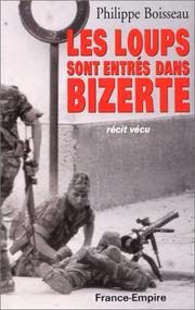
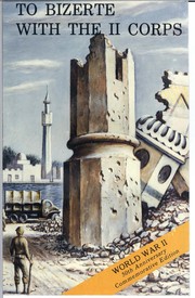
Search results from Open Library.
Recent natural events nearby
Ground air-quality sensors
Recently spotted species
Events
Gallery
Sources
- • Wikipedia
- • Wikidata
- • Open-Meteo / sunrise-sunset.org
- • Wikipedia Pageviews API
- • Open Library