Browse / United States / Tennessee / Collierville
Collierville
Tennesseetown

Collierville
Total population
51,515
Median home value
$485,900
Bachelor's+
Median income
$138,598
Founded
1836
Demographic figures from US Census Bureau · ACS 5-year estimates. Overview below cites Wikipedia and may reference a different year.
City facts
Facts from Wikidata (CC0).
Overview
Collierville, officially the Town of Collierville, is a town in Shelby County, Tennessee, United States, and a suburb located in the Memphis metropolitan area. With a population of 51,324 in the 2020 census, Collierville is the third-largest municipality in the county after Memphis and Bartlett. It is home to the Carriage Crossing shopping mall and is served by Collierville Schools.
Read more on WikipediaHistory & geography
History
The second oldest town in Shelby County, Collierville was laid out in 1836 and named after 19th century businessman Jesse R. Collier, who bought land and advertised it as "The Town of Collier". The original town was chartered in 1850 during the Richard Ramsey mayoral administration. Two significant battles were fought at Collierville during the American Civil War. The first came on October 11, 1863, when Confederate Brigadier-General James Chalmers's division of 3,000 cavalrymen attacked the U.S. federal garrison protecting the Memphis and Charleston Railroad. The garrison, defended by U.S. Army Major-General William T. Sherman, successfully repulsed the Confederates. The second battle was fought on November 3, 1863, when Chalmers was again repulsed, this time by Colonel Edward Hatch. Chalmers withdrew a second time to North Mississippi. The railroad remained open to Tuscumbia, Alabama, for federal troop movements. Estimated casualties were 60 on the side of the Union and 95 on the side of the Confederacy. Because of Sherman's participation in the first engagement, his monument in Washington, D.C. lists "Colliersville" as one of his battles. Federal commanders referred to the settlement as "Colliersville" in official reports. Collierville sustained severe damage during the American Civil War and the original settlement was completely destroyed. Rechartered in 1870 during the James B. Abington mayoral administration; Collierville's population increased with help from the cotton, dairy, and manufacturing industries.
Geography
Collierville is located at (35.054366, −89.682306). According to the United States Census Bureau, the town has a total area of , of which is land and , or 0.41%, is water. * Interstate 269 * Nonconnah/Bill Morris Parkway (State Route 385) * U. S. Route 72 (Poplar Avenue)/Tennessee State Route 86 * State Route 57 (Poplar Avenue) * State Route 175 (Byhalia Road, Collierville Road, S Houston Levee Road, and E Shelby Drive) * State Route 205 (Collierville-Arlington Road)
Excerpted from the corresponding Wikipedia article (CC BY-SA).
Demographics & economy
Race & ethnicity
Source: US Census Bureau — American Community Survey, 5-year estimates.
Geography
Coordinates & boundaries from the US Census TIGER/Line shapefiles.
Climate
Air quality
Industrial & pollution facilities
Natural hazard risk
Health (adults)
Age-adjusted prevalence estimates from CDC PLACES (latest release).
Walkability
Amenities nearby
Wildlife & biodiversity
Schools
Largest nearby schools
- Collierville High SchoolHigh · Collierville · 2,836 students · 19.4:1 ratio
- Cordova High SchoolHigh · Cordova · 2,110 students · 20.7:1 ratio
- Houston High SchoolHigh · Germantown · 1,938 students · 18.6:1 ratio
- Germantown HighHigh · Germantown · 1,806 students · 16.7:1 ratio
- Southwind HighHigh · Memphis · 1,507 students · 23.9:1 ratio
- West Collierville Middle SchoolMiddle · Collierville · 1,309 students · 17.5:1 ratio
- Riverdale Elementary SchoolElementary · Germantown · 1,171 students · 14.1:1 ratio
- Macon-Hall ElementaryElementary · Cordova · 1,141 students · 15.6:1 ratio
Public K–12 schools within ~10 mi from Urban Institute Education Data Portal (NCES Common Core of Data, 2022).
Earthquake history
Photos
Sights & places nearby
Notable people from here


People born within ~10 km, from Wikidata (CC0). Click any name for their Wikipedia article.
Geography & sun
Elevation, sunrise/sunset and daylight from Open-Meteo. Solar climatology from NASA POWER.
Nearby airports
Public attention
Pageview totals from the Wikimedia Pageviews API.
Books about Collierville


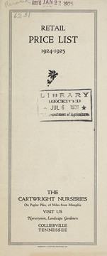
Search results from Open Library.
Recent natural events nearby
Ground air-quality sensors
Recently spotted species
Nearest stream gauge
Events
Gallery
Sources
- • Wikipedia
- • US Census Bureau (ACS 5-year estimates)
- • Wikidata
- • NCES via Urban Institute Education Data Portal
- • CDC PLACES
- • Open-Meteo / sunrise-sunset.org
- • Wikipedia Pageviews API
- • Open Library