Browse / Tunisia / Nabeul / Hammamet
Hammamet
Nabeulcity
Total population
97,579
Demographic figures from INS Tunisia. Overview below cites Wikipedia and may reference a different year.
City facts
Overview
Hammamet is a sizeable town located in Nabeul, Tunisia. Hammamet maps to 36.401°, 10.619° — squarely within the warm temperate belt. Census-style estimates put the resident count near 97,579. Solar-resource estimates put the area at about 1,706 kWh/m² of solar irradiance per year with sunshine for roughly 67% of daylight hours. Climatically, locations at this latitude tend to experience warm summers and cool winters. Continue scrolling for population, climate, environmental and points-of-interest data drawn from public sources.
Summary composed automatically from structured open data on this page. See our Terms for details.
History & geography
Geography
Coordinates & boundaries from the US Census TIGER/Line shapefiles.
Climate
Air quality
Walkability
Amenities nearby
Wildlife & biodiversity
Earthquake history
Photos
Sights & places nearby
Notable people from here


People born within ~10 km, from Wikidata (CC0). Click any name for their Wikipedia article.
Nearby places in Nabeul
- Bir Bouregba3.5 mi away
- Menzel Temime33.5 mi away · pop. 65,645
- Tazoghrane36.8 mi away
- Kelibia40.5 mi away · pop. 58,491
- Ormea554 mi away · pop. 1,967
- Valsorda555.9 mi away
- Casario558.9 mi away
- Fontane560.8 mi away
- Tetti Mecci561.4 mi away
- Prà di Roburent562 mi away
- Battifollo564 mi away · pop. 263
- San Giacomo di Roburent564 mi away
Geography & sun
Elevation, sunrise/sunset and daylight from Open-Meteo. Solar climatology from NASA POWER.
Nearby airports
Public attention
Books about Hammamet
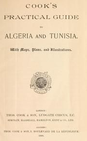
Search results from Open Library.
Recent natural events nearby
Ground air-quality sensors
Recently spotted species
Events
Gallery
Sources
- • Wikidata
- • Open-Meteo / sunrise-sunset.org
- • Open Library