Browse / Türkiye / Bartın / Bartın
Bartın
Bartıncity
Total population
207,634
Demographic figures from TurkStat. Overview below cites Wikipedia and may reference a different year.
City facts
Facts from Wikidata (CC0).
Overview
Bartın is a city in northern Turkey, near the Black Sea. It is the seat of Bartın Province and Bartın District. Its population is 81,692 (2021).
Read more on WikipediaHistory & geography
History
The history of the antique Parthenios city (Παρθένιος in Greek), or Parthenia, dates back to 1200 BC, when its area was inhabited by the Kaskian tribe. In the following centuries, the region had entered under the dominance of Hittites, Phrygians, Cimmerians, Lydians, Greeks, and Persians. Later, it was part of the Roman Empire and then of the Byzantine Empire, until it fell to the Seljuk Turks and the Candaroğulları State between the 11th and the 13th centuries AD. Bartın was conquered by the Ottoman sultan Mehmet II in 1460. In the late 19th and early 20th century, Bartın was part of the Kastamonu Vilayet of the Ottoman Empire.
Geography
The city of Bartın consists of 22 quarters: * Kırtepe * Kemerköprü * Gölbucağı * Orta * Okulak * Köyortası * Orduyeri * Tuna * Demirciler * Aladağ * Karaköy * Çaydüzü * Esentepe * Cumhuriyet * Hürriyet * Karaçay * Ağdacı * Gecen * Gürgenpınarı * Şiremirçavuş * Uzunöz * Yıldız Bartın has a borderline oceanic (Cfb) and humid subtropical (Cfa) climate under the Köppen classification, or an oceanic climate (Do) under the Trewartha classification. Summers are warm, the average temperature is around in July and August. Winters are cool and damp, and the average temperature is around in January and February. For a long time, Bartın city center was considered to only have an oceanic climate (Cfb), with its warmest month being well below the threshold, yet in recent decades climate change and global warming has been contributing to its classification slowly turning humid subtropical (Cfa) and therefore the city center is currently classified as borderline oceanic-humid subtropical. Precipitation is heaviest in autumn and early winter and lightest in spring. Snowfall is somewhat common between the months of December and March, snowing for a week or two, and it can be heavy once it snows. Highest recorded temperature: on 13 July 2000Lowest recorded temperature: on 23 February 1985
Excerpted from the corresponding Wikipedia article (CC BY-SA).
Geography
Coordinates & boundaries from the US Census TIGER/Line shapefiles.
Climate
Air quality
Walkability
Amenities nearby
Wildlife & biodiversity
Earthquake history
Photos
Sights & places nearby
Notable people from here
Geography & sun
Elevation, sunrise/sunset and daylight from Open-Meteo. Solar climatology from NASA POWER.
Nearby airports
Public attention
Pageview totals from the Wikimedia Pageviews API.
Books about Bartın
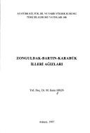

Search results from Open Library.
Recent natural events nearby
Ground air-quality sensors
Recently spotted species
Events
Gallery
Sources
- • Wikipedia
- • Wikidata
- • Open-Meteo / sunrise-sunset.org
- • Wikipedia Pageviews API
- • Open Library
- • Wikidata SPARQL (CC0) — population, area, elevation, inception, head of government, Commons image