Browse / Türkiye / Istanbul / Beyoğlu
Beyoğlu
Istanbultown

Beyoğlu
Total population
238,762
Founded
1926
Demographic figures from TurkStat. Overview below cites Wikipedia and may reference a different year.
City facts
Sister cities
Facts from Wikidata (CC0).
Overview
Beyoğlu is a municipality and district of Istanbul Province, Turkey. Its area is 9 km2 (3.5 sq mi), and its population is 225,920 as of 2022. It is on the European side of Istanbul, Turkey, separated from the old city by the Golden Horn.
Read more on WikipediaHistory & geography
History
The area now known as Beyoğlu has been inhabited since Byzas founded the City of Byzantium in the 7th century BC, and predates the founding of Constantinople. During the Byzantine era, Greek speaking inhabitants named the hillside covered with orchards Sykai (The Fig Orchard), or Peran en Sykais (The Fig Field on the Other Side), referring to the "other side" of the Golden Horn. As the Byzantine Empire grew, so did Constantinople and its environs. The northern side of the Golden Horn became built up as a suburb of Byzantium as early as the 5th century. In this period the area began to be called Galata, and Emperor Theodosius II (reigned 402–450) built a fortress. The Greeks believe that the name comes either from galatas (meaning "milkman"), as the area was used by shepherds in the early medieval period, or from the word Galatai (meaning "Gauls"), as the Celtic tribe of Gauls were thought to have camped here during the Hellenistic period before settling into Galatia in central Anatolia, becoming known as the Galatians. The inhabitants of Galatia are famous for the Epistle to the Galatians and the Dying Galatian statue. The name may have also derived from the Italian word Calata, meaning "downward slope", as Galata, formerly a colony of the Republic of Genoa between 1273 and 1453, stands on a hilltop that goes downwards to the sea. The area came to be the base of European merchants, particularly from Genoa and Venice, in what was then known as Pera. Following the Fourth Crusade in 1204, and during the Latin Empire of Constantinople (1204–1261), the Venetians became more prominent in Pera. The Dominican Church of St. Paul (1233), today known as the Arap Camii, is from this period. In 1273 the Byzantine Emperor Michael VIII Palaiologos granted Pera to the Republic of…
Excerpted from the corresponding Wikipedia article (CC BY-SA).
Geography
Coordinates & boundaries from the US Census TIGER/Line shapefiles.
Climate
Air quality
Walkability
Amenities nearby
Wildlife & biodiversity
Most-observed species
- Hooded CrowCorvus cornix Linnaeus, 1758 · Aves10,761
- Yellow-legged GullLarus michahellis J.F.Naumann, 1840 · Aves10,331
- House SparrowPasser domesticus (Linnaeus, 1758) · Aves7,163
- Great TitParus major Linnaeus, 1758 · Aves6,376
- Rock PigeonColumba livia J.F.Gmelin, 1789 · Aves6,359
- Western JackdawColoeus monedula (Linnaeus, 1758) · Aves5,805
- Eurasian MagpiePica pica (Linnaeus, 1758) · Aves5,744
- Rose-ringed ParakeetPsittacula krameri (Scopoli, 1769) · Aves5,058
Citizen-science & research observations from the Global Biodiversity Information Facility (GBIF).
Earthquake history
Most recent
- M 5 — 2025-10-0222 km S of Marmara Ereğlisi, Turkey
- M 3.8 — 2025-07-0530 km SSW of Kumburgaz, Turkey
- M 4.2 — 2025-07-024 km NE of Gemlik, Turkey
- M 4 — 2025-07-013 km S of Umurbey, Turkey
- M 3.7 — 2025-05-0327 km SE of Marmara Ereğlisi, Turkey
- M 4.3 — 2025-04-2519 km SSW of Kumburgaz, Turkey
Events from the USGS Earthquake Catalog (global) (FDSN Event Web Service).
Photos
Sights & places nearby
Notable people from here
Nearby places in Istanbul
- Bakırköy6.2 mi away · pop. 226,685
- Bibione859.3 mi away · pop. 2,564
- San Giorgio al Tagliamento865.7 mi away
- Villanova Sant'Antonio868.7 mi away
- Villanova Santa Margherita869.1 mi away
- Borghetto870.8 mi away
- La Salute di Livenza871.4 mi away
- San Giorgio di Livenza871.4 mi away
- Torre di Fine872.1 mi away
- Ponte Crepaldo875.1 mi away
- Lido di Jesolo876.4 mi away · pop. 10,523
- Blessaglia877.8 mi away
Geography & sun
Elevation, sunrise/sunset and daylight from Open-Meteo. Solar climatology from NASA POWER.
Nearby airports
Public attention
Pageview totals from the Wikimedia Pageviews API.
Books about Beyoğlu
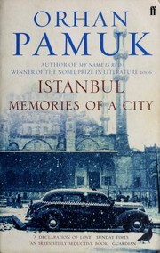


Search results from Open Library.
Recent natural events nearby
Ground air-quality sensors
Recently spotted species
Events
Gallery
Sources
- • Wikipedia
- • Wikidata
- • USGS Earthquake Catalog (global feed)
- • GBIF (Global Biodiversity Information Facility)
- • Open-Meteo / sunrise-sunset.org
- • Wikipedia Pageviews API
- • Open Library
- • Wikidata SPARQL (CC0) — population, area, elevation, inception, head of government, Commons image