Browse / Türkiye / Bitlis / Bitlis
Bitlis
Bitliscity

Bitlis
Total population
352,277
Demographic figures from TurkStat. Overview below cites Wikipedia and may reference a different year.
City facts
Facts from Wikidata (CC0).
Overview
Bitlis is a city in southeastern Turkey. It is the seat of Bitlis District and Bitlis Province. Its population is 53,023 (2021). The city is located at an elevation of 1,545 metres, 15 km from Lake Van, in the steep-sided valley of the Bitlis River, a tributary of the Tigris. The local economy is mainly based on agricultural products which include fruits, grain and tobacco. Industry is fairly limited, and deals mainly with leatherworking, manufacture of tobacco products as well as weaving and dyeing of coarse cloth. Bitlis is connected to other urban centres by road, including Tatvan on Lake Van, 25 km to the northeast, and the cities of Muş (Mush), 100 km northwest, and Diyarbakır, 200 km to the west. The climate of Bitlis can be harsh, with long winters and heavy snowfalls. Since the local elections of March 2019, the Mayor of Bitlis is Nesrullah Tanğlay. Bitlis has been identified in the scholarly literature as a historically Kurdish city. Martin van Bruinessen (2013), examining Kurdish urbanisation, noted the predominantly Kurdish character of Bitlis and its population. Demographic studies of Turkey's Kurdish-majority provinces have consistently identified Bitlis among the provinces with the highest concentrations of Kurdish speakers.
Read more on WikipediaHistory & geography
History
The origin of the name Bitlis is not known. A popular folk etymology explanation, without historical basis, is that it is derived from "Lis/Batlis", the name of a general said to have built Bitlis castle by the order of Alexander the Great. To Armenians, it was known as Balalesa or Baghaghesh, and later Baghesh. According to one popular Armenian folk story, on a cold, wintry day a donkey escaped from its stable and wandered down to the Jlifat valley below. The donkey became trapped in the snow and froze to death. It was only discovered a week later, once the snow had melted; thus, it received the name , or "Cold Donkey." Baghesh was one of the most important cities of the Kingdom of Armenia's province of Aghdznik', and it served as the primary fortress of the province's canton of Salnodzor. The Arabs conquered Baghesh at the end of the seventh century and it eventually became the capital of the Zurārid emirs of Arzan. Because it was on an important trade route, it prospered greatly. The next two centuries, however, marked a turbulent period in the town's history. After Bugha al-Kabir's destructive 852-855 campaign in Armenia, the Shaybanid emirs wrested control of Baghesh from the Zurārids; thereafter, in the first quarter of the tenth century, it was taken by the Kaysite emirs of Manzikert. In his 929-30 campaign against the Kaysites, the Byzantine general John Curcuas was able to capture and annex Baghesh. For centuries, Bitlis and nearby Kurdish principalities were deeply influenced by Persian language and culture through their ties with Persian-centered empires. Persian was the language of administration, used by Sufis, poets, merchants, and scholars. Bitlis’s elites adopted Persian to align with the broader Persianate world. From the 14th century, Persian…
Excerpted from the corresponding Wikipedia article (CC BY-SA).
Geography
Coordinates & boundaries from the US Census TIGER/Line shapefiles.
Climate
Air quality
Walkability
Amenities nearby
Wildlife & biodiversity
Most-observed species
- Hooded CrowCorvus cornix Linnaeus, 1758 · Aves13
- Eurasian MagpiePica pica (Linnaeus, 1758) · Aves12
- Rock PigeonColumba livia J.F.Gmelin, 1789 · Aves11
- RookCorvus frugilegus Linnaeus, 1758 · Aves10
- House SparrowPasser domesticus (Linnaeus, 1758) · Aves9
- Western JackdawColoeus monedula (Linnaeus, 1758) · Aves9
- Loweia tityrus (Poda, 1761)Loweia tityrus (Poda, 1761) · Insecta8
- Armenian GullLarus armenicus Buturlin, 1934 · Aves8
Citizen-science & research observations from the Global Biodiversity Information Facility (GBIF).
Earthquake history
Photos
Sights & places nearby
Notable people from here


People born within ~10 km, from Wikidata (CC0). Click any name for their Wikipedia article.
Nearby places in Bitlis
Geography & sun
Elevation, sunrise/sunset and daylight from Open-Meteo. Solar climatology from NASA POWER.
Nearby airports
Public attention
Pageview totals from the Wikimedia Pageviews API.
Books about Bitlis
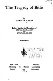

Search results from Open Library.
Recent natural events nearby
Ground air-quality sensors
Recently spotted species
Events
Gallery
Sources
- • Wikipedia
- • Wikidata
- • GBIF (Global Biodiversity Information Facility)
- • Open-Meteo / sunrise-sunset.org
- • Wikipedia Pageviews API
- • Open Library
- • Wikidata SPARQL (CC0) — population, area, elevation, inception, head of government, Commons image