Browse / Türkiye / Istanbul / Güngören
Güngören
Istanbultown

Güngören
Total population
298,509
Founded
1992
Demographic figures from TurkStat. Overview below cites Wikipedia and may reference a different year.
City facts
Facts from Wikidata (CC0).
Overview
Güngören is a municipality and district of Istanbul Province, Turkey. Its area is 7 km2, making it the smallest district of Turkey in terms of land area. Its population is 282,692 (2022), down from a peak of 318,545 in 2007. It is an industrial and working class area. It is located near the district of Bakırköy on the Çatalca Peninsula in the western half of Istanbul Province. Güngören, which became a district on June 3, 1992, is adjacent to Zeytinburnu to the east, Esenler, Bakırköy in the south, and Bahçelievler to the west. The district is now fully urbanized and consists of 11 neighborhoods. The mayor is Bünyamin Demir (AKP).
Read more on WikipediaHistory & geography
History
Güngören was once primarily farmland set on rolling hills and was known by the village name of Vidos. Güngören, like neighboring Zeytinburnu and Bağcılar have grown rapidly since the 1950s and in a largely unplanned way which has caused significant quality of life issues. Informally built gecekondu have been replaced with more formal apartment blocks while vacant land has been transformed into trade zones and industrial parks. The majority of the population is made up of migrants who arrived from rural Anatolia. As metropolitan Istanbul grew, the national government developed State road D.100 which runs through the center of the district. The construction of the highway led to the demolition of hundreds of informally built housing units but also made travel through the region significantly easier. In 1992, the T1 line of the Istanbul Tram was extended through the neighborhood towards its terminus in Bağcılar. The area is now served extensively by the Metrobus, M1A line of the Istanbul Metro and the Istanbul Tram. Despite the evolution of the district into a formally built urban area serviced by the Istanbul Metropolitan Municipality it remains at high risk of damage due to earthquakes. The area is increasingly the focus of both the national and municipal governments for reconstruction and retrofitting of existing structures in order to mitigate risk of collapse. Güngören is a district with a variety of socio-economic issues including poverty, joblessness, poor education, pollution, poor quality construction and lack of green space. While originally catering to migrants from Anatolia, the area is now home to a growing population of people from Afghanistan, Xinjiang and Syria. The district was the site of the 2008 Istanbul bombings. The area is hard to distinguish from…
Excerpted from the corresponding Wikipedia article (CC BY-SA).
Geography
Coordinates & boundaries from the US Census TIGER/Line shapefiles.
Climate
Air quality
Walkability
Amenities nearby
Wildlife & biodiversity
Most-observed species
- Hooded CrowCorvus cornix Linnaeus, 1758 · Aves9,930
- Yellow-legged GullLarus michahellis J.F.Naumann, 1840 · Aves9,748
- House SparrowPasser domesticus (Linnaeus, 1758) · Aves6,689
- Great TitParus major Linnaeus, 1758 · Aves5,956
- Rock PigeonColumba livia J.F.Gmelin, 1789 · Aves5,931
- Eurasian MagpiePica pica (Linnaeus, 1758) · Aves5,435
- Western JackdawColoeus monedula (Linnaeus, 1758) · Aves5,374
- Rose-ringed ParakeetPsittacula krameri (Scopoli, 1769) · Aves4,983
Citizen-science & research observations from the Global Biodiversity Information Facility (GBIF).
Earthquake history
Most recent
- M 5 — 2025-10-0222 km S of Marmara Ereğlisi, Turkey
- M 3.8 — 2025-07-0530 km SSW of Kumburgaz, Turkey
- M 4.2 — 2025-07-024 km NE of Gemlik, Turkey
- M 4 — 2025-07-013 km S of Umurbey, Turkey
- M 3.7 — 2025-05-0327 km SE of Marmara Ereğlisi, Turkey
- M 4.3 — 2025-04-2519 km SSW of Kumburgaz, Turkey
Events from the USGS Earthquake Catalog (global) (FDSN Event Web Service).
Photos
Sights & places nearby
Notable people from here
Geography & sun
Elevation, sunrise/sunset and daylight from Open-Meteo. Solar climatology from NASA POWER.
Nearby airports
Public attention
Pageview totals from the Wikimedia Pageviews API.
Books about Güngören
Search results from Open Library.
Recent natural events nearby
Ground air-quality sensors
Recently spotted species
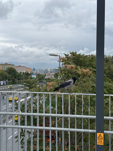







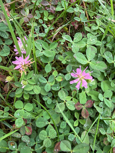
Research-grade observations from iNaturalist (within ~15 mi).
Events
Gallery
Sources
- • Wikipedia
- • Wikidata
- • USGS Earthquake Catalog (global feed)
- • GBIF (Global Biodiversity Information Facility)
- • iNaturalist
- • Open-Meteo / sunrise-sunset.org
- • Wikipedia Pageviews API
- • Open Library
- • Wikidata SPARQL (CC0) — population, area, elevation, inception, head of government, Commons image