Browse / Türkiye / Trabzon / Trabzon
Trabzon
Trabzoncity

Trabzon
Total population
816,684
Demographic figures from TurkStat. Overview below cites Wikipedia and may reference a different year.
City facts
Facts from Wikidata (CC0).
Overview
Trabzon is a city on the Black Sea coast of northeastern Turkey and the capital of Trabzon Province. Historically known as Trebizond, the city was founded in 756 BC as Trapezous by Greek colonists from Miletus. It was added into the Achaemenid Empire by Cyrus the Great and was later part of the independent Kingdom of Pontus that challenged Rome until 68 BC. Thenceforth part of the Roman and later Byzantine Empire, the city was the capital of the Empire of Trebizond, one of the successor states of the Byzantine Empire after the Fourth Crusade in 1204. In 1461, it came under Ottoman rule.
Read more on WikipediaHistory & geography
History
Before the city was founded as a Greek colony, the area was dominated by Colchians (west Georgian) and Chaldian (Anatolian) tribes. The Hayasa, who had been in conflict with the Central-Anatolian Hittites in the 14th century BC, are believed to have lived in the area south of Trabzon. Later, Greek authors mentioned the Macrones and the Chalybes as native peoples. One of the dominant Caucasian groups to the east were the Laz, who were part of the monarchy of the Colchis, together with other related Georgian peoples. The city was founded in classical antiquity in 756 BC as Tραπεζούς (Trapezous), by Milesian traders from Sinope. It was one of a number (about ten) of Milesian emporia or trading colonies along the shores of the Black Sea. Others included Abydos and Cyzicus in the Dardanelles, and nearby Kerasous. Like most Greek colonies, the city was a small enclave of Greek life, and not an empire unto its own, in the later European sense of the word. As a colony, Trapezous initially paid tribute to Sinope, but early banking (money-changing) activity is suggested to have occurred in the city already in the 4th century BC, according to a silver drachma coin from Trapezus in the British Museum, London. Cyrus the Great added the city to the Achaemenid Empire, and was possibly the first ruler to consolidate the eastern Black Sea region into a single political entity (a satrapy). Trebizond's trade partners included the Mossynoeci. When Xenophon and the Ten Thousand mercenaries were fighting their way out of Persia, the first Greek city they reached was Trebizond (Xenophon, Anabasis, 5.5.10). The city and the local Mossynoeci had become estranged from the Mossynoecian capital, to the point of civil war. Xenophon's force resolved this in the rebels' favor, and so in…
Geography
Trabzon Province has a total area of and is bordered by the provinces of Rize, Giresun, and Gümüşhane. The total area is 22.4% plateau and 77.6% hills. The Pontic Mountains pass through the Trabzon Province. Trabzon used to be an important reference point for navigators in the Black Sea during harsh weather conditions. The popular expression "perdere la Trebisonda" (losing Trebizond) is still commonly used in the Italian language to describe situations in which the sense of direction is lost. A very small percentage of the province can be classified as subtropical, however, as slightly elevated rural areas near the coast are oceanic (Cfb/Do), the mountainous offshores are humid continental (Dfb/Dc) and subarctic (Dfc/Eo); and tundra (ET/Ft) can be found in the peaks of the Pontic Alps. Furthermore, during the time the Köppen climate classification was created, the city center had a borderline oceanic-humid subtropical climate, falling just under the threshold for the hottest month of the year, yet climate change and the city's urban heat island contributed to its reclassification as humid subtropical in recent decades. This and the fact that the subtropical microclimate zone along the shore occupies a very narrow band due to the continuous parallel mountain range starting right at the coast is why local authorities still classify the city as oceanic, as this climate subtype is better representative of the entire coastal region of the province. Summers are warm, the average maximum temperature is around in August, while winters are generally cool, the lowest average minimum temperature is in February. During winter, brief periods with foehn winds can cause temperatures to rise substantially, raising the seasonal average compared to the usual cold conditions. The…
Excerpted from the corresponding Wikipedia article (CC BY-SA).
Geography
Coordinates & boundaries from the US Census TIGER/Line shapefiles.
Climate
Air quality
Walkability
Amenities nearby
Wildlife & biodiversity
Earthquake history
Photos
Sights & places nearby
Notable people from here


People born within ~10 km, from Wikidata (CC0). Click any name for their Wikipedia article.
Nearby places in Trabzon
- Ortahisar0.2 mi away · pop. 334,228
- Yomra6.9 mi away · pop. 45,632
- Akçaabat8.4 mi away · pop. 128,348
- Arsin11.1 mi away · pop. 31,548
- Maçka14.7 mi away · pop. 24,869
- Araklı17.8 mi away · pop. 48,382
- Düzköy18.3 mi away · pop. 13,575
- Çarşıbaşı19.1 mi away · pop. 15,395
- Sürmene21 mi away · pop. 26,161
- Vakfıkebir23.8 mi away · pop. 27,081
- Tonya24.4 mi away · pop. 13,754
- Köprübaşı24.7 mi away · pop. 4,371
Geography & sun
Elevation, sunrise/sunset and daylight from Open-Meteo. Solar climatology from NASA POWER.
Nearby airports
Public attention
Pageview totals from the Wikimedia Pageviews API.
Books about Trabzon
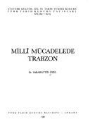

Search results from Open Library.
Recent natural events nearby
Ground air-quality sensors
Recently spotted species
Events
Notable, recurring, and historical events associated with Trabzon, sourced from Wikidata.
- Q1257282Feb 14, 2011sporting event
Source: Wikidata (CC0).
Gallery
Sources
- • Wikipedia
- • Wikidata
- • Open-Meteo / sunrise-sunset.org
- • Wikipedia Pageviews API
- • Open Library
- • Wikidata SPARQL (CC0) — population, area, elevation, inception, head of government, Commons image