Browse / United States / Texas / Grand Prairie
Grand Prairie
Texascity

Grand Prairie
Total population
207,618
Median home value
$322,900
Bachelor's+
Median income
$82,195
Founded
1863
Demographic figures from US Census Bureau · ACS 5-year estimates. Overview below cites Wikipedia and may reference a different year.
- Wind Advisory · ModerateWind Advisory issued October 15 at 12:18PM CDT until October 16 at 7:00PM CDT by NWS Fort Worth TX
Source: NOAA National Weather Service.
City facts
Sister cities
Facts from Wikidata (CC0).
Overview
Grand Prairie is a city in the U.S. state of Texas, located in Dallas, Tarrant, and Ellis counties with a small part extending into Johnson county. It is part of the Mid-Cities region in the Dallas–Fort Worth metroplex. It had a population of 175,396 according to the 2010 census, making it the fifteenth most populous city in the state. Remaining the 15th-most populous city in Texas, the 2020 census reported a population of 196,100.
Read more on WikipediaHistory & geography
History
The city of Grand Prairie was first established as Dechman by Alexander McRae Dechman in 1863. He based the name of the town on Big Prairie, Ohio. Prior to then, he resided in Young County near Fort Belknap. The 1860 U.S. Federal Census—Slave Schedules shows an A McR Dechman as having four slaves, ages 50, 25, 37 and 10. Dechman learned that he could trade his oxen and wagons for land in Dallas County. In 1863, Dechman bought of land on the eastern side of the Trinity River and of timber land on the west side of the river for a broken-down wagon, oxen team and US$200 in Confederate money. He tried to establish a home on the property, but ran into difficulties, so he returned to his family in Birdville before joining in the Civil War. In 1867, Dechman filed a town plat with Dallas County, consisting of . After the war, Dechman returned to Birdville for two years before selling that farm in 1867 and moving to Houston, where yellow fever broke out, causing the family to settle in Bryan. In 1876, Dechman traded half his "prairie" property to the T&P Railroad to ensure the railroad came through the town. The railroad named the depot "Dechman", prompting its namesake to relocate his home from Bryan to Dechman. His son Alexander had been living in Dechman and operating a trading post and farm. The first church in the area was the Good Hope Cumberland Sabbath School, established in 1870 by Rev. Andrew Hayter. The church was later renamed West Fork United Presbyterian Church and remains an active church. The first U.S. post office opened in 1877 under the name "Deckman" rather than "Dechman", because the U.S. Postal Service could not read the writing on the form completed to open the post office. Later that same year, after the Postal Service had adopted the "Deckman" name,…
Geography
Grand Prairie is located along the border between Tarrant and Dallas counties, with a small portion extending south into Ellis County. The city is bordered by Dallas to the east, Cedar Hill and Midlothian to the southeast, Mansfield to the southwest, Arlington to the west, Fort Worth to the northwest, and Irving to the north. According to the United States Census Bureau, the city has a total area of , of which is land and , or 11.08%, is water. The West Fork of the Trinity River and a major tributary, Johnson Creek, flow through Grand Prairie. Grand Prairie has a long history of flooding from Johnson Creek. In the 1980s, a major Army Corps of Engineers project was begun to straighten the channel, which has reduced the damage of flooding. Grand Prairie is part of the humid subtropical region.
Excerpted from the corresponding Wikipedia article (CC BY-SA).
Demographics & economy
Race & ethnicity
Source: US Census Bureau — American Community Survey, 5-year estimates.
Geography
Coordinates & boundaries from the US Census TIGER/Line shapefiles.
Climate
Current forecast
Forecast for Grand Prairie, TX from NOAA NWS API.
Air quality
Industrial & pollution facilities
Natural hazard risk
Health (adults)
Age-adjusted prevalence estimates from CDC PLACES (latest release).
Walkability
Amenities nearby
Wildlife & biodiversity
Schools
Largest nearby schools
- DUNCANVILLE H SHigh · DUNCANVILLE · 4,501 students · 19.7:1 ratio
- SOUTH GRAND PRAIRIE H SHigh · GRAND PRAIRIE · 3,351 students · 16.2:1 ratio
- GRAND PRAIRIE H SHigh · GRAND PRAIRIE · 3,001 students · 15.4:1 ratio
- NIMITZ H SHigh · IRVING · 2,361 students · 14.4:1 ratio
- CEDAR HILL H SHigh · CEDAR HILL · 2,197 students · 16.4:1 ratio
- MOISES E MOLINA H SHigh · DALLAS · 2,074 students · 16.3:1 ratio
- JOHN A DUBISKI CAREER H SHigh · GRAND PRAIRIE · 1,488 students · 15:1 ratio
- VILLAGE TECH SCHOOLSOther · DUNCANVILLE · 1,316 students · 17.1:1 ratio
Public K–12 schools within ~10 mi from Urban Institute Education Data Portal (NCES Common Core of Data, 2022).
Earthquake history
Photos
Sights & places nearby
Notable people from here


People born within ~10 km, from Wikidata (CC0). Click any name for their Wikipedia article.
Nearby places in Texas
- Dalworthington Gardens7.8 mi away
- Cockrell Hill8.5 mi away
- Bedford12.9 mi away · pop. 49,928
- Everman15.8 mi away
- Colleyville16 mi away · pop. 26,057
- Bear Creek Ranch17.3 mi away
- Edgecliff Village18.7 mi away
- Crowley21 mi away
- Briaroaks21.1 mi away
- Addison22 mi away
- Alvarado22.4 mi away
- Cross Timber22.7 mi away
Geography & sun
Elevation, sunrise/sunset and daylight from Open-Meteo. Solar climatology from NASA POWER.
Nearby airports
Public attention
Pageview totals from the Wikimedia Pageviews API.
Books about Grand Prairie

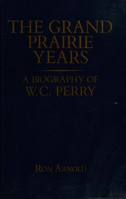
Search results from Open Library.
Recent natural events nearby
Ground air-quality sensors
Recently spotted species
Nearest stream gauge
Events
Gallery
Sources
- • Wikipedia
- • US Census Bureau (ACS 5-year estimates)
- • NOAA National Weather Service
- • Wikidata
- • NCES via Urban Institute Education Data Portal
- • CDC PLACES
- • Open-Meteo / sunrise-sunset.org
- • Wikipedia Pageviews API
- • Open Library