Browse / United States / Texas / San Angelo
San Angelo
Texascity

San Angelo
Total population
99,661
Median home value
$222,600
Bachelor's+
Median income
$67,498
Demographic figures from US Census Bureau · ACS 5-year estimates. Overview below cites Wikipedia and may reference a different year.
- Wind Advisory · ModerateWind Advisory issued October 16 at 11:01AM CDT until October 16 at 7:00PM CDT by NWS San Angelo TX
Source: NOAA National Weather Service.
City facts
Facts from Wikidata (CC0).
Overview
San Angelo is a city in and the county seat of Tom Green County, Texas, United States. It is in the Concho Valley, a region of West Texas between the Permian Basin to the northwest, Chihuahuan Desert to the southwest, Osage Plains to the northeast, and Central Texas to the southeast. According to the 2020 United States Census, San Angelo had a population of 99,893. It is the principal city and center of the San Angelo metropolitan area, which had a population of 100,159.
Read more on WikipediaHistory & geography
History
In 1632, a short-lived mission of Franciscans under Spanish auspices was founded in the area to serve native people. The mission was led by the friars Juan de Salas and Juan de Ortega, with Ortega remaining for six months. The area was visited by the Castillo-Martin expedition of 1650 and the Diego de Guadalajara expedition of 1654. During the region's development, San Angelo was at the western edge of the area called Texas, successively claimed in the 1800s by Spain, Mexico, the Republic of Texas, and finally the United States in 1846. The city of San Angelo was founded in 1867, when the United States built Fort Concho, one of a series of forts designed to protect the frontier. The fort was home to cavalry, infantry, and the famous Black Cavalry, also known as buffalo soldiers by American Indians. The settler Bartholomew J. DeWitt founded the village of Santa Angela outside the fort at the junction of the North and South Concho Rivers. He named the village after his wife, Carolina Angela. The name was eventually changed to San Angela. It changed again to San Angelo in 1883 on the insistence of the United States Postal Service, as "San Angela" is ungrammatical in Spanish. The town became a trade center for farmers and settlers in the area, as well as a fairly lawless cowtown filled with brothels, saloons, and gambling houses. After being designated as the county seat, the town grew quickly in the 1880s, aided by being on the route of newly constructed railroads. It became a central transportation hub for the region. The Santa Fe Railroad arrived in 1888 and the Kansas City, Mexico and Orient Railway in 1909. After a tuberculosis (TB) outbreak hit the U.S. in the early 1900s, many patients moved to San Angelo. At the time, doctors could only recommend rest in dry,…
Geography
According to the United States Census Bureau, the city has an area of 58.2 sq mi (150.9 km), of which 2.3 sq mi (6.1 km) (4.03%) are covered by water. San Angelo is on the northwestern edge of the Edwards Plateau and the northeastern edge of the Chihuahuan Desert at the junction of the North and South Concho Rivers. The city has three lakes: Twin Buttes Reservoir, O.C. Fisher Reservoir, and Lake Nasworthy. The Middle Concho River joined the South Concho several miles upstream, but the confluence has been obscured by the Twin Buttes dam. San Angelo is about west of Austin. San Angelo falls near the boundary between the subtropical semiarid scrubland (Köppen BSh) and midlatitude scrubland climates (Köppen BSk). It is in the region where Central Texas meets West Texas weather. Temperatures reach about 30.1 days per year on average. In 2011, San Angelo recorded 100 days of or higher. The typical year has 60.3 days with lows below freezing. | source 2 = National Weather Service | source = }}
Excerpted from the corresponding Wikipedia article (CC BY-SA).
Demographics & economy
Race & ethnicity
Source: US Census Bureau — American Community Survey, 5-year estimates.
Geography
Coordinates & boundaries from the US Census TIGER/Line shapefiles.
Climate
Current forecast
Forecast for San Angelo, TX from NOAA NWS API.
Air quality
Industrial & pollution facilities
Natural hazard risk
Health (adults)
Walkability
Amenities nearby
Wildlife & biodiversity
Most-observed species
- Northern MockingbirdMimus polyglottos (Linnaeus, 1758) · Aves4,496
- White-winged DoveZenaida asiatica (Linnaeus, 1758) · Aves3,743
- Northern CardinalCardinalis cardinalis (Linnaeus, 1758) · Aves3,698
- Turkey VultureCathartes aura (Linnaeus, 1758) · Aves3,348
- Mourning DoveZenaida macroura (Linnaeus, 1758) · Aves3,116
- Great Blue/Cocoi HeronArdea herodias Linnaeus, 1758 · Aves3,114
- Red-winged BlackbirdAgelaius phoeniceus (Linnaeus, 1766) · Aves2,965
- House SparrowPasser domesticus (Linnaeus, 1758) · Aves2,964
Citizen-science & research observations from the Global Biodiversity Information Facility (GBIF).
Schools
Earthquake history
Most recent
- M 2.6 — 2026-06-0118 km SSE of Westbrook, Texas
- M 3.3 — 2026-04-2026 km S of Westbrook, Texas
- M 2.9 — 2026-03-0324 km SSW of Westbrook, Texas
- M 3 — 2026-01-0223 km S of Westbrook, Texas
- M 2.9 — 2026-01-0223 km S of Westbrook, Texas
- M 2.6 — 2025-12-2224 km SSW of Westbrook, Texas
Events from the USGS Earthquake Catalog (global) (FDSN Event Web Service).
Photos
Sights & places nearby
Notable people from here
Nearby places in Texas
- Eldorado41 mi away · pop. 1,737
- Melvin54 mi away
- Garden City67.9 mi away · pop. 109
- Loraine68.6 mi away
- Lake Colorado City68.8 mi away
- Brady69 mi away · pop. 5,230
- Lake Brownwood83.3 mi away
- Clyde86.7 mi away · pop. 3,954
- Mason86.7 mi away
- Baird90.4 mi away · pop. 1,642
- Iraan93.1 mi away
- McCaulley93.6 mi away · pop. 35
Geography & sun
Elevation, sunrise/sunset and daylight from Open-Meteo. Solar climatology from NASA POWER.
Nearby airports
Public attention
Pageview totals from the Wikimedia Pageviews API.
Books about San Angelo
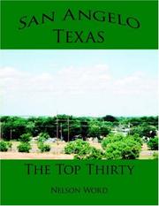

Search results from Open Library.
Recent natural events nearby
- Prescribed Fire RX Tom Green 7105, Tom Green, TexasWildfires · 2026-08-20 · 20 mi
- Prescribed Fire RX Tom Green 6687, Tom Green, TexasWildfires · 2026-08-10 · 20 mi
- Wildfire Rafter 4B, Schleicher, TexasWildfires · 2026-09-26 · 47 mi
- Wildfire Dry River, Sutton, TexasWildfires · 2026-09-15 · 65 mi
- Wildfire West Fork, Sutton, TexasWildfires · 2026-08-28 · 76 mi
- Wildfire McKee Draw, Edwards, TexasWildfires · 2026-08-29 · 87 mi
- Wildfire Clark, Edwards, TexasWildfires · 2026-09-16 · 104 mi
- Wildfire Kurk, San Saba, TexasWildfires · 2026-09-08 · 109 mi
Wildfires, storms and other events from NASA EONET (last 12 months, within 250 mi).
Ground air-quality sensors
Recently spotted species
Nearest stream gauge
Live readings from USGS NWIS · measured 2026-10-16 12:00 UTC.
Events
Gallery
Sources
- • Wikipedia
- • US Census Bureau (ACS 5-year estimates)
- • NOAA National Weather Service
- • Wikidata
- • USGS Earthquake Catalog (global feed)
- • USGS NWIS (water data)
- • GBIF (Global Biodiversity Information Facility)
- • Open-Meteo / sunrise-sunset.org
- • Wikipedia Pageviews API
- • Open Library
- • NASA EONET