Browse / United Kingdom / Scotland / Banff
Banff
Scotlandtown

Banff
Total population
3,968
Demographic figures from UK Office for National Statistics. Overview below cites Wikipedia and may reference a different year.
City facts
Overview
Banff is a coastal town in the Banff and Buchan area of Aberdeenshire, Scotland. It is situated on Banff Bay and faces the town of Macduff across the estuary of the River Deveron. It is a former royal burgh, and is the county town of the historic county of Banffshire. It had a population of 3,968 in 2022.
Read more on WikipediaHistory & geography
History
Banff's first castle was built to repel Viking invaders and a charter of 1163 AD shows that Malcolm IV was living there at that time. During this period the town was a busy trading centre in the "free hanse" of Northern Scottish burghs, despite not having its own harbour until 1775. The first recorded Sheriff of Banff was Richard de Strathewan in 1264, and in 1372 Royal Burgh status was conferred by King Robert II, who had a established a Carmelite priory near Banff in 1321. (The priory was destroyed by arson in 1559). By the 15th century Banff was one of three principal towns exporting salmon to the continent of Europe, along with Aberdeen and Montrose. There was a great deal of lawlessness in 17th-century Scotland, and some of the worst offenders were members of the nobility. According to records kept by historian William Cramond, the tolbooth (courthouse and prison) of Banff was, in 1628, the site of an altercation between Lord Banff and James Ogilvie, his relative. Reportedly, he struck James Ogilvie upon the head with a baton during a court hearing. Twenty of his friends and followers then attacked Ogilvie with swords before chasing him into the street and finishing him off with a pistol shot. Banff and Macduff are separated by the valley of the River Deveron. This unpredictable river was finally tamed by the seven arched bridge completed in 1779 by John Smeaton. An earlier bridge had been built in 1765, but was swept away in 1768. The old ferry was brought back into use, until it was lost in a flood in 1773. A public meeting was held in 1800 and passed a resolution for the building of a turnpike road between Turriff and Banff as the existing road was in a sad state of repair. Later 19th century transport improvements included the building of two railway lines,…
Excerpted from the corresponding Wikipedia article (CC BY-SA).
Geography
Coordinates & boundaries from the US Census TIGER/Line shapefiles.
Climate
Air quality
Walkability
Amenities nearby
Wildlife & biodiversity
Earthquake history
Photos
Sights & places nearby
Notable people from here
Nearby places in Scotland
Geography & sun
Elevation, sunrise/sunset and daylight from Open-Meteo. Solar climatology from NASA POWER.
Nearby airports
Public attention
Pageview totals from the Wikimedia Pageviews API.
Books about Banff
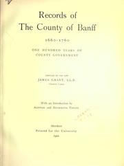


Search results from Open Library.
Recent natural events nearby
Ground air-quality sensors
Recently spotted species
Events
Gallery
Official Identifiers
ONS — UK Office for National Statistics
- ONS code
- osgb4000000074560758
- Local type
- Town
- Region
- Scotland
api.postcodes.io / OS Open Names
Sources
- • Wikipedia
- • Open-Meteo / sunrise-sunset.org
- • Wikipedia Pageviews API
- • Open Library
- • ONS / OS Open Names — UK official place gazetteer, via api.postcodes.io (OS code, local type, county/unitary, district/borough, region)
- • ONS — UK Office for National Statistics — api.postcodes.io / OS Open Names