Browse / United Kingdom / Scotland / Beith
Beith
Scotlandtown

Beith
Total population
6,210
Demographic figures from UK Office for National Statistics. Overview below cites Wikipedia and may reference a different year.
City facts
Overview
Beith is a town in the Garnock Valley, North Ayrshire, Scotland approximately 20 miles south-west of Glasgow. The town is situated on the crest of a hill and was known originally as the "Hill o' Beith" after its Court Hill.
Read more on WikipediaHistory & geography
History
Beith's name is thought to emanate from Ogham, which is sometimes referred to as the "Celtic Tree Alphabet", ascribing names of trees to individual letters. Beithe in Old Irish means Birch-tree (cognate to Latin betula). There is reason to believe that the whole of the district was covered with woods. The town of Beith itself was once known as 'Hill of Beith' as this was the name of the feudal barony and was itself derived from the Court Hill near Hill of Beith Castle. Alternatively, Beith may be derived from Cumbric *baɣeδ, 'boar' (Welsh baedd). The local pronunciation of the name would favour this theory. The Wood of Beit, now the 'Moor of Beith', has been identified as an Arthurian site where according to Taliessin in a poem under the name of 'Canowan' it was the site of a battle in the wood of Beit at the close of the day. Beith is said to have been the occasional residence of Saint Inan, a confessor of some celebrity, whose principal place of abode was Irvine. He flourished about 839. Although he is said to have been a hermit, according to tradition Saint Inan often visited Beith, frequenting Cuff Hill with its Rocking Stone and various other prehistoric monuments. A cleft in the west-front of Lochlands Hill is still known as "St. Inan's Chair" and said to have been used by the saint as a pulpit. An unsuccessful search for the saint's writings which were said to be preserved in the library of Bonci, Archbishop of Pisa, was made by Colonel Mure of Caldwell in the 19th century. Saint Inan is said to have preached to the assembled people from the chair on the hill. There was not a great population in the area at that time and the people were located not in Beith, but up on the top of the Bigholm near to the old Beith water dams. The first settlements were in…
Excerpted from the corresponding Wikipedia article (CC BY-SA).
Geography
Coordinates & boundaries from the US Census TIGER/Line shapefiles.
Climate
Air quality
Walkability
Amenities nearby
Wildlife & biodiversity
Earthquake history
Photos
Sights & places nearby
Notable people from here


People born within ~10 km, from Wikidata (CC0). Click any name for their Wikipedia article.
Geography & sun
Elevation, sunrise/sunset and daylight from Open-Meteo. Solar climatology from NASA POWER.
Nearby airports
Public attention
Pageview totals from the Wikimedia Pageviews API.
Books about Beith

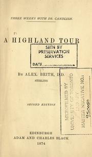
Search results from Open Library.
Recent natural events nearby
Ground air-quality sensors
Recently spotted species
Events
Gallery
Official Identifiers
ONS — UK Office for National Statistics
- ONS code
- osgb4000000074552615
- Local type
- Village
- Region
- Scotland
api.postcodes.io / OS Open Names
Sources
- • Wikipedia
- • Wikidata
- • Open-Meteo / sunrise-sunset.org
- • Wikipedia Pageviews API
- • Open Library
- • ONS / OS Open Names — UK official place gazetteer, via api.postcodes.io (OS code, local type, county/unitary, district/borough, region)
- • ONS — UK Office for National Statistics — api.postcodes.io / OS Open Names