Browse / United Kingdom / England / Corby Glen
Corby Glen
Englandvillage

Corby Glen
Total population
1,008
Demographic figures from UK Office for National Statistics. Overview below cites Wikipedia and may reference a different year.
City facts
Overview
Corby Glen, formerly just Corby, is a village and civil parish in the South Kesteven district of Lincolnshire, England. It is approximately 9 miles (14 km) south-east of Grantham and 8 miles (13 km) north west of Bourne. In 2011 it had a population of 1,017.
Read more on WikipediaHistory & geography
History
St John the Evangelist's Church, the Church of England parish church, dates in part from the 12th century and has a notable collection of 14th- and 15th-century murals. Following the purchase of Irnham Hall by a Protestant family in the mid-19th century the Catholic Chapel of the hall was taken down and re-erected in Corby Glen as the Roman Catholic Church of Our Lady of Mount Carmel to the designs of architects Weightman, Hadfield & Goldie. A thousand wagonloads of material were carried between the two sites. The new church opened in 1856. The church closed in 2012. The church and the attached presbytery are Grade II Listed buildings. The village's first Methodist chapel was built in 1846, and replaced in 1902 by the present building which is still in use. The original chapel is now a private house. To the north of the parish church is a substantial castle mound or motte. Historian David Roffe refers to it as "an early defended manor house". In 1238 King Henry III chartered a weekly market and an annual sheep fair. The sheep fair is still held and is claimed to be the longest-established such event in Britain. The [http://www.willoughbygallery.com/ Willoughby Memorial Library and Art Gallery] is housed in a 17th-century building that was originally Reads Grammar School. The school was founded in 1669 by the bequest of Charles Read (1604–1669), who was born at Darlton in Nottinghamshire and became a wealthy shipper in Hull. Read also founded Read School at Drax in Yorkshire and a grammar school at Tuxford in Notts. Reads Grammar School in Corby closed in 1909. The building was restored and reopened for its current uses in 1965 by the Willoughby Memorial Trust which was founded by Lord Ancaster in memory of his son Timothy, Lord Willoughby de Eresby, who died in…
Geography
The village of Corby Glen is in the South Kesteven district of Lincolnshire. It lies mainly to the north of the A151, a former toll road, and to the east of the West Glen River, near where the Glen flows through a small graben in the Jurassic limestone. Until the 1950s the name of the village was simply Corby. However, in the nearby county of Northamptonshire another Corby had been greatly enlarged by the addition of a steel works and housing to match. Some confusion arose between the two Corbys, so British Railways consulted the villagers to choose an additional name to distinguish the two. The villagers chose "Glen" in reference to the western branch of the River Glen which flows through the village. In 1956 the civil parish was renamed from "Corby" to "Corby Glen".
Excerpted from the corresponding Wikipedia article (CC BY-SA).
Geography
Coordinates & boundaries from the US Census TIGER/Line shapefiles.
Climate
Air quality
Walkability
Amenities nearby
Wildlife & biodiversity
Earthquake history
Photos
Sights & places nearby
Notable people from here


People born within ~10 km, from Wikidata (CC0). Click any name for their Wikipedia article.
Geography & sun
Elevation, sunrise/sunset and daylight from Open-Meteo. Solar climatology from NASA POWER.
Nearby airports
Public attention
Pageview totals from the Wikimedia Pageviews API.
Books about Corby Glen
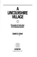

Search results from Open Library.
Recent natural events nearby
Ground air-quality sensors
Recently spotted species
Events
Gallery
Official Identifiers
ONS — UK Office for National Statistics
- ONS code
- osgb4000000074550958
- Local type
- Village
- Region
- East Midlands
api.postcodes.io / OS Open Names
Sources
- • Wikipedia
- • Wikidata
- • Open-Meteo / sunrise-sunset.org
- • Wikipedia Pageviews API
- • Open Library
- • ONS / OS Open Names — UK official place gazetteer, via api.postcodes.io (OS code, local type, county/unitary, district/borough, region)
- • ONS — UK Office for National Statistics — api.postcodes.io / OS Open Names