Browse / United Kingdom / England / Dewsbury
Dewsbury
Englandtown

Dewsbury
Total population
54,341
Demographic figures from UK Office for National Statistics. Overview below cites Wikipedia and may reference a different year.
City facts
Overview
Dewsbury is a market town in the Metropolitan Borough of Kirklees, West Yorkshire, England. It is sited on the River Calder and on an arm of the Calder and Hebble Navigation waterway. It lies to the west of Wakefield, east of Huddersfield and south of Leeds. Historically a part of the West Riding of Yorkshire, after undergoing a period of major growth in the 19th century as a mill town, Dewsbury went through a period of decline. It forms part of the Heavy Woollen District, of which it is the largest town. The population of the built-up area was 63,722 at the 2021 Census.
Read more on WikipediaHistory & geography
Geography
Dewsbury is situated between Leeds and Bradford to the north, Huddersfield a similar distance to the south west, and Wakefield east. Its proximity to these major urban centres, the M1 and M62 motorways and its position on the Huddersfield Line, served by the TransPennine Express, have contributed to its growth. Dewsbury is part of the West Yorkshire Urban Area, although its natural boundaries are not well-defined, with built up areas of the town running into Batley, Heckmondwike and Ossett. Geologically, the town is situated on rocks of the Carboniferous Period, consisting of coal measures and gritstones. Quaternary Period rock, glacial deposits and gravels exist in the Calder Valley. Coal, sandstone and gravel have been exploited commercially. Average rainfall is 100 cm per annum. The town is dominated by hills, notably Earlsheaton, Dewsbury Moor, Staincliffe and Thornhill. The town centre is between above sea level, rising to at Earlsheaton and Batley Carr, and at Grange Moor. The approach from Earlsheaton through the Wakefield Road cutting, constructed in 1830 , is dramatic with the view of the town centre in the Calder Valley opening up. Dewsbury has a number of districts with different geographical and socio-economic patterns, they are, Chickenley, Crackenedge, Dewsbury Moor, Earlsheaton, Eastborough, Eightlands, Flatts, Ravensthorpe, Savile Town, Shaw Cross, Scout Hill, Thornhill Lees, Westborough, Westtown. Batley Carr, Hanging Heaton and Staincliffe have areas which lie in both Dewsbury and neighbouring Batley. Thornhill, Briestfield and Whitley Lower are part of Dewsbury unparished area. Thornhill was annexed in 1910.
Excerpted from the corresponding Wikipedia article (CC BY-SA).
Geography
Coordinates & boundaries from the US Census TIGER/Line shapefiles.
Climate
Air quality
Walkability
Amenities nearby
Wildlife & biodiversity
Earthquake history
Photos
Sights & places nearby
Notable people from here


People born within ~10 km, from Wikidata (CC0). Click any name for their Wikipedia article.
Nearby places in England
Geography & sun
Elevation, sunrise/sunset and daylight from Open-Meteo. Solar climatology from NASA POWER.
Nearby airports
Public attention
Pageview totals from the Wikimedia Pageviews API.
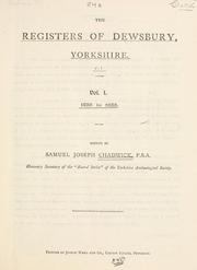
Books about Dewsbury

![[Report 1947]](https://covers.openlibrary.org/b/id/7975325-M.jpg)
![[Report 1949]](https://covers.openlibrary.org/b/id/7924024-M.jpg)
![[Report 1948]](https://covers.openlibrary.org/b/id/7916651-M.jpg)
Search results from Open Library.
Recent natural events nearby
Ground air-quality sensors
Recently spotted species
Events
Gallery
Official Identifiers
ONS — UK Office for National Statistics
- ONS code
- osgb4000000074570591
- Local type
- Town
- Region
- Yorkshire and the Humber
api.postcodes.io / OS Open Names
Sources
- • Wikipedia
- • Wikidata
- • Open-Meteo / sunrise-sunset.org
- • Wikipedia Pageviews API
- • Open Library
- • Wikidata SPARQL (CC0) — population, area, elevation, inception, head of government, Commons image
- • ONS / OS Open Names — UK official place gazetteer, via api.postcodes.io (OS code, local type, county/unitary, district/borough, region)
- • ONS — UK Office for National Statistics — api.postcodes.io / OS Open Names