Browse / United Kingdom / Scotland / Dunblane
Dunblane
Scotlandtown

Dunblane
Total population
9,370
Demographic figures from UK Office for National Statistics. Overview below cites Wikipedia and may reference a different year.
City facts
Overview
Dunblane is a historic cathedral town in the council area of Stirling, in central Scotland; it is inside the historic boundaries of the county of Perthshire. It is a commuter town, with many residents making use of good transport links to much of the Central Belt, including Glasgow and Edinburgh.
Read more on WikipediaHistory & geography
History
The earliest evidence for Christianity on the site are two cross-slabs of the 10th to 11th centuries which are preserved in the cathedral. Incorporated into the later medieval building, but originally free-standing, is an 11th-century bell-tower, whose height was increased in the 15th century. The nave and aisleless choir date from the 13th century. Dunblane did not have a rich or extensive medieval diocese (37 parishes), and so the cathedral is relatively modest in scale, but its refined architecture is much admired, as is its setting overlooking the valley of the Allan Water. After the Reformation, the nave of the cathedral was abandoned and soon became roofless and used for burials. The choir was retained as the parish church. In 1715, the Battle of Sherriffmuir was fought on land very close to Dunblane. Many combatants were billeted in the town before the battle. Dunblane railway station opened in 1848, as a stop on the Scottish Central Railway's Stirling to Perth line; it later served as a junction with another line to Callander that eventually reached Oban. This line was closed in 1965 during the Beeching axe. During the boom years of the Hydropathy movement in the 19th century, Dunblane was the location of a successful hydropathic establishment. The nave of the cathedral was re-roofed between 1889 and 1893, with new furnishings provided by Robert Rowand Anderson. Since the early 1970s the town has grown extensively and is now regarded as a highly sought-after commuter town due to its excellent road and rail links and good schools. Dunblane is close to the University of Stirling's campus at Bridge of Allan and is a popular location for academics. On 13 March 1996, local man Thomas Hamilton shot dead 16 children and their teacher, Gwen Mayor, in Dunblane…
Excerpted from the corresponding Wikipedia article (CC BY-SA).
Geography
Coordinates & boundaries from the US Census TIGER/Line shapefiles.
Climate
Air quality
Walkability
Amenities nearby
Wildlife & biodiversity
Earthquake history
Photos
Sights & places nearby
Notable people from here
Geography & sun
Elevation, sunrise/sunset and daylight from Open-Meteo. Solar climatology from NASA POWER.
Nearby airports
Public attention
Pageview totals from the Wikimedia Pageviews API.
Books about Dunblane
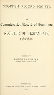


Search results from Open Library.
Recent natural events nearby
Ground air-quality sensors
Recently spotted species
Events
Gallery
Official Identifiers
ONS — UK Office for National Statistics
- ONS code
- osgb4000000074548646
- Local type
- Town
- Region
- Scotland
api.postcodes.io / OS Open Names
Sources
- • Wikipedia
- • Open-Meteo / sunrise-sunset.org
- • Wikipedia Pageviews API
- • Open Library
- • ONS / OS Open Names — UK official place gazetteer, via api.postcodes.io (OS code, local type, county/unitary, district/borough, region)
- • ONS — UK Office for National Statistics — api.postcodes.io / OS Open Names