Browse / United Kingdom / Scotland / Dunfermline
Dunfermline
Scotlandcity

Dunfermline
Total population
53,100
Air quality index
Demographic figures from UK Office for National Statistics. Overview below cites Wikipedia and may reference a different year.
City facts
Sister cities
Facts from Wikidata (CC0).
Overview
Dunfermline is a city, parish, and former royal burgh in Fife, Scotland, 3 miles (5 km) from the northern shore of the Firth of Forth. Dunfermline was the de facto capital of the Kingdom of Scotland between the 11th and 15th centuries.
Read more on WikipediaHistory & geography
History
There have been various interpretations of the name, "Dunfermline". The first element, "dun" translated from Gaelic, has been accepted as a (fortified) hill, and is assumed to be referring to the rocky outcrop at the site of Malcolm Canmore's Tower in Pittencrieff Glen (now Pittencrieff Park). The rest of the name is problematic. A cropmark which is understood to have been used as a possible mortuary enclosure has been found at Deanpark House, also near the town. By the time of the Bronze Age, the area was beginning to show some importance. Important finds included a bronze axe in Wellwood and a gold torc from the Parish Churchyard. The first historic record for Dunfermline was made in the 11th century. According to the fourteenth-century chronicler, John of Fordun, Malcolm III married his second bride, the Anglo-Saxon princess Saint Margaret, at the church in Dunfermline between 1068 and 1070; the ceremony was performed by Fothad, the last Celtic bishop of St Andrews. Malcolm III established Dunfermline as a new seat for royal power in the mid-11th century and initiated changes that eventually made the township the de facto capital of Scotland for much of the period until the assassination of James I in 1437. Following her marriage to King Malcolm III, Queen Margaret encouraged her husband to convert the small culdee chapel into a church for Benedictine monks. The founding of this new church of Dunfermline was inaugurated around 1072, but was not recorded in the town's records. The foundations of the church evolved into an Abbey in 1128, under the reign of their son, David I. A total of eighteen royals, including seven Kings, were buried here from Queen Margaret in 1093 to Robert Stewart, Duke of Albany in 1420. During the Wars of Scottish Independence, Robert…
Geography
Dunfermline is at on the coastal fringe of Fife. Temperatures in Dunfermline, much like the rest of Scotland, are relatively moderate given its northern latitude. Fife is a peninsula, between the Firth of Tay to the north, Firth of Forth to the south and the North Sea to the east. Summers are relatively cool and the warming of the water over the summer, results in warm winters. Average annual temperatures in Dunfermline range from a maximum of to a minimum of . The town is geologically separated from the area to the north by the Cleish Hills.
Excerpted from the corresponding Wikipedia article (CC BY-SA).
Geography
Coordinates & boundaries from the US Census TIGER/Line shapefiles.
Climate
Air quality
Current readings from Open-Meteo Air Quality API (Copernicus CAMS European reanalysis).
Walkability
Amenities nearby
Wildlife & biodiversity
Most-observed species
- Common Wood-PigeonColumba palumbus Linnaeus, 1758 · Aves13,077
- Carrion CrowCorvus corone Linnaeus, 1758 · Aves11,659
- Eurasian MagpiePica pica (Linnaeus, 1758) · Aves11,050
- Eurasian BlackbirdTurdus merula Linnaeus, 1758 · Aves9,716
- European RobinErithacus rubecula (Linnaeus, 1758) · Aves9,525
- Eurasian Blue TitCyanistes caeruleus (Linnaeus, 1758) · Aves8,446
- Herring GullLarus argentatus Pontoppidan, 1763 · Aves8,437
- MallardAnas platyrhynchos Linnaeus, 1758 · Aves7,210
Citizen-science & research observations from the Global Biodiversity Information Facility (GBIF).
Earthquake history
Most recent
- M 3.5 — 2026-04-1642 km WNW of Comrie, United Kingdom
- M 3.9 — 2025-10-2029 km NW of Comrie, United Kingdom
- M 2.5 — 2018-08-301 km ENE of Gourock, United Kingdom
- M 2.5 — 2005-12-313 km WSW of Auchterarder, United Kingdom
- M 2.5 — 2003-06-2012 km NNW of Balfron, United Kingdom
- M 2.8 — 2003-06-2014 km NNW of Balfron, United Kingdom
Events from the USGS Earthquake Catalog (global) (FDSN Event Web Service).
Photos
Sights & places nearby
Notable people from here


People born within ~10 km, from Wikidata (CC0). Click any name for their Wikipedia article.
Nearby places in Scotland
Geography & sun
Elevation, sunrise/sunset and daylight from Open-Meteo. Solar climatology from NASA POWER.
Nearby airports
Public attention
Pageview totals from the Wikimedia Pageviews API.
Books about Dunfermline
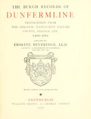
![[Report 1959]](https://covers.openlibrary.org/b/id/7955550-M.jpg)
![[Report 1953]](https://covers.openlibrary.org/b/id/7962991-M.jpg)
![[Report 1945]](https://covers.openlibrary.org/b/id/13373045-M.jpg)
![[Report 1947]](https://covers.openlibrary.org/b/id/7960823-M.jpg)
![[Report 1948]](https://covers.openlibrary.org/b/id/7973284-M.jpg)
![[Report 1957]](https://covers.openlibrary.org/b/id/7980497-M.jpg)
Search results from Open Library.
Recent natural events nearby
Ground air-quality sensors
Recently spotted species
Events
Gallery
Geotagged photos within ~6 miles of Dunfermline, from Wikimedia Commons contributors.


_(3841621207).jpg)
_(3819720823).jpg)


Photos via Wikimedia Commons — see each image page for license & attribution.
Official Identifiers
ONS — UK Office for National Statistics
- ONS code
- osgb4000000074558327
- Local type
- City
- Region
- Scotland
api.postcodes.io / OS Open Names
Sources
- • Wikipedia
- • Wikimedia Commons
- • Wikidata
- • Open-Meteo Air Quality (CAMS)
- • USGS Earthquake Catalog (global feed)
- • GBIF (Global Biodiversity Information Facility)
- • Open-Meteo / sunrise-sunset.org
- • Wikipedia Pageviews API
- • Open Library
- • Wikidata SPARQL (CC0) — population, area, elevation, inception, head of government, Commons image
- • ONS / OS Open Names — UK official place gazetteer, via api.postcodes.io (OS code, local type, county/unitary, district/borough, region)
- • ONS — UK Office for National Statistics — api.postcodes.io / OS Open Names