Browse / United Kingdom / England / Hunstanton
Hunstanton
Englandtown

Hunstanton
Total population
4,229
Demographic figures from UK Office for National Statistics. Overview below cites Wikipedia and may reference a different year.
City facts
Facts from Wikidata (CC0).
Overview
Hunstanton is a seaside town and civil parish in the King's Lynn and West Norfolk district, in the county of Norfolk, England. The town's seafront faces west across The Wash. Hunstanton lies 102 miles (164 km) north-north-east of London and 40 miles (64 km) north-west of Norwich. At the 2021 census, the parish had a population of 4,370 and the built-up area had a population of 4,193.
Read more on WikipediaHistory & geography
History
Hunstanton is a 19th-century resort town, initially known as New Hunstanton to distinguish it from the adjacent village of that name. The new town soon exceeded the village in scale and population. In 1846, Henry L'Estrange Styleman Le Strange (1815–1862), decided to develop the area south of Old Hunstanton as a bathing resort. He brought a group of like-minded investors into building a railway line from King's Lynn. In 1861, Le Strange, as principal landowner, became a director of the railway company. By 1862 the line had been built. Le Strange died that year at the age of 47, leaving his son Hamon to reap the rewards of his efforts. The Lynn and Hunstanton Railway became one of the most consistently profitable in the country. Le Strange moved the ancient village cross from Old Hunstanton to a new site in 1846. In 1848 the first main building, the Royal Hotel (now the Golden Lion), was built by Victorian architect, William Butterfield, a friend of Le Strange. Overlooking a sloping green and the sea, and for several years standing alone, it earned the nickname "Le Strange's Folly". In 1850 Le Strange, an amateur architect and painter, appointed a land agent to survey the site and prepare a plan. Le Strange drew and painted a map and a perspective of the scheme, showing shops, a station and a church. He consulted William Butterfield on the design. Their shared passion was for an "Old English" style of architecture for domestic buildings, owing much to medieval precedents and the earnest Victorian Gothic Revival. Hunstanton came to exemplify a 19th-century estate seaside town. Most of the fabric and character of that development survives. In 1915, during the First World War, Hunstanton was the headquarters of the West Norfolk training programme of the Queen's Own…
Excerpted from the corresponding Wikipedia article (CC BY-SA).
Geography
Coordinates & boundaries from the US Census TIGER/Line shapefiles.
Climate
Air quality
Walkability
Amenities nearby
Wildlife & biodiversity
Earthquake history
Photos
Sights & places nearby
Notable people from here


People born within ~10 km, from Wikidata (CC0). Click any name for their Wikipedia article.
Nearby places in England
Geography & sun
Elevation, sunrise/sunset and daylight from Open-Meteo. Solar climatology from NASA POWER.
Nearby airports
Public attention
Pageview totals from the Wikimedia Pageviews API.
Books about Hunstanton

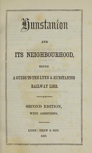


Search results from Open Library.
Recent natural events nearby
Ground air-quality sensors
Recently spotted species
Events
Gallery
Official Identifiers
ONS — UK Office for National Statistics
- ONS code
- osgb4000000074550223
- Local type
- Town
- Region
- Eastern
api.postcodes.io / OS Open Names
Sources
- • Wikipedia
- • Wikidata
- • Open-Meteo / sunrise-sunset.org
- • Wikipedia Pageviews API
- • Open Library
- • ONS / OS Open Names — UK official place gazetteer, via api.postcodes.io (OS code, local type, county/unitary, district/borough, region)
- • ONS — UK Office for National Statistics — api.postcodes.io / OS Open Names