Browse / United Kingdom / England / Isleworth
Isleworth
Englandtown

Isleworth
Demographic figures from UK Office for National Statistics. Overview below cites Wikipedia and may reference a different year.
City facts
Facts from Wikidata (CC0).
Overview
Isleworth is a suburban town in the London Borough of Hounslow, west London, England. Its main retail street London Road becomes Hounslow High Street and adjoining Treaty Centre for shopping centre only a few hundred metres away from its westernmost point. No physical signs mark this boundary, which reflects how Isleworth contained the east of Hounslow, originally.
Read more on WikipediaHistory & geography
History
Excavations around the eastern end of the Syon Park estate have unearthed evidence of a Romano-British settlement. 'Gislheresuuyrth', meaning in Old English Enclosure belonging to [a man called] Gīslhere, is first referred to as a permanent settlement in an Anglo-Saxon charter in the year 695. The Domesday Book says that during the reign (1042–1066) of Edward the Confessor the manor belonged to "Earl Algar" (probably Ælfgar of Mercia), and a modern road off South Street today carries his name. Isleworth was a well-cultivated farming and trading settlement, more valuable than many of its neighbours at the time of the Norman Conquest in 1066. For centuries it continued to stretch from the Middlesex bank of the Thames in the east, west to include the centre of what was its hamlet then chapelry Hounslow (including the medieval founded Hounslow Priory) and to bound Whitton, as far north so as to bound Southall (in Hayes parish at the time), and as south as to bound Twickenham. The Domesday Book (1086) as Gistelesworde records its 55 ploughlands, 118 households and amount rendered, £72 per year, to its feudal system overlords. After the Conquest, successive Norman barons of the Saint Valeri family held the manor of Isleworth but there is no evidence that they lived there – it being held as a source of rentals and subinfeudation/lettings/charitable giving power. One of the later barons gave several manorial rents and privileges to London's Hospital of Saint Giles. He also gave the church and advowson to the Abbey of Saint Valeri, at the mouth of the Somme in Picardy. In 1227, when he took control of England from his childhood regents, Henry III seized Isleworth manor and other property of the Saint Valeri family and gave the manor to his brother, Richard, 1st Earl of…
Geography
If deemed to still include Osterley, elevations range from in the northwest to by the Thames OD. The boundaries are longstanding, subject to twentieth-century western and southern circonscriptions: Isleworth is east of the town of Hounslow which has more retail and offices, in the borough of that name; west of the River Thames; north of its tributary and the northernmost confluence of the Crane; and south of the crest by the M4 motorway separating the Brent and Crane catchments. Half of the River Crane flows into the Thames south of the Ait, and its newest distributary the Duke of Northumberland's River flows toward the Ait's midpoint. Isleworth is on the Heathrow flight path. It experiences a high level of airplane noise daily. Hundreds of flights per day go over Isleworth. Both flight paths 27R and 27L go through Isleworth. The average daily noise level at Isleworth station is 61 decibels.
Excerpted from the corresponding Wikipedia article (CC BY-SA).
Geography
Coordinates & boundaries from the US Census TIGER/Line shapefiles.
Climate
Air quality
Walkability
Amenities nearby
Wildlife & biodiversity
Earthquake history
Photos
Sights & places nearby
Notable people from here


People born within ~10 km, from Wikidata (CC0). Click any name for their Wikipedia article.
Geography & sun
Elevation, sunrise/sunset and daylight from Open-Meteo. Solar climatology from NASA POWER.
Nearby airports
Public attention
Pageview totals from the Wikimedia Pageviews API.
Books about Isleworth
![[Report of the Medical Officer of Health for Heston and Isleworth UDC 1925]](https://covers.openlibrary.org/b/id/13365143-M.jpg)
![[Report of the Medical Officer of Health for Heston and Isleworth UDC 1921]](https://covers.openlibrary.org/b/id/13412033-M.jpg)
![[Report of the Medical Officer of Health for Heston and Isleworth UDC 1920]](https://covers.openlibrary.org/b/id/13364019-M.jpg)
![[Report of the Medical Officer of Health for Heston and Isleworth UDC 1918]](https://covers.openlibrary.org/b/id/13356603-M.jpg)
![[Report of the School Medical Officer for Heston and Isleworth 1913]](https://covers.openlibrary.org/b/id/13356046-M.jpg)
![[Report of the School Medical Officer for Heston and Isleworth 1925]](https://covers.openlibrary.org/b/id/13408891-M.jpg)
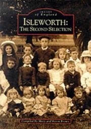

Search results from Open Library.
Recent natural events nearby
Ground air-quality sensors
Recently spotted species
Events
Gallery
Official Identifiers
ONS — UK Office for National Statistics
- ONS code
- osgb4000000074561688
- Local type
- Other Settlement
- Region
- London
api.postcodes.io / OS Open Names
Sources
- • Wikipedia
- • Wikidata
- • Open-Meteo / sunrise-sunset.org
- • Wikipedia Pageviews API
- • Open Library
- • ONS / OS Open Names — UK official place gazetteer, via api.postcodes.io (OS code, local type, county/unitary, district/borough, region)
- • ONS — UK Office for National Statistics — api.postcodes.io / OS Open Names