Browse / United Kingdom / England / Luton
Luton
Englandtown

Luton
Total population
203,200
Demographic figures from UK Office for National Statistics. Overview below cites Wikipedia and may reference a different year.
City facts
Facts from Wikidata (CC0).
Overview
Luton is a town and borough in Bedfordshire, England. The borough had a population of 225,262 at the 2021 census.
Read more on WikipediaHistory & geography
History
Luton is believed to have been founded by the Anglo-Saxons sometime in the 6th century. Its name first appears in the 8th century as Lygetun, meaning "town on the River Lea". The Domesday Book records Luton as Loitone and as Lintone. In 1121 Robert, 1st Earl of Gloucester started work on St Mary's Church in the centre of the town. The work was completed by 1137. A motte-and-bailey castle which gives its name to the modern Castle Street was built in 1139 but demolished by 1154. The hat making industry began in the 17th century and became synonymous with the town. The town grew: in 1801 the population was 3,095, but by 1850 it was over 10,000 and by 1901 it was almost 39,000. Newspaper printing arrived in the town in 1854. The first public cemetery was opened in the same year and Luton was made a borough in 1876. Luton's hat trade reached its peak in the 1930s, but severely declined after the Second World War and was replaced by other industries. In 1907, Vauxhall Motors opened the largest car plant in the United Kingdom in Luton, during the Second World War, it built Churchill tanks as part of the war effort. Despite heavy camouflage, the factory made Luton a target for the Luftwaffe and the town suffered a number of air raids. 107 died and there was extensive damage to the town (over 1,500 homes were damaged or destroyed). The original town hall was destroyed in 1919 during Peace Day celebrations at the end of the First World War. Dr. John G. Dony, author of The Flora of Bedfordshire, told his history students (he taught at Luton Grammar, predecessor of Luton Sixth Form College) in the 1950s that he had broken the last intact window of the old town hall during the 1919 riots. Local people, including many ex-servicemen, were unhappy with unemployment and had…
Geography
The town is situated in a gap at the far east of the Chiltern Hills and is built on the River Lea, which Luton is named after. The town is the most populous settlement in Bedfordshire followed by Bedford. Luton forms a conurbation with the town of Dunstable, which is located to the west on the opposite side of the M1 motorway, and also includes Houghton Regis. Luton is situated north-west of London, north-west of St Albans, west of Stevenage, north-east of Aylesbury, south of Bedford, (about 66 – 145 million years ago) and deposits laid at the southernmost points of the ice sheet during the last ice age (the Warden Hill area can be seen from much of the town). Bedfordshire had a reputation for brick making but the industry is now significantly reduced. The brickworks at Stopsley took advantage of the clay deposits in the east of the town. There are few routes through the hilly area for some miles, this has led to several major roads (including the M1 and the A6) and a major rail-link being constructed through the town. Luton has a temperate marine climate, like much of the British Isles, with generally light precipitation throughout the year. The weather is very changeable from day to day and the warming influence of the Gulf Stream makes the region mild for its latitude. The average total annual rainfall is with rain falling on 117 days of the year. The local climate around Luton is differentiated somewhat from much of South East England due to its position in the Chiltern Hills, meaning it tends to be 1–2 degrees Celsius cooler than the surrounding towns – often flights at Luton airport, lying above sea level, will be suspended when marginal snow events occur, while airports at lower elevations, such as Heathrow, at above sea level, continue to…
Excerpted from the corresponding Wikipedia article (CC BY-SA).
Geography
Coordinates & boundaries from the US Census TIGER/Line shapefiles.
Climate
Air quality
Walkability
Amenities nearby
Wildlife & biodiversity
Earthquake history
Photos
Sights & places nearby
Notable people from here


People born within ~10 km, from Wikidata (CC0). Click any name for their Wikipedia article.
Nearby places in England
Geography & sun
Elevation, sunrise/sunset and daylight from Open-Meteo. Solar climatology from NASA POWER.
Nearby airports
Public attention
Pageview totals from the Wikimedia Pageviews API.
Books about Luton

![[Report 1941-1945]](https://covers.openlibrary.org/b/id/8093085-M.jpg)

Search results from Open Library.
Recent natural events nearby
Ground air-quality sensors
Recently spotted species
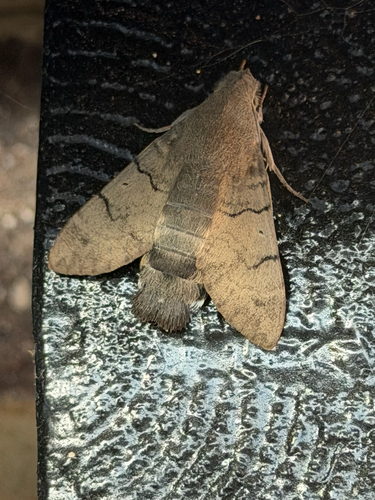








Research-grade observations from iNaturalist (within ~15 mi).
Events
Gallery
Official Identifiers
ONS — UK Office for National Statistics
- ONS code
- osgb4000000074572547
- Local type
- Town
- Region
- Eastern
api.postcodes.io / OS Open Names
Sources
- • Wikipedia
- • Wikidata
- • iNaturalist
- • Open-Meteo / sunrise-sunset.org
- • Wikipedia Pageviews API
- • Open Library
- • Wikidata SPARQL (CC0) — population, area, elevation, inception, head of government, Commons image
- • ONS / OS Open Names — UK official place gazetteer, via api.postcodes.io (OS code, local type, county/unitary, district/borough, region)
- • ONS — UK Office for National Statistics — api.postcodes.io / OS Open Names