Browse / United Kingdom / England / Maidenhead
Maidenhead
Englandtown

Maidenhead
Total population
73,404
Air quality index
Demographic figures from UK Office for National Statistics. Overview below cites Wikipedia and may reference a different year.
City facts
Facts from Wikidata (CC0).
Overview
Maidenhead is a market town in the Royal Borough of Windsor and Maidenhead in the county of Berkshire, England. It lies on the southwestern bank of the River Thames, which at this point forms the border with Buckinghamshire. In the 2021 Census, the Maidenhead built-up area had a population of 67,375. The town is 27 miles (43 km) west of Charing Cross, London and 13 miles (21 km) east-northeast of Reading.
Read more on WikipediaHistory & geography
History
The antiquary John Leland claimed that the area around Maidenhead's present town centre was a small Roman settlement called Alaunodunum. He stated that it had all but disappeared by the end of the Roman occupation. Although his source is unknown, there is documented and physical evidence of Roman settlement in the town. There are two well known villa sites in the town, one being in the suburb of Cox Green, and the other just west of the town centre on Castle Hill. This villa sat on the route of the Camlet Way which was a Roman road linking Silchester (Calleva Atrebatum) and Colchester (Camulodunum) via St Albans (Verulamium) and passes through the present town centre. Remnants of the road have been unearthed at various locations nearby, but its exact route is unclear. Maidenhead's name stems from the riverside area where the first "New wharf" or "Maiden Hythe" was built, as early as Saxon times. In the year 870, an army of Danes invaded the kingdom of Wessex. They disembarked from their longboats by the wharf and ferry crossing at Maidenhead and fought their way overland to Reading where they set up camp and made it their regional power base. The area of the present town centre was originally a small Anglo-Saxon town known as "South Ellington". The town would have likely developed on the Camlet Way on the site of Alaunodunum as the Bath Road was not re-routed until the 13th century. Maidenhead is recorded in the Domesday Book as the settlement of Ellington in the hundred of Beynhurst. A wooden bridge was erected across the river in about 1280 to replace the ferry in South Ellington. The Great West Road to Reading, Gloucester and Bristol was diverted over the new bridge. Previously, it had kept to the north bank and crossed the Thames by ford at Cookham, and the…
Geography
The Maidenhead urban area includes urban and suburban regions within the bounds of the town, called Maidenhead Court, North Town, Furze Platt, Pinkneys Green, Highway, Tittle Row, Boyn Hill, Fishery and Bray Wick; as well as adjoining built-up areas in surrounding civil parishes: Cox Green and Altwood in Cox Green parish, Woodlands Park in White Waltham parish, and part of Bray Wick in Bray parish. Bray village is linked to Maidenhead by the exclusive Fishery Estate which lies on the west bank of the Thames. To the east, on the opposite side of the river from Maidenhead, is the large village of Taplow in Buckinghamshire which almost adjoins the suburban village of Burnham, which itself nearly adjoins the urban area of the large, industrial town of Slough. To the north are the Cookhams: Cookham Village, Cookham Rise and Cookham Dean. To the west is the area of Pinkneys Green. These lie south of the Berkshire-Buckinghamshire border, which is formed by the River Thames (which then bends southwards to form the Maidenhead-Taplow border). Adjoining Bray and Bray Wick to the south is the suburban village of Holyport. Continuing by road to the south-east leads to the historic, royal twin towns of Windsor and Eton. Maidenhead lies immediately west of the Taplow ridge, a wooded spur of the Chilterns which rises dramatically above one of the most scenic stretches of the Thames. The ridge is crowned by the spectacular Cliveden House which can be seen from various parts of the town. Maidenhead has a site of Special Scientific Interest (SSSI) in the northern outskirts of the town called Cannoncourt Farm Pit, where the largest hand axe of the Paleolithic era in Britain was discovered. The town also has a local nature reserve called The Gullet. On 12 July 1901 Maidenhead entered the…
Excerpted from the corresponding Wikipedia article (CC BY-SA).
Geography
Coordinates & boundaries from the US Census TIGER/Line shapefiles.
Climate
Air quality
Current readings from Open-Meteo Air Quality API (Copernicus CAMS European reanalysis).
Walkability
Amenities nearby
Wildlife & biodiversity
Earthquake history
Most recent
- M 3.1 — 2020-09-225 km N of Aylesbury, United Kingdom
- M 3.9 — 2020-09-082 km WSW of Pitstone, United Kingdom
- M 3.3 — 2019-02-273 km SE of Dorking, United Kingdom
- M 2.8 — 2018-07-051 km S of Ewhurst, United Kingdom
- M 2.6 — 2018-06-275 km W of Capel, United Kingdom
- M 2.7 — 2018-04-014 km E of Holmwood, United Kingdom
Events from the USGS Earthquake Catalog (global) (FDSN Event Web Service).
Photos
Sights & places nearby
Notable people from here
Geography & sun
Elevation, sunrise/sunset and daylight from Open-Meteo. Solar climatology from NASA POWER.
Nearby airports
Public attention
Pageview totals from the Wikimedia Pageviews API.
Books about Maidenhead

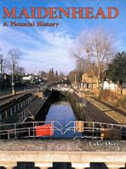

Search results from Open Library.
Recent natural events nearby
Ground air-quality sensors
Recently spotted species
Events
Gallery
Official Identifiers
ONS — UK Office for National Statistics
- ONS code
- osgb4000000074564961
- Local type
- Town
- Region
- South East
api.postcodes.io / OS Open Names
Sources
- • Wikipedia
- • Wikidata
- • Open-Meteo Air Quality (CAMS)
- • USGS Earthquake Catalog (global feed)
- • Open-Meteo / sunrise-sunset.org
- • Wikipedia Pageviews API
- • Open Library
- • Wikidata SPARQL (CC0) — population, area, elevation, inception, head of government, Commons image
- • ONS / OS Open Names — UK official place gazetteer, via api.postcodes.io (OS code, local type, county/unitary, district/borough, region)
- • ONS — UK Office for National Statistics — api.postcodes.io / OS Open Names