Browse / United Kingdom / Northern Ireland / Portadown
Portadown
Northern Irelandtown

Portadown
Total population
22,000
Demographic figures from UK Office for National Statistics. Overview below cites Wikipedia and may reference a different year.
City facts
Facts from Wikidata (CC0).
Overview
Portadown is a town in County Armagh, Northern Ireland. The town stands on the River Bann in the north of the county, about 24 miles (39 km) southwest of Belfast. It is in the Armagh City, Banbridge and Craigavon Borough Council area and had a population of about 22,000 at the 2021 Census. For some purposes, Portadown is treated as part of the "Craigavon Urban Area", alongside Craigavon and Lurgan.
Read more on WikipediaHistory & geography
History
The Portadown area had long been populated by Irish Gaels. At the beginning of the 1600s, this area was within the district of Clancann (Clann Chana), which was part of the larger territory of Oneilland (Uí Nialláin). This district was named after the dominant local clan—the McCanns (Mac Cana)—who had occupied the area since before the 13th century. The McCanns were then a vassal sept of the O'Neills (Uí Néill). The town's name comes from the Irish Port a' Dúnáin (or, more formally, Port an Dúnáin), meaning the port or landing place of the small fort. This was likely a fort of the McCanns. In 1610, as part of the Plantation, the lands of Portadown were granted to William Powell. The present-day People's Park was part of its grounds. The Blacker family, descended from Danes who had invaded and settled in Ireland in the 9th century, founded an estate at Carrick, on the Portadown–Gilford road. The land had been bought by Colonel Valentine Blacker from Sir Anthony Cope of Loughgall. It became known as Carrickblacker, and is now the site of Portadown Golf Club. One of the notables in the Blacker family, Colonel William Blacker, High Sheriff of Armagh, took part in the "Battle of the Diamond" and was a founding member of the Orange Order. This, and subsequent events such as the founding of a 'provisional' Grand Lodge in the town after the 'voluntary' dissolution of the Order in 1825, led to the town being known as 'The Orange Citadel'. It was a center of sectarian strife for two centuries. Many of the Blacker family were soldiers or churchmen. The family estate was purchased in 1937 by Portadown Golf Club. In 1988 the club demolished Carrickblacker House to make way for a new clubhouse. A large prisoner-of-war (POW) camp was built at Portadown during World War II. It…
Geography
Portadown is located in a relatively flat part of Northern Ireland, near the southern shore of Lough Neagh. Two small wetland areas are on the outskirts of the town; one at Selshion in the west and another at Annagh in the south. The Ballybay River flows into the town from the west before joining the River Bann. Most of the town is built on the western side of the River Bann, which supported its industry and prosperity. Construction in 1740 of the Newry Canal (linking Carlingford Lough with Lough Neagh) enabled Portadown to become a hub for the water traffic between Newry and Belfast. There are three bridges across the river at Portadown. Bridge Street and Northway are both road bridges, and there is a railway bridge beside the Northway. The 'Bann Bridge' on Bridge Street is the oldest. It was unusual in that it was built over dry earth. After the bridge was completed, the course of the River Bann was diverted by some 100 yards to straighten a meander and run under the bridge. The old riverbed was then built upon. In the 21st century, an archaeological dig in the area of the old riverbed uncovered the bones of some of those who were drowned in the 1641 massacre in the town. Like the rest of Ireland, the Portadown area has long been divided into townlands, whose names came mostly from the Irish language. Portadown sprang up along a road (High Street/Market Street) that marked the boundary between two of these – Tavanagh and Corcrain. Over time, the surrounding townlands have been built upon and they have given their names to many roads and housing estates. The following is a list of townlands within Portadown's urban area, alongside their likely etymologies: West bank of the River Bann (parish of Drumcree): *Annagh () *Ballyoran (from Baile Uaráin meaning…
Excerpted from the corresponding Wikipedia article (CC BY-SA).
Geography
Coordinates & boundaries from the US Census TIGER/Line shapefiles.
Climate
Air quality
Walkability
Amenities nearby
Wildlife & biodiversity
Earthquake history
Photos
Sights & places nearby
Notable people from here


People born within ~10 km, from Wikidata (CC0). Click any name for their Wikipedia article.
Nearby places in Northern Ireland
Geography & sun
Elevation, sunrise/sunset and daylight from Open-Meteo. Solar climatology from NASA POWER.
Nearby airports
Public attention
Pageview totals from the Wikimedia Pageviews API.
Books about Portadown
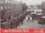
Search results from Open Library.
Recent natural events nearby
Ground air-quality sensors
Recently spotted species
Events
Gallery
Sources
- • Wikipedia
- • Wikidata
- • Open-Meteo / sunrise-sunset.org
- • Wikipedia Pageviews API
- • Open Library
- • Wikidata SPARQL (CC0) — population, area, elevation, inception, head of government, Commons image