Browse / United Kingdom / England / Sheringham
Sheringham
Englandtown

Sheringham
Total population
7,367
Demographic figures from UK Office for National Statistics. Overview below cites Wikipedia and may reference a different year.
City facts
Sister cities
Facts from Wikidata (CC0).
Overview
Sheringham is a seaside town and civil parish in the county of Norfolk, England. The motto of the town, granted in 1953 to the Sheringham Urban District Council, is Mare Ditat Pinusque Decorat, Latin for "The sea enriches and the pine adorns".
Read more on WikipediaHistory & geography
History
The place-name Sheringham is first attested in the Domesday Book of 1086, where it appears as Silingeham. It appears as Siringeham in 1174 and Scheringham in the Book of Fees (Liber feodorum) in 1242. The name means 'the homestead of Scira's people'. Historically, the parish of Sheringham comprised the two villages of Upper Sheringham, a farming community, and Lower Sheringham, which combined farming with fishing. The fishing industry was at its peak in the late 19th and early 20th centuries, as the coming of the railways made it possible for fish to be transported more efficiently to market. Through the 1900s, the focus of the fishing, as all along the north Norfolk coast, began to be on crabs, lobsters and whelks. The local fishermen were major suppliers of crabs and lobsters to the London fish markets. Long lining for cod and the catching of herring began to become less important in the second half of the century, as did whelking. Today, from a peak of maybe 200 boats, Sheringham has eight boats operated single-handed. The current town of Sheringham was once Lower Sheringham, a fishing station for the main village, now known as Upper Sheringham. It is a railway town that was developed with the coming of the Midland and Great Northern Joint Railway line in the late 19th century. Most of Sheringham's range of buildings and shops come from this period and the early 20th century. It has a particularly interesting range of buildings using flint, not normally in the traditional Norfolk style but in a variety of techniques. Sheringham Town Hall, the former headquarters of Sheringham Urban District Council, was completed in 1912. In the First World War, Sheringham was struck by two bombs dropped by the German Imperial Navy Zeppelin L 4 (LZ 27) at approximately 20:30 and…
Excerpted from the corresponding Wikipedia article (CC BY-SA).
Geography
Coordinates & boundaries from the US Census TIGER/Line shapefiles.
Climate
Air quality
Walkability
Amenities nearby
Wildlife & biodiversity
Earthquake history
Photos
Sights & places nearby
Notable people from here
Geography & sun
Elevation, sunrise/sunset and daylight from Open-Meteo. Solar climatology from NASA POWER.
Nearby airports
Public attention
Pageview totals from the Wikimedia Pageviews API.
Books about Sheringham


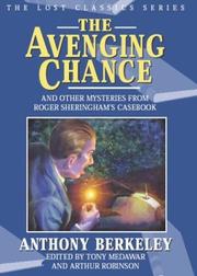
Search results from Open Library.
Recent natural events nearby
Ground air-quality sensors
Recently spotted species
Events
Gallery
Official Identifiers
ONS — UK Office for National Statistics
- ONS code
- osgb4000000074569819
- Local type
- Town
- Region
- Eastern
api.postcodes.io / OS Open Names
Sources
- • Wikipedia
- • Wikidata
- • Open-Meteo / sunrise-sunset.org
- • Wikipedia Pageviews API
- • Open Library
- • ONS / OS Open Names — UK official place gazetteer, via api.postcodes.io (OS code, local type, county/unitary, district/borough, region)
- • ONS — UK Office for National Statistics — api.postcodes.io / OS Open Names