Browse / United Kingdom / England / Shipley
Shipley
Englandtown

Shipley
Demographic figures from UK Office for National Statistics. Overview below cites Wikipedia and may reference a different year.
City facts
Overview
Shipley is a historic market town and civil parish in the City of Bradford, West Yorkshire, England. Located on the River Aire and the Leeds and Liverpool Canal, Shipley is directly north of the city of Bradford. The population of Shipley at the 2011 Census was 15,483.
Read more on WikipediaHistory & geography
History
The place-name Shipley derives from two words: the Old English ('sheep', a Northumbrian dialect form, contrasting with the Anglian dialect form which underlies modern English sheep) and meaning either 'a forest, wood, glade, clearing' or, later, 'a pasture, meadow'. It has therefore been variously defined as 'forest clearing used for sheep' or 'sheep field'. Shipley appears to have first been settled in the late Bronze Age and is mentioned in the Domesday Book of 1086, in the form . Its early history relies on the records of a succession of Lords of the Manor, not all of whom were in permanent residence. The rolls of the manor court have been missing since the 18th century, leaving the records incomplete. In the 12th century, 'Adam, son of Peter', an early Lord of the manor, granted grazing and iron ore mining rights to the monks of Rievaulx Abbey. Through the Middle Ages the Lords were the 'Earls of Ormande' (sic), possibly the Irish Earls of Ormond, followed by the Gascoigne family. In 1495, Rosamund Gascoigne, a daughter of one of the William Gascoignes who held the title, married Robert Rawson, thought to be related to the Rawson family of Bradford, after whom one of the city's markets is named. Their son, William, married a cousin, Agnes Gascoigne, and through the marriage the Rawson family inherited the manor in 1570. The Rawsons lived at Over Hall known as the Manor House, on the site of the current town hall. The manor estates extended to Northcliff, to the south of Shipley. The family had interests in Halifax and moved there in the early 18th century, retaining their Shipley estates until the last male heir died in 1745. By the 19th century the Rawson estates and those of the Fields, another prominent land-owning family, had become…
Geography
Shipley is located at an important crossing of the River Aire, where the route from Otley to Bradford crosses the route from Skipton to Leeds. It is sheltered by the millstone crags of Wrose and Windhill to the east, and to the north by Baildon and Hawksworth Moors. Early development in Shipley was centred on the crossroads, locally known today as Fox Corner after the former Fox and Hounds pub that stood there. Here, as today, the route from Otley to Bradford crossed the route from Skipton to Leeds at an important crossing of the River Aire. The present Kirkgate and Manor Lane (then known as Sower Lane) were probably no more than tracks. In medieval times, Shipley consisted of the settlement around the crossroads, and the unenclosed fields at Shipley Fields and the Hirst which were collectively farmed. Beyond these lay the Low Moor, which ran from the Crowghyll to the former Saltaire roundabout (now a junction on the Bradford to Keighley road), in the approximate area of modern day Wycliffe, and the wasteland of High Moor (from Saltaire roundabout, through Moorhead, as far as New Brighton and Noon Nick). These areas were steep, rocky land, unsuitable for farming. By 1600 at the latest, the open fields had been enclosed and given way to individual farms. The town was bounded to the north by the River Aire, to the east by Bradford Beck, with Cottingley and Heaton lying beyond its western and southern boundaries. Outlying districts, such as Windhill, were not part of Shipley until the 19th century. Saltaire became part of Shipley after its foundation in the 1860s, while Windhill, which had previously been part of Idle, became part of the Shipley Urban District in 1894.
Excerpted from the corresponding Wikipedia article (CC BY-SA).
Geography
Coordinates & boundaries from the US Census TIGER/Line shapefiles.
Climate
Air quality
Walkability
Amenities nearby
Wildlife & biodiversity
Most-observed species
- Common Wood-PigeonColumba palumbus Linnaeus, 1758 · Aves11,014
- Eurasian MagpiePica pica (Linnaeus, 1758) · Aves9,345
- Eurasian BlackbirdTurdus merula Linnaeus, 1758 · Aves9,103
- Carrion CrowCorvus corone Linnaeus, 1758 · Aves8,986
- European RobinErithacus rubecula (Linnaeus, 1758) · Aves8,560
- Eurasian Blue TitCyanistes caeruleus (Linnaeus, 1758) · Aves7,868
- MallardAnas platyrhynchos Linnaeus, 1758 · Aves6,455
- Great TitParus major Linnaeus, 1758 · Aves6,173
Citizen-science & research observations from the Global Biodiversity Information Facility (GBIF).
Earthquake history
Most recent
- M 3.4 — 2025-12-030 km ESE of Carnforth, United Kingdom
- M 2.7 — 2023-06-282 km SE of Cheadle, United Kingdom
- M 2.8 — 2020-01-231 km NW of Stockton-on-Tees, United Kingdom
- M 2.6 — 2014-10-282 km NNE of Hucknall, United Kingdom
- M 3.6 — 2011-01-035 km S of Masham, United Kingdom
- M 3.7 — 2009-04-283 km WSW of Flookburgh, United Kingdom
Events from the USGS Earthquake Catalog (global) (FDSN Event Web Service).
Photos
Sights & places nearby
Notable people from here
Geography & sun
Elevation, sunrise/sunset and daylight from Open-Meteo. Solar climatology from NASA POWER.
Nearby airports
Public attention
Pageview totals from the Wikimedia Pageviews API.
Books about Shipley

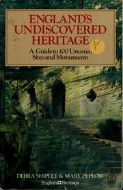


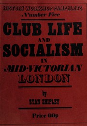
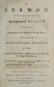

Search results from Open Library.
Recent natural events nearby
Ground air-quality sensors
Recently spotted species
Events
Gallery
Official Identifiers
ONS — UK Office for National Statistics
- ONS code
- osgb4000000074573367
- Local type
- Town
- Region
- Yorkshire and the Humber
api.postcodes.io / OS Open Names
Sources
- • Wikipedia
- • USGS Earthquake Catalog (global feed)
- • GBIF (Global Biodiversity Information Facility)
- • Open-Meteo / sunrise-sunset.org
- • Wikipedia Pageviews API
- • Open Library
- • ONS / OS Open Names — UK official place gazetteer, via api.postcodes.io (OS code, local type, county/unitary, district/borough, region)
- • ONS — UK Office for National Statistics — api.postcodes.io / OS Open Names