Browse / United Kingdom / Scotland / Stranraer
Stranraer
Scotlandtown

Stranraer
Total population
10,320
Demographic figures from UK Office for National Statistics. Overview below cites Wikipedia and may reference a different year.
City facts
Overview
Stranraer, also known as the Toon or the Cleyhole, is a town in Dumfries and Galloway, Scotland, on Loch Ryan and the northern side of the isthmus joining the Rhins of Galloway to the mainland. Stranraer is Dumfries and Galloway's second-largest town, with a population of 9,751 in 2022.
Read more on WikipediaHistory & geography
History
The Battle of Loch Ryan was fought near Stranraer on 9/10 February 1307 during the Scottish Wars of Independence. King Robert I of Scotland's invasion of his ancestral lands in Annandale and Carrick began in 1307. The Annandale and Galloway invasion force was led by his brothers Alexander de Brus and Thomas de Brus, Malcolm McQuillan, Lord of Kintyre, an Irish sub-king and Sir Reginald de Crawford. The force consisted of 1,000 men and 18 galleys. They sailed into Loch Ryan and landed near Stranraer. The invasion force was quickly overwhelmed by local forces, led by Dungal MacDouall, who was a supporter of the Balliols, Comyns and King Edward I of England, and only two galleys escaped. All the leaders were captured. MacDouall summarily executed the Irish sub-king and Malcolm McQuillan, Lord of Kintyre. Alexander, Thomas and Reginald de Crawford were sent to Carlisle, England, where they were executed. The heads of McQuillan and two Irish chiefs were sent to King Edward I. On 12 November 1595, the Clashant of Stranrawer was named part of Ninian Adair's lands of Barony and, in 1596, was erected into a burgh of barony, the Barony of Kinhilt. This is recorded in the Register of the Great Seal of Scotland. The partial translation into English is: At Linlithgow, 12 November 1595, the King confirms and for faithful service again dedicates to Ninian Adair of Kinhilt, and the legitimate male heirs of his body, which failing his nearest legitimate male heirs whosoever bear the name and insignia of Adair[, various lands....] In addition, the King creates the village at Clauchane de Stranraer as a free burgh of the barony with a free port, called the Burgh and Port of Stranraer; and the said Ninian etc shall have the authority to appoint a bailiff, treasurer, Dean of Guild,…
Excerpted from the corresponding Wikipedia article (CC BY-SA).
Geography
Coordinates & boundaries from the US Census TIGER/Line shapefiles.
Climate
Air quality
Walkability
Amenities nearby
Wildlife & biodiversity
Earthquake history
Photos
Sights & places nearby
Notable people from here
Nearby places in Scotland
Geography & sun
Elevation, sunrise/sunset and daylight from Open-Meteo. Solar climatology from NASA POWER.
Nearby airports
Public attention
Pageview totals from the Wikimedia Pageviews API.
Books about Stranraer
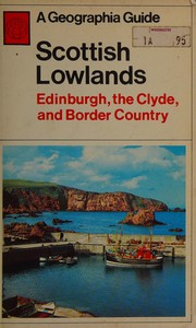



Search results from Open Library.
Recent natural events nearby
Ground air-quality sensors
Recently spotted species
Events
Gallery
Official Identifiers
ONS — UK Office for National Statistics
- ONS code
- osgb4000000074566999
- Local type
- Town
- Region
- Scotland
api.postcodes.io / OS Open Names
Sources
- • Wikipedia
- • Open-Meteo / sunrise-sunset.org
- • Wikipedia Pageviews API
- • Open Library
- • Wikidata SPARQL (CC0) — population, area, elevation, inception, head of government, Commons image
- • ONS / OS Open Names — UK official place gazetteer, via api.postcodes.io (OS code, local type, county/unitary, district/borough, region)
- • ONS — UK Office for National Statistics — api.postcodes.io / OS Open Names