Browse / United Kingdom / England / Watford
Watford
Englandtown

Watford
Total population
120,000
Demographic figures from UK Office for National Statistics. Overview below cites Wikipedia and may reference a different year.
City facts
Sister cities
Facts from Wikidata (CC0).
Overview
Watford is a town and non-metropolitan district with borough status in Hertfordshire, England, 15 miles (24 km) northwest of Central London, on the banks of the River Colne.
Read more on WikipediaHistory & geography
History
There is evidence of some limited prehistoric occupation around the Watford area, with a few Celtic and Roman finds, though there is no evidence of a settlement until much later. Watford stands where the River Colne could be crossed on an ancient trackway from the southeast to the northwest. Watford's High Street follows the line of part of this route. The town was located on the first dry ground above the marshy edges of the River Colne. The name Watford may have arisen from the Old English for "waet" (full of water – the area was marshy), or "wath" (hunting), and ford. The name Watford is first mentioned in an Anglo-Saxon charter of 1007, where "Watforda" is one of the places marking the boundary of "Oxanhæge". It is not mentioned in the Domesday Book of 1086, when this area was part of St Albans Abbey's manor of Cashio. In the 12th century the Abbey was granted a charter allowing it to hold a market here, and the building of St Mary's Church began. The settlement's location helped it to grow, since as well as trade along this north–south through route it possessed good communications into the vale of St Albans to the east and into the Chiltern Hills along the valley of the River Chess to the west. The town grew modestly, assisted by travellers passing through to Berkhamsted Castle and the royal palace at Kings Langley. A big house was built at Cassiobury in the 16th century. This was partly rebuilt in the 17th century and another substantial house was built nearby at The Grove. The houses were expanded and developed throughout the following centuries. Cassiobury became the family seat of the Earls of Essex, and The Grove the seat of the Earls of Clarendon. Writing between 1724 and 1727, Daniel Defoe described Watford as a "genteel market town, very long,…
Geography
Watford developed on the River Colne in southern Hertfordshire, England, northwest of central London. Ethnicity is 61.9% White British, 2.3% Irish, 0.1% Gypsy or Irish traveller, 7.7% Other White, 17.9% Asian/Asian British, 5.8% Black or Black British. The borough had 102,246 inhabitants at the time of the 2021 census.
Excerpted from the corresponding Wikipedia article (CC BY-SA).
Geography
Coordinates & boundaries from the US Census TIGER/Line shapefiles.
Climate
Air quality
Walkability
Amenities nearby
Wildlife & biodiversity
Earthquake history
Photos
Sights & places nearby
Notable people from here


People born within ~10 km, from Wikidata (CC0). Click any name for their Wikipedia article.
Geography & sun
Elevation, sunrise/sunset and daylight from Open-Meteo. Solar climatology from NASA POWER.
Nearby airports
Public attention
Pageview totals from the Wikimedia Pageviews API.
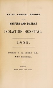
Books about Watford

![[Report 1893]](https://covers.openlibrary.org/b/id/11797440-M.jpg)


Search results from Open Library.
Recent natural events nearby
Ground air-quality sensors
Recently spotted species
Events
Gallery
Official Identifiers
ONS — UK Office for National Statistics
- ONS code
- osgb4000000074562546
- Local type
- Town
- Region
- Eastern
api.postcodes.io / OS Open Names
Sources
- • Wikipedia
- • Wikidata
- • Open-Meteo / sunrise-sunset.org
- • Wikipedia Pageviews API
- • Open Library
- • Wikidata SPARQL (CC0) — population, area, elevation, inception, head of government, Commons image
- • ONS / OS Open Names — UK official place gazetteer, via api.postcodes.io (OS code, local type, county/unitary, district/borough, region)
- • ONS — UK Office for National Statistics — api.postcodes.io / OS Open Names