Browse / United States / Virginia / Appalachia
Appalachia
Virginiatown

Appalachia
Total population
1,391
Median home value
$67,100
Bachelor's+
Median income
$43,068
Founded
1898
Demographic figures from US Census Bureau · ACS 5-year estimates. Overview below cites Wikipedia and may reference a different year.
City facts
Facts from Wikidata (CC0).
Overview
Appalachia is a town in Wise County, Virginia, United States. As of the 2020 census, Appalachia had a population of 1,432.
Read more on WikipediaHistory & geography
History
The Appalachia post office was established in 1898. The community was named for the surrounding Appalachian Mountains. The Derby Historic District, Kelly View School, and Stonega Historic District are listed on the National Register of Historic Places. Appalachia was formerly home to three railroad companies. The "big three" were the Southern Railway, Louisville & Nashville, and the Interstate Railroad. As of 2022, the Norfolk Southern Railroad is the only operating line through Appalachia, hauling only coal and the occasional ammonium nitrate and limestone aggregate product. These hoppers can be easily identified behind Main Street with the markings of the former railroads painted on the ribbed sides, most reading "Southern" and some "Norfolk & Western". In 2006, fourteen Appalachia residents, including mayor Ben Cooper and the police chief, were indicted on charges relating to an electoral fraud conspiracy. Cooper was convicted of intercepting absentee ballots and changing the votes on them; buying votes with beer, cigarettes, and pork rinds; and conspiring with his appointee, the police chief, to steal money and other items from residents, among 243 felony charges. Ten other conspirators pleaded guilty and received fines or short jail sentences.
Geography
According to the United States Census Bureau, the town has a total area of 2.3 square miles (6.0 km2), all land. Appalachia is surrounded by numerous coal camp communities, including Andover, Arno, Derby, Imboden, Exeter, Dunbar, Pardee, Osaka, Roda, and Stonega. Many of these communities formed at the beginning of the 20th-century with the arrival of the mining and railroad industry.
Excerpted from the corresponding Wikipedia article (CC BY-SA).
Demographics & economy
Race & ethnicity
Source: US Census Bureau — American Community Survey, 5-year estimates.
Geography
Coordinates & boundaries from the US Census TIGER/Line shapefiles.
Climate
Current forecast
Forecast for Appalachia, VA from NOAA NWS API.
Air quality
Industrial & pollution facilities
Natural hazard risk
Health (adults)
Age-adjusted prevalence estimates from CDC PLACES (latest release).
Walkability
Amenities nearby
Wildlife & biodiversity
Most-observed species
- American CrowCorvus brachyrhynchos C.L.Brehm, 1822 · Aves476
- American RobinTurdus migratorius Linnaeus, 1766 · Aves468
- Northern CardinalCardinalis cardinalis (Linnaeus, 1758) · Aves404
- Carolina WrenThryothorus ludovicianus (Latham, 1790) · Aves393
- Eastern TowheePipilo erythrophthalmus (Linnaeus, 1758) · Aves384
- Song SparrowMelospiza melodia (A.Wilson, 1810) · Aves380
- Red-eyed VireoVireo olivaceus (Linnaeus, 1766) · Aves372
- Blue JayCyanocitta cristata (Linnaeus, 1758) · Aves363
Citizen-science & research observations from the Global Biodiversity Information Facility (GBIF).
Schools
Largest nearby schools
- UNION PRIMARYElementary · Big Stone Gap · 861 students · 14.6:1 ratio
- UNION HIGHHigh · Big Stone Gap · 601 students · 15.8:1 ratio
- UNION MIDDLEMiddle · Big Stone Gap · 583 students · 13:1 ratio
Public K–12 schools within ~10 mi from Urban Institute Education Data Portal (NCES Common Core of Data, 2022).
Earthquake history
Most recent
- M 2.6 — 2026-01-0411 km SW of Middlesboro, Kentucky
- M 2.74 — 2024-05-2218 km SSE of Hyden, Kentucky
- M 2.57 — 2023-06-25Kentucky-Tennessee border region
- M 2.56 — 2021-11-219 km SSW of Abingdon, Virginia
- M 3.1 — 2021-10-26Tennessee-Virginia border region
- M 2.79 — 2021-02-128 km SW of Banner Hill, Tennessee
Events from the USGS Earthquake Catalog (global) (FDSN Event Web Service).
Photos
Sights & places nearby
Notable people from here
Nearby places in Virginia
Geography & sun
Elevation, sunrise/sunset and daylight from Open-Meteo. Solar climatology from NASA POWER.
Nearby airports
Public attention
Pageview totals from the Wikimedia Pageviews API.
Books about Appalachia




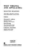


Search results from Open Library.
Recent natural events nearby
Ground air-quality sensors
Recently spotted species
Nearest stream gauge
Events
Gallery
Sources
- • Wikipedia
- • US Census Bureau (ACS 5-year estimates)
- • NOAA National Weather Service
- • Wikidata
- • USGS Earthquake Catalog (global feed)
- • NCES via Urban Institute Education Data Portal
- • GBIF (Global Biodiversity Information Facility)
- • CDC PLACES
- • Open-Meteo / sunrise-sunset.org
- • Wikipedia Pageviews API
- • Open Library