Browse / United States / Virginia / Burke
Burke
VirginiaCDP

Burke
Total population
44,029
Median home value
$747,700
Bachelor's+
Median income
$185,818
Demographic figures from US Census Bureau · ACS 5-year estimates. Overview below cites Wikipedia and may reference a different year.
City facts
Facts from Wikidata (CC0).
Overview
Burke is an unincorporated section of Fairfax County, Virginia, United States, traditionally defined as the area served by the Burke post office. Burke includes two census-designated places: the Burke CDP, population 42,312 in 2020 and the Burke Centre CDP, population 17,518 in 2020.
Read more on WikipediaHistory & geography
History
Burke is named after Silas Burke (1796–1854), who built a house on a hill overlooking the valley of Pohick Creek in approximately 1824. Burke was a farmer, merchant, and local politician. He was a judge, sheriff, director of the Orange and Alexandria Railroad Company, president of the Fairfax Agricultural Society and the Fairfax Turnpike Company, among other leadership titles. He was also an overseer of the Fitzhugh’s plantation, which meant that he managed the Fitzhugh’s slaves and farming tasks. Burke also had personal slaves for his own farm. The Silas Burke house still stands. When the Orange and Alexandria Railroad was constructed in the late 1840s, the railroad station at the base of that hill was named "Burke's Station" after Burke, who owned the land in the area and donated a right-of-way to the railroad company. The community that grew up around the railroad station acquired a post office branch in 1852. The railroad tracks located on the same historical line are owned by the Norfolk Southern Railway and form part of the Manassas Line of the Virginia Railway Express commuter rail system, which has two stations (Rolling Road and Burke Centre) in the Burke area. The original Burke Station building can still be seen in the community, turned 90 degrees from its historical footprint. During the Civil War, the railway station was garrisoned by Union troops. The Bog Wallow Ambush occurred nearby in 1861. On December 28, 1862, Confederate cavalry under General J.E.B. Stuart raided the station. Stuart seized supplies from the area, destroyed a nearby bridge, monitored Union messages passing over the telegraph lines, and then famously sent a telegram to Union Quartermaster General Montgomery C. Meigs complaining of the poor quality of the mules he had captured.…
Geography
Burke is located south of the center of Fairfax County at (38.781480, −77.270750). The Burke CDP is bordered by the CDPs of Burke Centre to the west, Kings Park West to the northwest, Long Branch and Wakefield to the north, Kings Park to the northeast, West Springfield to the east, Newington Forest to the south, and South Run to the southwest. Burke Lake Park, which borders the Burke CDP to the southwest and is not part of any CDP, is a large recreational park operated by the Fairfax County Park Authority, featuring a golf course and woodland surrounding Burke Lake. According to the United States Census Bureau, the Burke CDP has a total area of , of which is land and , or 1.22%, is water. Most of the water making up Burke consists of artificial ponds and lakes.
Excerpted from the corresponding Wikipedia article (CC BY-SA).
Demographics & economy
Race & ethnicity
Source: US Census Bureau — American Community Survey, 5-year estimates.
Geography
Coordinates & boundaries from the US Census TIGER/Line shapefiles.
Climate
Current forecast
Forecast for Burke, VA from NOAA NWS API.
Air quality
Industrial & pollution facilities
Natural hazard risk
Health (adults)
Age-adjusted prevalence estimates from CDC PLACES (latest release).
Walkability
Amenities nearby
Wildlife & biodiversity
Schools
Largest nearby schools
- LAKE BRADDOCK SECONDARYHigh · Burke · 4,377 students · 16.8:1 ratio
- ROBINSON SECONDARYHigh · Fairfax · 3,607 students · 16.6:1 ratio
- HAYFIELD SECONDARYHigh · Alexandria · 3,145 students · 16.7:1 ratio
- OAKTON HIGHHigh · Vienna · 2,701 students · 17.5:1 ratio
- WEST SPRINGFIELD HIGHHigh · Springfield · 2,663 students · 17.6:1 ratio
- CENTREVILLE HIGHHigh · Clifton · 2,623 students · 17.6:1 ratio
- WOODSON HIGHHigh · Fairfax · 2,478 students · 15.3:1 ratio
- JUSTICE HIGHHigh · Falls Church · 2,362 students · 16.2:1 ratio
Public K–12 schools within ~10 mi from Urban Institute Education Data Portal (NCES Common Core of Data, 2022).
Earthquake history
Photos
Sights & places nearby
Notable people from here


People born within ~10 km, from Wikidata (CC0). Click any name for their Wikipedia article.
Nearby places in Virginia
Geography & sun
Elevation, sunrise/sunset and daylight from Open-Meteo. Solar climatology from NASA POWER.
Nearby airports
Public attention
Pageview totals from the Wikimedia Pageviews API.
Books about Burke
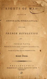

Search results from Open Library.
Recent natural events nearby
Ground air-quality sensors
Recently spotted species
Nearest stream gauge
Events
Gallery
Sources
- • Wikipedia
- • US Census Bureau (ACS 5-year estimates)
- • NOAA National Weather Service
- • Wikidata
- • NCES via Urban Institute Education Data Portal
- • CDC PLACES
- • Open-Meteo / sunrise-sunset.org
- • Wikipedia Pageviews API
- • Open Library