Browse / United States / Virginia / Dunn Loring
Dunn Loring
VirginiaCDP

Dunn Loring
Total population
8,957
Median home value
$951,400
Bachelor's+
Median income
$244,265
Demographic figures from US Census Bureau · ACS 5-year estimates. Overview below cites Wikipedia and may reference a different year.
City facts
Facts from Wikidata (CC0).
Overview
Dunn Loring is a census-designated place (CDP) in Fairfax County, Virginia, United States. The population was 9,464 as of the 2020 census. This suburban area is bordered by Merrifield to the south, Vienna to the west, Tysons to the north, and Idylwood to the east. Dunn Loring is located within the Washington metropolitan area.
Read more on WikipediaHistory & geography
History
Dunn Loring (archaic "Dunn-Loring"), the earliest platted subdivision in Fairfax County and possibly the Commonwealth of Virginia, was founded in 1886. General William McKee Dunn and his wife Elizabeth Lanier Dunn purchased about located on the Washington, Ohio and Western Railroad, now the Washington and Old Dominion Regional Trail, from L. B. Clarke and his wife on June 8, 1886. On September 22, 1886, the land was transferred to the Loring Land and Improvement Company, composed of General Dunn, then a retired Army brigadier general and former Judge Advocate General; George B. Loring, a former congressman and Commissioner of Agriculture; and George H. LeFetra, a Washington temperance hotel proprietor. The Town of Dunn Loring was advertised for residential sales in 1887. The Loring Land and Improvement Company built a railroad station and a post office, but shortly thereafter General Dunn died, and the development stagnated. During the Spanish–American War, the founding of Camp Russell A. Alger brought growth and prosperity to Dunn Loring, and among the troops trained at Camp Alger was the celebrated author-poet Carl Sandburg, after whom the present Sandburg Street was named. In 1912, Fairfax Shield McCandlish bought out the interests of the developers, consolidated parcels, and subdivided the land into its current platting. Following World War II, the area began to develop as part of Metropolitan Washington, D.C. Up until the mid-1990s, large portions of the land (mainly between Lee Highway and Gallows Road) had been horse farms and plantations before being developed.
Geography
Dunn Loring is located in northeastern Fairfax County at (38.891982, −77.231150). It is bordered to the west by the town of Vienna, to the north by Tysons Corner, to the east by the Capital Beltway, and to the south by Interstate 66. Dunn Loring is west of downtown Washington, D.C. According to the U.S. Census Bureau, the CDP has a total area of , all land.
Excerpted from the corresponding Wikipedia article (CC BY-SA).
Demographics & economy
Race & ethnicity
Source: US Census Bureau — American Community Survey, 5-year estimates.
Geography
Coordinates & boundaries from the US Census TIGER/Line shapefiles.
Climate
Air quality
Industrial & pollution facilities
Natural hazard risk
Health (adults)
Age-adjusted prevalence estimates from CDC PLACES (latest release).
Walkability
Amenities nearby
Wildlife & biodiversity
Schools
Largest nearby schools
- LAKE BRADDOCK SECONDARYHigh · Burke · 4,377 students · 16.8:1 ratio
- ROBINSON SECONDARYHigh · Fairfax · 3,607 students · 16.6:1 ratio
- CHANTILLY HIGHHigh · Chantilly · 2,937 students · 16.2:1 ratio
- OAKTON HIGHHigh · Vienna · 2,701 students · 17.5:1 ratio
- WEST SPRINGFIELD HIGHHigh · Springfield · 2,663 students · 17.6:1 ratio
- SOUTH LAKES HIGHHigh · Reston · 2,530 students · 15.2:1 ratio
- WOODSON HIGHHigh · Fairfax · 2,478 students · 15.3:1 ratio
- MCLEAN HIGHHigh · McLean · 2,441 students · 17.6:1 ratio
Public K–12 schools within ~10 mi from Urban Institute Education Data Portal (NCES Common Core of Data, 2022).
Earthquake history
Photos
Sights & places nearby
Notable people from here


People born within ~10 km, from Wikidata (CC0). Click any name for their Wikipedia article.
Nearby places in Virginia
Geography & sun
Elevation, sunrise/sunset and daylight from Open-Meteo. Solar climatology from NASA POWER.
Nearby airports
Public attention
Pageview totals from the Wikimedia Pageviews API.
Books about Dunn Loring


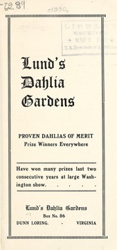
Search results from Open Library.
Recent natural events nearby
Ground air-quality sensors
Recently spotted species
Nearest stream gauge
Events
Gallery
Sources
- • Wikipedia
- • US Census Bureau (ACS 5-year estimates)
- • Wikidata
- • NCES via Urban Institute Education Data Portal
- • CDC PLACES
- • Open-Meteo / sunrise-sunset.org
- • Wikipedia Pageviews API
- • Open Library