Browse / United States / Virginia / Manassas
Manassas
Virginiacity

Manassas
Total population
42,976
Median home value
$449,900
Bachelor's+
Median income
$113,590
Founded
1975
Demographic figures from US Census Bureau · ACS 5-year estimates. Overview below cites Wikipedia and may reference a different year.
City facts
Facts from Wikidata (CC0).
Overview
Manassas, formerly Manassas Junction, is an independent city in the Commonwealth of Virginia, United States. The population was 42,772 at the 2020 Census. It is the county seat of Prince William County, although the two are separate jurisdictions. Manassas borders the independent city of Manassas Park. The Bureau of Economic Analysis includes both Manassas and Manassas Park with Prince William County for statistical purposes.
Read more on WikipediaHistory & geography
History
In 1851, a post office and railroad stop servicing the Orange and Alexandria Railroad (O&A) were established in the area then known as Tudor Hall, named for a nearby plantation home. Soon after, construction began on the Manassas Gap Railroad (MGRR), which was planned to run westward from the O&A at Tudor Hall to the Shenandoah Valley, by way of Manassas Gap. By 1854, the MGRR was completed between Tudor Hall and Strasburg. In the early 1860s, following the construction of the railroad junction, the village of Tudor Hall became known as Manassas Junction. In July 1861, the First Battle of Bull Run—also known as the Battle of First Manassas —was fought nearby, the first major land battle of the American Civil War. Manassas commemorated its 150th anniversary on July 21–24, 2011. The Second Battle of Bull Run (or the Battle of Second Manassas) was fought near Manassas on August 28–30, 1862. At that time, Manassas Junction was little more than a railroad crossing, but a strategic one, with rails leading to Richmond, Virginia, Washington, D.C., and the Shenandoah Valley. Despite these two Confederate victories, Manassas Junction was in Union hands for most of the war. Following the war, the crossroads grew into the town of Manassas, which was incorporated in 1873. In 1894, Manassas was designated the county seat of Prince William County, replacing Brentsville. Between July 16 and July 22, 1911, veterans from both sides of the war reunited in Manassas for a Peace Jubilee marking 50 years since the First Battle of Bull Run. On July 21, after meeting and shaking hands at Henry House Hill, they picnicked together on the former battlefield before re-uniting again at the then-fairly new Prince William County Courthouse to hear a speech by President William Howard Taft,…
Geography
Manassas is mainly served by I-66, U.S. 29, Virginia State Route 234 Business and Virginia State Route 28. According to the United States Census Bureau, the city has a total area of , of which is land and (0.5%) is water. Since its origin the city has been crossed by key transportation routes which have led to the area being incorporated into major developments such as Interstate 66 and major rail lines, and serving as the government center for Prince William County. The climate in this area is characterized by hot, humid summers and generally mild to cool winters. According to the Köppen Climate Classification system, Manassas has a humid subtropical climate, abbreviated "Cfa" on climate maps. Average monthly temperatures range from in January to in July. The local hardiness zone is 7a.
Excerpted from the corresponding Wikipedia article (CC BY-SA).
Demographics & economy
Race & ethnicity
Source: US Census Bureau — American Community Survey, 5-year estimates.
Geography
Coordinates & boundaries from the US Census TIGER/Line shapefiles.
Climate
Air quality
Industrial & pollution facilities
Natural hazard risk
Health (adults)
Age-adjusted prevalence estimates from CDC PLACES (latest release).
Walkability
Amenities nearby
Wildlife & biodiversity
Most-observed species
- Northern CardinalCardinalis cardinalis (Linnaeus, 1758) · Aves47,395
- Carolina WrenThryothorus ludovicianus (Latham, 1790) · Aves38,878
- American CrowCorvus brachyrhynchos C.L.Brehm, 1822 · Aves33,649
- American RobinTurdus migratorius Linnaeus, 1766 · Aves31,190
- Tufted TitmouseBaeolophus bicolor (Linnaeus, 1766) · Aves30,672
- Mourning DoveZenaida macroura (Linnaeus, 1758) · Aves30,590
- Blue JayCyanocitta cristata (Linnaeus, 1758) · Aves30,237
- Carolina ChickadeePoecile carolinensis (Audubon, 1834) · Aves29,479
Citizen-science & research observations from the Global Biodiversity Information Facility (GBIF).
Schools
Largest nearby schools
- OSBOURN HIGHHigh · Manassas · 2,323 students · 17.5:1 ratio
- GRACE E. METZ MIDDLEMiddle · Manassas · 1,102 students · 15.5:1 ratio
- MAYFIELD INTERMEDIATEMiddle · Manassas · 840 students
- PENNINGTON TRADITIONALElementary · Manassas · 654 students · 17.7:1 ratio
- Baldwin ElementaryElementary · Manassas · 630 students · 17:1 ratio
- Richard C. Haydon ElementaryElementary · Manassas · 608 students · 16.9:1 ratio
- Jennie Dean ElementaryElementary · Manassas · 589 students · 15.9:1 ratio
- Weems ElementaryElementary · Manassas · 566 students · 15.3:1 ratio
Public K–12 schools within ~10 mi from Urban Institute Education Data Portal (NCES Common Core of Data, 2022).
Earthquake history
Photos
Sights & places nearby
Notable people from here
Nearby places in Virginia
Geography & sun
Elevation, sunrise/sunset and daylight from Open-Meteo. Solar climatology from NASA POWER.
Nearby airports
Public attention
Pageview totals from the Wikimedia Pageviews API.
Books about Manassas
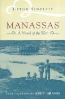
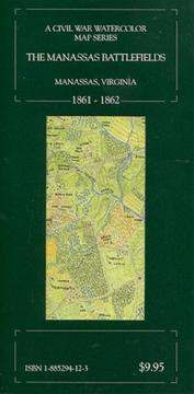
Search results from Open Library.
Recent natural events nearby
Ground air-quality sensors
Recently spotted species
Nearest stream gauge
Events
Gallery
Sources
- • Wikipedia
- • US Census Bureau (ACS 5-year estimates)
- • Wikidata
- • NCES via Urban Institute Education Data Portal
- • GBIF (Global Biodiversity Information Facility)
- • CDC PLACES
- • Open-Meteo / sunrise-sunset.org
- • Wikipedia Pageviews API
- • Open Library