Browse / United States / Virginia / Midlothian
Midlothian
VirginiaCDP

Midlothian
Total population
19,120
Median home value
$408,500
Bachelor's+
Median income
$110,084
Demographic figures from US Census Bureau · ACS 5-year estimates. Overview below cites Wikipedia and may reference a different year.
City facts
Facts from Wikidata (CC0).
Overview
Midlothian is an unincorporated area and census-designated place in Chesterfield County, Virginia, United States. Settled as a coal town, Midlothian village experienced suburbanization effects and is now part of the western suburbs of Richmond, south of the James River in the Greater Richmond Region. Because of its unincorporated status, Midlothian has no formal government, and the name is used to represent the original small Village of Midlothian and a vast expanse of Chesterfield County in the northwestern portion of Southside Richmond served by the Midlothian post office. As of the 2020 census, Midlothian had a population of 18,320.
Read more on WikipediaHistory & geography
History
The origins of the name of Midlothian are subject to debate. A prevalent story is that the name came from two brothers from East Lothian and West Lothian in Scotland who founded a village. For the name of the village they decided to name it after their respective homelands and a compromise was made, thus making the name of Midlothian. This local legend is based in some truth. The two brothers who were said to have founded the village were likely Abraham Salle and Dr. Archibald Logwood Wooldridge (often called A. S. and A. L. Wooldridge). They, along with their two sisters, Jane Elam and Charlotte Wooldridge, incorporated a mining company called the Midlothian Coal Mining Company in 1835. This company's lands consisted of most of the present-day land south of Midlothian Turnpike in the village of Midlothian and is thought to have given its name to the village. The name of the coal company came from the Midlothian tract of land that was one of the two tracts that made up the company's original land holdings of 404 1/2 acres. The name of the tract came from a house that was located there and was owned by the Wooldridge family. The first Wooldridge in America, and the one who had assembled most of the Midlothian area lands, John Wooldridge came in the late 17th century from England. However, his ancestors in England had connections with the region of Midlothian in Scotland, and it is from here that the name is originally derived. The village had not always been called Midlothian. In the late 1700s, the area was listed on maps simply as "Coal Mines" and later came to be known as Coalfield. The modern-day Coalfield Road is a remnant of this name. The station where the Richmond and Danville railroads cut through the village was called Coalfield Station. It was first built…
Geography
Midlothian is located in the Piedmont geologic region of the state, and is made up of mainly a hilled, fertile land (it is somewhat of a plain). It is located on the Richmond Basin, which is one of the Eastern North America Rift Basins. It contains some sedimentary rock and bituminous coal. The Midlothian area serves as the headwaters to a number of creeks which ultimately contribute their waters to the flow of the James River. These include Swift Creek and Falling Creek. The Swift Creek Reservoir serves as the major source of fresh water for the county.
Excerpted from the corresponding Wikipedia article (CC BY-SA).
Demographics & economy
Race & ethnicity
Source: US Census Bureau — American Community Survey, 5-year estimates.
Geography
Coordinates & boundaries from the US Census TIGER/Line shapefiles.
Climate
Current forecast
Forecast for Midlothian, VA from NOAA NWS API.
Air quality
Industrial & pollution facilities
Natural hazard risk
Health (adults)
Walkability
Amenities nearby
Wildlife & biodiversity
Most-observed species
- Northern CardinalCardinalis cardinalis (Linnaeus, 1758) · Aves31,408
- Carolina WrenThryothorus ludovicianus (Latham, 1790) · Aves26,982
- Carolina ChickadeePoecile carolinensis (Audubon, 1834) · Aves24,622
- Tufted TitmouseBaeolophus bicolor (Linnaeus, 1766) · Aves21,506
- American RobinTurdus migratorius Linnaeus, 1766 · Aves21,211
- Red-bellied WoodpeckerMelanerpes carolinus (Linnaeus, 1758) · Aves20,544
- American CrowCorvus brachyrhynchos C.L.Brehm, 1822 · Aves19,428
- Blue JayCyanocitta cristata (Linnaeus, 1758) · Aves19,295
Citizen-science & research observations from the Global Biodiversity Information Facility (GBIF).
Schools
Earthquake history
Most recent
- M 2.96 — 2025-05-068 km S of Dillwyn, Virginia
- M 2.77 — 2025-01-141 km NNE of Wyndham, Virginia
- M 2.66 — 2020-02-0310 km S of Louisa, Virginia
- M 2.51 — 2019-09-233 km WNW of Wyndham, Virginia
- M 2.6 — 2017-03-136 km ENE of Goochland, Virginia
- M 2.67 — 2015-11-043 km NE of Dillwyn, Virginia
Events from the USGS Earthquake Catalog (global) (FDSN Event Web Service).
Photos
Sights & places nearby
Notable people from here


People born within ~10 km, from Wikidata (CC0). Click any name for their Wikipedia article.
Nearby places in Virginia
Geography & sun
Elevation, sunrise/sunset and daylight from Open-Meteo. Solar climatology from NASA POWER.
Nearby airports
Public attention
Pageview totals from the Wikimedia Pageviews API.
Books about Midlothian

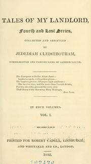


Search results from Open Library.
Recent natural events nearby
Ground air-quality sensors
Recently spotted species
Nearest stream gauge
Live readings from USGS NWIS · measured 2026-09-17 10:30 UTC.
Events
Gallery
Sources
- • Wikipedia
- • US Census Bureau (ACS 5-year estimates)
- • NOAA National Weather Service
- • Wikidata
- • USGS Earthquake Catalog (global feed)
- • USGS NWIS (water data)
- • GBIF (Global Biodiversity Information Facility)
- • Open-Meteo / sunrise-sunset.org
- • Wikipedia Pageviews API
- • Open Library