Browse / United States / Vermont / Cambridge
Cambridge
Vermontvillage

Cambridge
Total population
173
Median home value
$245,500
Bachelor's+
Median income
$50,568
Founded
1781
Air quality index
Demographic figures from US Census Bureau · ACS 5-year estimates. Overview below cites Wikipedia and may reference a different year.
City facts
Facts from Wikidata (CC0).
Overview
Cambridge is a town in Lamoille County, Vermont, United States. The population was 3,839 at the 2020 United States Census. Cambridge includes the villages of Jeffersonville and Cambridge.
Read more on WikipediaHistory & geography
History
Granted on November 7, 1780, Cambridge was chartered on August 13, 1781, to Samuel Robinson, John Fassett Jr., Jonathan Frost and 64 others. It was first settled in 1783 by John Safford from Piermont, New Hampshire. The valleys proved good but rough, best for grazing livestock. By 1839, the town had about 7,000 sheep. The Lamoille River offered water power for watermills. Industries included one woolen factory, one tannery, and one gristmill, plus several sawmills and cabinet shops. Cambridge and neighboring Johnson were together known as the King's College Tract, being created by Lieutenant Governor Cadwallader Colden by authority of King George III in 1764. The King's College Tract was reserved for the eventual establishment of a university on the site. The place name "Cambridge" suggests the University of Cambridge in England. Johnson, the other town in the King's College Grant, was named for William Samuel Johnson. Both the St. Johnsbury & Lake Champlain Railroad and the Burlington & Lamoille Railroad passed through the town. The former is now the Lamoille Valley Rail Trail.
Geography
Cambridge is in western Lamoille County, bordered to the northwest by Franklin County and to the southwest by Chittenden County. The village of Jeffersonville is in the center of the town, and the village of Cambridge is in the west. According to the United States Census Bureau, the town has a total area of , of which are land and , or 0.78%, are water. Cambridge is drained by the Lamoille River, which flows from east to west across the center of the town, passing through the north sides of Jeffersonville and Cambridge villages. Two main tributaries of the Lamoille drain the southern part of the town: the Brewster River originates in Smugglers Notch at the crest of the Green Mountains in the southernmost part of the town and flows north to Jeffersonville, while the Seymour River originates in Underhill and flows north to Cambridge village. The town is crossed by Vermont Route 15, Vermont Route 104, Vermont Route 108 and Vermont Route 109. VT-15 leads southwest to Winooski, next to Burlington, and southeast to Morrisville. VT-104 leads northwest to St. Albans, while VT-108 leads north to Enosburg Falls and south through Smugglers Notch to Stowe. VT-109 leads northeast to Belvidere. (All distances are measured from Jeffersonville.)
Excerpted from the corresponding Wikipedia article (CC BY-SA).
Demographics & economy
Race & ethnicity
Source: US Census Bureau — American Community Survey, 5-year estimates.
Geography
Coordinates & boundaries from the US Census TIGER/Line shapefiles.
Climate
Air quality
Current readings from Open-Meteo Air Quality API (Copernicus CAMS European reanalysis).
Industrial & pollution facilities
Natural hazard risk
Health (adults)
Age-adjusted prevalence estimates from CDC PLACES (latest release).
Walkability
Amenities nearby
Wildlife & biodiversity
Most-observed species
- Black-capped ChickadeePoecile atricapillus (Linnaeus, 1766) · Aves10,890
- Blue JayCyanocitta cristata (Linnaeus, 1758) · Aves7,643
- American CrowCorvus brachyrhynchos C.L.Brehm, 1822 · Aves7,539
- American RobinTurdus migratorius Linnaeus, 1766 · Aves7,039
- American GoldfinchSpinus tristis (Linnaeus, 1758) · Aves6,670
- Northern CardinalCardinalis cardinalis (Linnaeus, 1758) · Aves5,996
- Song SparrowMelospiza melodia (A.Wilson, 1810) · Aves5,953
- White-breasted NuthatchSitta carolinensis Latham, 1790 · Aves5,495
Citizen-science & research observations from the Global Biodiversity Information Facility (GBIF).
Schools
Largest nearby schools
- Cambridge Elementary SchoolElementary · Jeffersonville · 336 students · 11.2:1 ratio
- Waterville Elementary SchoolElementary · Waterville · 81 students · 7.4:1 ratio
Public K–12 schools within ~10 mi from Urban Institute Education Data Portal (NCES Common Core of Data, 2022).
Earthquake history
Most recent
- M 2.7 — 2025-10-144 km NNW of Chazy, New York
- M 2.8 — 2024-07-2911 km SSW of Sainte-Martine, Canada
- M 2.6 — 2024-06-183 km SE of Haverhill, New Hampshire
- M 2.5 — 2024-06-0510 km S of Franklin, Canada
- M 3.1 — 2020-05-069 km SE of Bedford, Canada
- M 3.4 — 2020-01-135 km SW of Franklin, Canada
Events from the USGS Earthquake Catalog (global) (FDSN Event Web Service).
Photos
Sights & places nearby
Notable people from here


People born within ~10 km, from Wikidata (CC0). Click any name for their Wikipedia article.
Nearby places in Vermont
- Jeffersonville2.8 mi away · pop. 739
- Fairfax6.7 mi away · pop. 880
- Westford7 mi away · pop. 203
- Underhill Flats8.5 mi away · pop. 650
- Underhill Center9 mi away · pop. 56
- Johnson10 mi away · pop. 1,347
- Bakersfield10.7 mi away · pop. 443
- Jericho10.7 mi away · pop. 1,166
- Milton11.9 mi away · pop. 3,712
- Hyde Park13.7 mi away · pop. 433
- North Hyde Park14.5 mi away · pop. 395
- Essex Junction15.3 mi away · pop. 10,646
Geography & sun
Elevation, sunrise/sunset and daylight from Open-Meteo. Solar climatology from NASA POWER.
Nearby airports
Public attention
Pageview totals from the Wikimedia Pageviews API.
Books about Cambridge
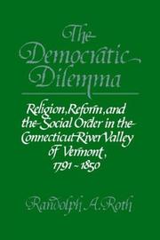
Search results from Open Library.
Recent natural events nearby
Ground air-quality sensors
Recently spotted species
Nearest stream gauge
Live readings from USGS NWIS · measured 2026-06-01 02:15 UTC.
Events
Gallery
Geotagged photos within ~6 miles of Cambridge, from Wikimedia Commons contributors.
 0.5 mi
 0.5 mi
.jpg) 0.5 mi
0.5 mi 1.4 mi
 1.4 mi
 1.5 mi
 2.4 mi
 2.4 mi
 2.6 mi
 2.6 mi
 2.7 mi
 2.7 mi
 2.7 mi
 2.8 mi
 3.4 mi
 3.4 mi
 3.4 mi
 3.4 mi
 3.4 mi
 3.4 mi
 3.5 mi
 4.4 mi
 4.4 mi
 4.8 mi
Photos via Wikimedia Commons — see each image page for license & attribution.
Sources
- • Wikipedia
- • US Census Bureau (ACS 5-year estimates)
- • Wikimedia Commons
- • Wikidata
- • Open-Meteo Air Quality (CAMS)
- • USGS Earthquake Catalog (global feed)
- • USGS NWIS (water data)
- • NCES via Urban Institute Education Data Portal
- • GBIF (Global Biodiversity Information Facility)
- • CDC PLACES
- • Open-Meteo / sunrise-sunset.org
- • Wikipedia Pageviews API
- • Open Library
- • Wikidata SPARQL (CC0) — population, area, elevation, inception, head of government, Commons image