Browse / United States / Wisconsin / Cumberland
Cumberland
Wisconsincity

Cumberland
Total population
2,282
Median home value
$181,100
Bachelor's+
Median income
$49,479
Demographic figures from US Census Bureau · ACS 5-year estimates. Overview below cites Wikipedia and may reference a different year.
City facts
Facts from Wikidata (CC0).
Overview
Cumberland is a city in Barron County, Wisconsin, United States. The population was 2,274 at the 2020 census. The city is partially within the Town of Cumberland. It was incorporated in 1885.
Read more on WikipediaHistory & geography
History
Cumberland is often called the "Island City". The main part of the city, including the original settlement, is on land surrounded by Beaver Dam Lake, originally settled by the Ojibwe, whose name for it is Che-wa-cum-ma-towangok ("Lake Made by the Beavers"). Ojibwe Chief Pon-gee Rau-gen ("Little Pipe") lived in the area even after it was settled by European settlers, and drowned in a canoe on Beaver Dam Lake in 1895. In 1874, A. Ritan and R. H. Clothier explored the area with the intention of settling there. While exploring, they came across surveyors who informed them of the railroad line the North Wisconsin Railway Company planned to lay in the area. Ritan, who lived near what is today Turtle Lake, and the Norwegian-American Dahlby family, from New Richmond, both filed a homestead near the proposed railroad and built two log cabins 300 feet north of the present high school. In 1878, the North Wisconsin Railroad Company extended rail lines through the area. Before that, settlers got provisions in Rice Lake, Barron or Clayton. In 1880, the Dahlbys sold their cabin, moved to Chandler (now known as Spooner), and opened a store. Ritan, also originally from Norway, lived in Cumberland for many years and helped develop it before moving to Portland, Oregon. Clothier also took a homestead and built a farm in 1875. On December 30, 1875, the town of Lakeside was organized, encompassing what is now Lakeland Township, Almena Township, Crystal Lake Township and Maple Plain Township. During the winter of 1876, Bonett Bridge was built off the island. Soon a school was built on the mainland area near the bridge with Ida Schofield as the teacher. She was soon replaced by Carrie Fay, who arrived from nearby Prairie Farm. On January 1, 1880, the name was changed to Cumberland at…
Geography
Cumberland is located at (45.535892, −92.023389), along Beaver Dam Lake at the beginning of the Hay River. According to the United States Census Bureau, the city has an area of , of which is land and is water. Cumberland is along U.S. Highway 63 and Wisconsin Highway 48.
Excerpted from the corresponding Wikipedia article (CC BY-SA).
Demographics & economy
Race & ethnicity
Source: US Census Bureau — American Community Survey, 5-year estimates.
Geography
Coordinates & boundaries from the US Census TIGER/Line shapefiles.
Climate
Current forecast
Forecast for Cumberland, WI from NOAA NWS API.
Air quality
Industrial & pollution facilities
Natural hazard risk
Health (adults)
Age-adjusted prevalence estimates from CDC PLACES (latest release).
Walkability
Amenities nearby
Wildlife & biodiversity
Schools
Earthquake history
Photos
Sights & places nearby
Notable people from here
People born within ~10 km, from Wikidata (CC0). Click any name for their Wikipedia article.
Nearby places in Wisconsin
- Barronett7.1 mi away · pop. 42
- Almena8.4 mi away · pop. 641
- Turtle Lake11.7 mi away · pop. 960
- Barron12.7 mi away · pop. 3,681
- Haugen12.9 mi away · pop. 284
- Shell Lake14.3 mi away
- Prairie Farm20.8 mi away · pop. 423
- Spooner21.1 mi away
- Luck21.4 mi away · pop. 1,124
- Frederic22.7 mi away · pop. 1,140
- Clear Lake23.1 mi away · pop. 957
- Chetek23.6 mi away · pop. 2,177
Geography & sun
Elevation, sunrise/sunset and daylight from Open-Meteo. Solar climatology from NASA POWER.
Nearby airports
Public attention
Pageview totals from the Wikimedia Pageviews API.
Books about Cumberland
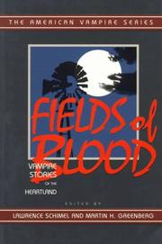
Search results from Open Library.
Recent natural events nearby
Ground air-quality sensors
Recently spotted species
Nearest stream gauge
Events
Gallery
Sources
- • Wikipedia
- • US Census Bureau (ACS 5-year estimates)
- • NOAA National Weather Service
- • Wikidata
- • CDC PLACES
- • Open-Meteo / sunrise-sunset.org
- • Wikipedia Pageviews API
- • Open Library