Browse / United States / Wisconsin / Manitowoc
Manitowoc
Wisconsincity

Manitowoc
Total population
34,620
Demographic figures from US Census Bureau · ACS 5-year estimates. Overview below cites Wikipedia and may reference a different year.
- Special Weather Statement · ModerateSpecial Weather Statement issued September 26 at 4:39AM CDT by NWS Green Bay WI
Source: NOAA National Weather Service.
City facts
Sister cities
Facts from Wikidata (CC0).
Overview
Manitowoc is a city in Manitowoc County, Wisconsin, United States, and its county seat. It is located on Lake Michigan at the mouth of the Manitowoc River. The population was 34,626 at the 2020 census.
Read more on WikipediaHistory & geography
History
Purported to mean dwelling of the great spirit, Manitowoc derived its name from either the Ojibwe word manidoowaak(wag), meaning spirit-spawn(s), or manidoowaak(oog), meaning spirit-wood(s), or manidoowak(iin), meaning spirit-land(s). In the Menominee language, it is called Manetōwak, which means "place of the spirits". The Menominee ceded this land to the United States in the 1836 Treaty of the Cedars, following years of negotiations over how to accommodate the Oneida, Stockbridge-Munsee, and Brothertown peoples who had been removed from New York to Wisconsin. In 1838, an act of the Territorial Legislature separated Manitowoc County from Brown County, keeping the native name for the region. The first Europeans in the area were French fur traders who arrived in 1673. The Northwest Fur Company established a trading post in 1795. In 1835, before the transfer of land from the Menominee Nation to the United States, President Andrew Jackson authorized land sales for the region, drawing the interest of land speculators. William Jones and Louis Fizette were the two first recorded buyers on August 3, 1835, with the majority of the land being procured by the Chicago firm Jones, King, & Co. Benjamin Jones, brother of William, took the Wisconsin property as his share and is considered the founder of Manitowoc. Early immigrant groups included Germans, Norwegians, British, Irish, and Canadians. The first school in Manitowoc was held in the Jones warehouse, with S. M. Peake instructing the twelve children of the community. The first religious organization in the county, St. James' Episcopal Church, first met in 1841. Manitowoc was chartered as a village on March 6, 1851 In 1847, Joseph Edwards built the first schooner in the area, the Citizen, a modest precursor to the…
Geography
According to the United States Census Bureau, the city has a total area of , of which is land and is water. The city is located at , on Lake Michigan at the mouth of the Manitowoc River. The nearest other cities are Green Bay, away, Sheboygan away, Appleton away, and Milwaukee away. Together with Two Rivers and the surrounding towns, the Manitowoc micropolitan area was, according to the 2000 census, home to 52,197 people. The city forms the core of the United States Census Bureau's Manitowoc Micropolitan Statistical Area, which includes all of Manitowoc County (2000 population: 82,887). Alverno is a formerly unincorporated community located in the western parts of the city. Located slightly northwest of the I-43 Technology & Enterprise Business Park, the community contained some homes, a banquet place, and a railroad crossing on the northern side. The community is also the eastern terminus of a short county highway (County Road CS) at the intersection of Alverno Road and Custer Street. Kellners Corners is also a formerly unincorporated community on the northwest side of the city at the intersection of Rapids Road (County Road R) and Menasha Avenue. This portion of Manitowoc is more residential with some businesses. Rapids Road was also the old alignment of US Highway 141 in Manitowoc until the completion of I-43 resulted in the portion of the old highway turned over to the county. Manitowoc has a humid continental climate. Lake Michigan exerts a moderating effect on its climate compared to regions more inland, making temperatures warmer in the winter and cooler in the summer than most nearby cities. Manitowoc has a yearly average high of and a yearly average low of . Manitowoc also has an extreme high and extreme low of and , respectively. The city…
Excerpted from the corresponding Wikipedia article (CC BY-SA).
Demographics & economy
Geography
Coordinates & boundaries from the US Census TIGER/Line shapefiles.
Climate
Current forecast
Forecast for Manitowoc, WI from NOAA NWS API.
Air quality
Industrial & pollution facilities
Natural hazard risk
Health (adults)
Walkability
Amenities nearby
Wildlife & biodiversity
Schools
Earthquake history
Photos
Sights & places nearby
Notable people from here


People born within ~10 km, from Wikidata (CC0). Click any name for their Wikipedia article.
Nearby places in Wisconsin
- Two Rivers6.4 mi away
- Whitelaw8.1 mi away
- Clarks Mills9.1 mi away · pop. 87
- Mishicot9.2 mi away
- Valders10.5 mi away
- St. Nazianz13.7 mi away
- Forest Junction24.7 mi away · pop. 594
- Sheboygan Falls26.5 mi away
- Bellevue28.6 mi away · pop. 16,442
- Wrightstown29.3 mi away
- Sherwood30.1 mi away
- Luxemburg30.9 mi away · pop. 2,737
Geography & sun
Elevation, sunrise/sunset and daylight from Open-Meteo. Solar climatology from NASA POWER.
Nearby airports
Public attention
Pageview totals from the Wikimedia Pageviews API.
Books about Manitowoc
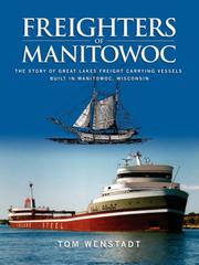
Search results from Open Library.
Recent natural events nearby
Ground air-quality sensors
Recently spotted species
Nearest stream gauge
Events
Gallery
Sources
- • Wikipedia
- • NOAA National Weather Service
- • Wikidata
- • Open-Meteo / sunrise-sunset.org
- • Wikipedia Pageviews API
- • Open Library