Browse / Yemen / Yemen / Tarim
Tarim
Yementown

Tarim
Total population
47,674
Air quality index
Demographic figures from Central Statistical Organization (Yemen). Overview below cites Wikipedia and may reference a different year.
City facts
Facts from Wikidata (CC0).
Overview
Tarim is a historic town situated in Hadhramaut, Yemen. It is widely acknowledged as the theological, juridical, and academic center of Wadi Hadhramaut. An important center of Islamic learning, it is estimated to contain the highest concentration of descendants of the Islamic Prophet Muhammad known as the Sayyids anywhere in the world. The city is distinguished for producing numerous Islamic scholars, including Imam al-Haddad. Additionally, Tarim is also home to Dar al-Mustafa, a well-known educational institution for the study of traditional Islamic Sciences.
Read more on WikipediaHistory & geography
History
In 625, Badhan, the Persian Governor of Sanaa accepted Islam and the rest of the country soon followed. Arab historians agree that Tarim was established in the fourth century of Hijra. The citizens of Tarim converted to Islam in the early days of Islam when the delegation of Hadhramaut met the Islamic Prophet Muhammad in Medina in the tenth year of Hijra (631). Tarim is often referred to as Al-Siddiqi City, in honor of Abu-Bakr al-Siddiq, the first caliph of Sunni Islam (r. 632–634). Abu Bakr prayed that Allah would increase Tarim's scholars and water, as its citizens stood with him during the Ridda wars after the Prophet's death (632–633). A battle occurred in Al-Nujir Fortress, in which many of the Prophet's companions (Sahabah) were injured and taken to Tarim for treatment. Some companions, however, were buried in the cemetery of Zambal. In 1809, disaster struck Hadhramaut following a Wahhabi invasion. Valuable books and documents from the Robat at Tarim were destroyed by fire or by dumping in wells. While the Wahhabi occupation was short-lived, it ravaged the economy. As a result, emigration increased, the top destination being Hyderabad (India), where the Nizam employed a considerable army. Here, a Yemeni soldier named Umar bin Awadh al Qu'aiti rose to the rank of Jemadar and amassed a fortune. Umar's influence enabled him to create the Quaiti dynasty in the late 19th century. Having secured all valuable land excluding the areas around Saiyun and Tarim, the Qu'aitis signed a treaty with the British in 1888, and created a unified sultanate in 1902 that became part of the Aden Protectorate. Despite establishing a regionally advanced administration, by the 1930s the Qu'aiti Sultan Saleh bin Ghalib (r. 1936–1956) was facing stiff pressure to modernize – a task…
Geography
The Hadhramaut Valley is a large region in southern Yemen spanning approximately . It consists of a narrow, arid coastal plain bounded by the steep escarpment of a broad plateau averaging around of altitude, with a sparse network of deeply sunk wadis (seasonal watercourses). Although the southern edge of Hadhramaut borders the Arabian Sea, Tarim is located around inland from the coast and north-east of Seiyun. The region is characterized by rocky plateaus that reach elevations of around , and are separated by numerous valleys. The closest airport to Tarim is located approximately away, in the city of Seiyun. The only international flights directly to Seiyun originate in Jeddah (Saudi Arabia, and Dubai and Abu Dhabi in the United Arab Emirates. Otherwise, travelers can fly to the capital city of Sanaa. Then one can either take another flight from Sanaa to Seiyun, or travel by bus or car to Tarim from Sanaa. The distance from Sanaa to Tarim is approximately , and driving time ranges from six to eight hours. Tarim has a hot desert climate (Köppen climate classification BWh). The city receives very little precipitation. A few times throughout the year, however, Tarim experiences heavy rainfall resulting in significant flooding.
Excerpted from the corresponding Wikipedia article (CC BY-SA).
Geography
Coordinates & boundaries from the US Census TIGER/Line shapefiles.
Climate
Air quality
Current readings from Open-Meteo Air Quality API (Copernicus CAMS European reanalysis).
Walkability
Amenities nearby
Wildlife & biodiversity
Earthquake history
Most recent
- M 4.4 — 2005-06-2343 km SE of At Ta??luf, Yemen
- M 4.3 — 2005-05-0645 km E of At Ta??luf, Yemen
Events from the USGS Earthquake Catalog (global) (FDSN Event Web Service).
Photos
Sights & places nearby
Notable people from here


People born within ~10 km, from Wikidata (CC0). Click any name for their Wikipedia article.
Nearby places in Yemen
- Haswayn209 mi away · pop. 2,581
- `Uqaqah377.1 mi away · pop. 3,442
- Chiruieh796.9 mi away
- Asalouyeh822.2 mi away · pop. 13,557
- Lamerd824 mi away · pop. 29,380
- Bandar Siraf830.2 mi away · pop. 6,992
- Bandar Dayyer835.7 mi away · pop. 18,454
- Jam840.6 mi away · pop. 31,436
- Kavarzin862 mi away
- Dayrestan862.4 mi away
- Kaki863.7 mi away · pop. 9,893
- Khonj865.5 mi away · pop. 19,217
Geography & sun
Elevation, sunrise/sunset and daylight from Open-Meteo. Solar climatology from NASA POWER.
Nearby airports
Public attention
Pageview totals from the Wikimedia Pageviews API.
Books about Tarim


Search results from Open Library.
Recent natural events nearby
Ground air-quality sensors
Recently spotted species
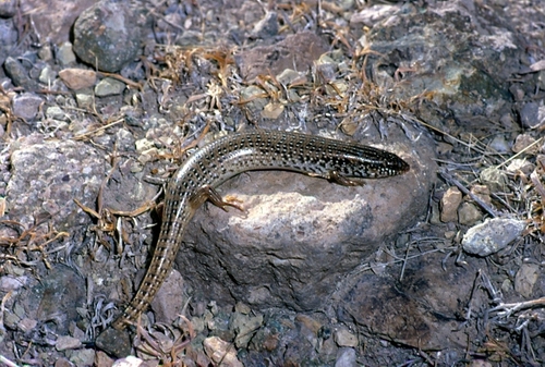
Research-grade observations from iNaturalist (within ~15 mi).
Events
Gallery
Sources
- • Wikipedia
- • Wikidata
- • Open-Meteo Air Quality (CAMS)
- • USGS Earthquake Catalog (global feed)
- • GBIF (Global Biodiversity Information Facility)
- • iNaturalist
- • Open-Meteo / sunrise-sunset.org
- • Wikipedia Pageviews API
- • Open Library