Browse / United States / Alaska / Delta Junction
Delta Junction
Alaskacity

Delta Junction
Total population
1,217
Founded
1957
Demographic figures from US Census Bureau · ACS 5-year estimates. Overview below cites Wikipedia and may reference a different year.
City facts
Facts from Wikidata (CC0).
Overview
Delta Junction is a city in Southeast Fairbanks Census Area, Alaska, United States. As of the 2020 census, its population was 918. The city is located a short distance south of the confluence of the Delta River with the Tanana River, which is at Big Delta. It is about 99 mi (160 km) south of Fairbanks. Native inhabitants are Tanana Athabaskans.
Read more on WikipediaHistory & geography
History
== History == For at least 10,000 years, Athabascan indigenous peoples have inhabited portions of the interior of Alaska. Early inhabitants survived by hunting and fishing. The early history of non-native settlement in the area occurred at the river crossing at Big Delta and is found at the entry, Big Delta, Alaska. In 1904, the location first served as a telegraph station. In 1928, a herd of 23 bison were brought from the National Bison Range in Montana to an area south of Big Delta to provide an additional game species for hunters. Buffalo Center, a small community near the center of present-day Delta Junction, was named because of their presence, especially during the winter months. The huge animals were troublesome, and sometimes made landings dangerous at nearby Allen Field. During World War II, the United States aided the Soviet Union against Germany by sending airplanes and supplies authorized by the Lend-lease Act to the Soviet Union through Alaska into the Russian Far East. The Alaska Highway was built to connect an existing road in Dawson Creek, British Columbia, Canada, with the Richardson Highway in Alaska, a distance of . The Alaska Highway met the Richardson Highway at a point south along the Delta River from Big Delta. The place where the highways met became known as Delta Junction. Allen Field was constructed south of Delta Junction for use in sending supplies to Russia. The Glenn Highway was built from Anchorage to what is now Glennallen, where it met the Richardson Highway. This connection created a motor route between Anchorage and Fairbanks, Alaska. After World War II, a U.S. army base, Fort Greely, was built next to the air field. The base, and a huge tract of land around it, was used for training soldiers for cold weather combat during the…
Geography
"Big Delta" lies at the intersection of the Delta River and the Tanana River. The city of Delta Junction sits on the Delta River at the intersection of the Richardson Highway and the terminus of the Alaska Highway. The city and Delta community lie within the fertile Tanana River valley. Three mountain ranges—the White Mountains to the north, the Granite Mountains to the southeast, and the Alaska Range to the southwest—and the Delta River to the west surround the city. Once overlain by glaciers, the geology is marked by glacial moraines as well as alluvial deposits from the Delta and Tanana Rivers. Numerous mineral deposits are found in the vicinity of Delta Junction ranging from gold to molybdenum to coal. A prominent natural feature on the landscape is Donnelly Dome, located within the Donnelly Training Area of Fort Wainwright (formerly a part of nearby Fort Greely until 2001), to the south of Delta Junction. This dome was formed as a glacier coming from the Alaska Range split in two, carving away sides of a former mountain. According to the United States Census Bureau, the city has a total area of , all land. === Climate === As is typical of the Alaska Interior, Delta Junction has a subarctic climate (Köppen Dwc), closely bordering on a semi-arid climate (Köppen BSk). The average high temperature is below freezing from mid-October thru late March, and during the height of winter cold, as the town is located in USDA Plant Hardiness Zone 2a, the coldest conditions of the year typically bottom out in the range, with sub- highs a common occurrence. Precipitation averages at only annually, and over half of this total occurs from June to August. Snow, which typically falls from October to April and sometimes May and September, is generally not heavy due to the dry…
Excerpted from the corresponding Wikipedia article (CC BY-SA).
Demographics & economy
Geography
Coordinates & boundaries from the US Census TIGER/Line shapefiles.
Climate
Current forecast
Forecast for Delta Junction, AK from NOAA NWS API.
Air quality
Industrial & pollution facilities
Natural hazard risk
Health (adults)
Age-adjusted prevalence estimates from CDC PLACES (latest release).
Walkability
Amenities nearby
Wildlife & biodiversity
Schools
Largest nearby schools
- Delta Junction ElementaryElementary · Delta Junction · 359 students · 15.6:1 ratio
- Alaska HomeschoolOther · Delta Junction · 218 students · 218:1 ratio
- Delta Junction Junior High SchoolMiddle · Delta Junction · 166 students · 16.6:1 ratio
- Delta Junction Senior High SchoolHigh · Delta Junction · 165 students · 15:1 ratio
Public K–12 schools within ~10 mi from Urban Institute Education Data Portal (NCES Common Core of Data, 2022).
Earthquake history
Photos
Sights & places nearby
Notable people from here
Nearby places in Alaska
- Big Delta7 mi away · pop. 565
- Deltana21.3 mi away · pop. 1,997
- Harding-Birch Lakes33.5 mi away · pop. 277
- Dry Creek43.9 mi away · pop. 162
- Salcha48.4 mi away · pop. 829
- Pleasant Valley67.4 mi away · pop. 790
- North Pole69.1 mi away · pop. 2,370
- Two Rivers70.9 mi away · pop. 451
- Badger71.8 mi away · pop. 18,677
- Paxson74.8 mi away · pop. 17
- Fairbanks79.3 mi away · pop. 32,083
- South Van Horn81.1 mi away · pop. 572
Geography & sun
Elevation, sunrise/sunset and daylight from Open-Meteo. Solar climatology from NASA POWER.
Nearby airports
Public attention
Pageview totals from the Wikimedia Pageviews API.
Books about Delta Junction

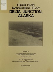
Search results from Open Library.
Recent natural events nearby
- Wildfire Mukluk, Southeast Fairbanks, AlaskaWildfires · 2026-08-17 · 95 mi
Wildfires, storms and other events from NASA EONET (last 12 months, within 250 mi).
Ground air-quality sensors
Recently spotted species
Nearest stream gauge
Live readings from USGS NWIS · measured 2026-10-05 16:00 UTC.
Events
Gallery
Sources
- • Wikipedia
- • NOAA National Weather Service
- • Wikidata
- • USGS NWIS (water data)
- • NCES via Urban Institute Education Data Portal
- • CDC PLACES
- • Open-Meteo / sunrise-sunset.org
- • Wikipedia Pageviews API
- • Open Library
- • NASA EONET