Browse / Austria / Tyrol / Seefeld in Tirol
Seefeld in Tirol
Tyrolvillage

Seefeld in Tirol
Total population
3,516
Air quality index
Demographic figures from Statistik Austria. Overview below cites Wikipedia and may reference a different year.
City facts
Sister cities
Facts from Wikidata (CC0).
Overview
Seefeld in Tirol is an old farming village, now a major tourist resort, in Innsbruck-Land District in the Austrian state of Tyrol with a local population of 3,312. The village is located about 17 km (11 mi) northwest of Innsbruck on a plateau between the Wetterstein mountains and the Karwendel on a historic road from Mittenwald to Innsbruck that has been important since the Middle Ages. It was first mentioned in 1022 and since the 14th century has been a pilgrimage site, benefiting not only from the visit of numerous pilgrims but also from its stacking rights as a trading station between Augsburg and the Venice. Also since the 14th century, Tyrolean shale oil has been extracted in the area. Seefeld was a popular holiday resort even before 1900 and, since the 1930s, has been a well known winter sports centres and amongst the most popular tourist resorts in Austria. The municipality, which has been the venue for several Winter Olympics Games, is the home village of Anton Seelos, the inventor of the parallel turn.
Read more on WikipediaHistory & geography
Geography
To the northwest Seefeld borders on Leutasch (village of Weidach), to the northeast on Scharnitz (village of Gießenbach). Its eastern municipal boundary with Zirl runs along the arête from the Seefelder Joch and Seefelder Spitze. To the south lies Reith (village of Auland) and to the west Telfs (village of Mösern). The village is situated on the south-facing Seefeld Plateau north of the River Inn on the watershed between the basins of the Inn and the Isar. The plateau (which also comprises the villages of Leutasch, Reith, Scharnitz and Mösern) is surrounded by the Wetterstein mountain range to the west, and the Karwendel mountain range to the east; it falls away in a steep drop off to the Inn valley to the south. To the north, the high valley leads through the village of Scharnitz towards the border with Germany at Mittenwald. Seefeld has two main mountain areas (for walking or skiing): one is the rounded hill, the Gschwandtkopf (1,495 m); the other is on the slopes of the mountains to the east and called the Rosshütte after the large mountain restaurant halfway up. These mountains dominate the Seefeld Plateau; from left/north to right/south, they are the Seefelder Joch, Seefelder Spitze (2,215 m), Härmelekopf (2,224 m) and Reither Spitze (2,374 m). Notable other landmarks include the Seekirchl, a small, onion-domed church, and the Pfarrhügel, a spur of the Gschwandtkopf running into the town centre and forming a small attractive hill. There is also a popular bathing lake called the Wildsee. On the east side of the Seefelder Joch rise the tributaries of the Haglbach, which flows west through the valley of Hermannstal, then swings south on reaching the plateau to run along the municipal boundary and feed the Wildsee. The Wildsee is threatened by sediment deposition…
Excerpted from the corresponding Wikipedia article (CC BY-SA).
Geography
Coordinates & boundaries from the US Census TIGER/Line shapefiles.
Climate
Air quality
Current readings from Open-Meteo Air Quality API (Copernicus CAMS European reanalysis).
Walkability
Amenities nearby
Wildlife & biodiversity
Most-observed species
- Eurasian BlackbirdTurdus merula Linnaeus, 1758 · Aves2,873
- Carrion CrowCorvus corone Linnaeus, 1758 · Aves2,594
- Great TitParus major Linnaeus, 1758 · Aves2,440
- Common ChaffinchFringilla coelebs Linnaeus, 1758 · Aves2,333
- Narrow-leaved RagwortSenecio inaequidens DC. · Magnoliopsida2,097
- MallardAnas platyrhynchos Linnaeus, 1758 · Aves1,997
- European RobinErithacus rubecula (Linnaeus, 1758) · Aves1,945
- Yellow-billed ChoughPyrrhocorax graculus (Linnaeus, 1766) · Aves1,903
Citizen-science & research observations from the Global Biodiversity Information Facility (GBIF).
Earthquake history
Most recent
- M 2.5 — 2021-10-035 km NNE of Silandro, Italy
- M 3.7 — 2021-08-161 km S of Niederau, Austria
- M 3.6 — 2020-08-085 km SE of Gramais, Austria
- M 3.8 — 2019-10-224 km SE of Ebbs, Austria
- M 3.8 — 2018-02-014 km N of Innerbraz, Austria
- M 4 — 2018-01-172 km NE of Innerbraz, Austria
Events from the USGS Earthquake Catalog (global) (FDSN Event Web Service).
Photos
Sights & places nearby
Notable people from here


People born within ~10 km, from Wikidata (CC0). Click any name for their Wikipedia article.
Nearby places in Tyrol
- Mösern2.1 mi away · pop. 344
- Leutasch3.5 mi away · pop. 2,140
- Ranggen5.1 mi away · pop. 846
- Oberperfuss6.5 mi away · pop. 2,712
- Grinzens7.6 mi away · pop. 1,280
- Tanneben8.3 mi away
- Untermieming9.8 mi away · pop. 515
- Kühtai11 mi away · pop. 29
- Obsteig12.4 mi away · pop. 1,099
- Ehrwald13.4 mi away · pop. 2,554
- Aldrans13.4 mi away · pop. 2,015
- Schönberg im Stubaital14.2 mi away · pop. 1,008
Geography & sun
Elevation, sunrise/sunset and daylight from Open-Meteo. Solar climatology from NASA POWER.
Nearby airports
Public attention
Pageview totals from the Wikimedia Pageviews API.
Books about this place
Recent natural events nearby
Ground air-quality sensors
Recently spotted species
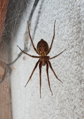


Research-grade observations from iNaturalist (within ~15 mi).
Events
Gallery
Geotagged photos within ~6 miles of Seefeld in Tirol, from Wikimedia Commons contributors.


Photos via Wikimedia Commons — see each image page for license & attribution.
Official Identifiers
Statistik Austria
- GKZ
- 70351
- Population (Wikidata)
- 3,462
- Wikidata
- Q660035
Gemeindekennziffer via Wikidata P964
Sources
- • Wikipedia
- • Wikimedia Commons
- • Wikidata
- • Open-Meteo Air Quality (CAMS)
- • USGS Earthquake Catalog (global feed)
- • GBIF (Global Biodiversity Information Facility)
- • iNaturalist
- • Open-Meteo / sunrise-sunset.org
- • Wikipedia Pageviews API
- • Statistik Austria — Gemeindekennziffer via Wikidata P964