Browse / Australia / New South Wales / Kiama
Kiama
New South Walestown

Kiama
Total population
14,761
Demographic figures from Australian Bureau of Statistics. Overview below cites Wikipedia and may reference a different year.
City facts
Facts from Wikidata (CC0).
Overview
Kiama is a coastal town 120 kilometres south of Sydney in the Illawarra region of New South Wales, Australia. One of the main tourist attractions is the Kiama Blowhole. Kiama features several popular surfing beaches and caravan parks, and numerous alfresco cafes and restaurants. Its proximity to the south of Sydney makes it an attractive destination for many day-trippers and weekenders. Kiama also has historically been a farming and agricultural centre. Even to today it maintains a country and agricultural community with a weekly farmers markets held on Wednesday afternoons.
Read more on WikipediaHistory & geography
History
Kiama was the site of two strong volcanic flows, called the Gerringong Volcanics, which came out of Saddleback Mountain, now a collapsed volcanic vent. The Kiama Blowhole is part of an erosion process on the more recent rock, formed into columnar basalt, or latite. Before the cedar-getters (comprising ex-convicts, convicts and runaways, some with cedar licences and many without) arrived in the area around 1810, the local Indigenous Australians, Wodi Wodi of the language group Dharawal, had been using the land for thousands of years, moving every six weeks or so in family groups. This is supported by a midden of shells at nearby Bass Point used for more than 17,000 years. During this time the whole coastal hills was covered in rainforest and cedar brush. There is evidence of a flourishing culture with intricate possum cloaks, a developed song and story cycle, and a deep understanding of the many plants of the rainforest. Only a few remnants of rainforest survive along the escarpment in places like the Minnamurra Rainforest Centre. There is strong evidence of recent sea debris showing a mega-tsunami hit this coast around 1487 A.D according to Dr Ted Bryant of Wollongong University. The first European to explore the area was George Bass who stopped there on 6 December 1797 and viewed Kiama's blowhole. During the early settlement of eastern Australia, the Kiama area was settled by wheat farmers, since the soil was volcanic and rain-swept unlike most of Australia. Early Jamberoo was the population centre from about 1830 to the 1860s and when the wheat failed to grow, the farmers switched to dairying. During this period, Kiama became the best example of 'chain migration' in Australia as many assisted migrants came from Northern Ireland on clearing leases and eventually…
Geography
The Kiama area includes many attractions, being situated on the coast south of the Minnamurra River, and to the west lie the foothills of Saddleback Mountain and the smaller less discernible peak of Mount Brandon. Also to the west is the town of Jamberoo with pasture-land in between, which contains many historic buildings and dry stone walls. Also of note is Seven Mile Beach to the south, a protected reserve. Kiama has several well-known surfing beaches, including Surf Beach, 'Mystics' and Boyds' Beach, as well as other more protected swimming beaches situated in coves between headlands such as Black Beach, Easts Beach and Kendalls Beach. Kiama Harbour forms one of several coves between headlands. The southern extreme of the subtropical rainforest is generally said to finish in the Kiama area, though several rainforest species reach their southern boundary at Mount Dromedary, around south of Kiama. Kiama is the northern edge of the oceanic climate (Köppen: Cfb), bordering on a humid subtropical climate. with warm summers and mild winters. Rainfall is spread relatively evenly throughout the year with the wettest months being in autumn and the driest in spring.
Excerpted from the corresponding Wikipedia article (CC BY-SA).
Geography
Coordinates & boundaries from the US Census TIGER/Line shapefiles.
Climate
Air quality
Walkability
Amenities nearby
Wildlife & biodiversity
Most-observed species
- Australian MagpieGymnorhina tibicen (Latham, 1802) · Aves8,371
- Magpie-larkGrallina cyanoleuca (Latham, 1802) · Aves6,964
- Australian RavenCorvus coronoides Vigors & Horsfield, 1827 · Aves6,769
- Superb FairywrenMalurus cyaneus (Ellis, 1782) · Aves5,581
- Rainbow LorikeetTrichoglossus haematodus (Linnaeus, 1771) · Aves5,494
- Welcome SwallowHirundo neoxena Gould, 1842 · Aves5,433
- Crimson RosellaPlatycercus elegans (Gmelin, 1788) · Aves4,961
- Willie-wagtailRhipidura leucophrys (Latham, 1802) · Aves4,930
Citizen-science & research observations from the Global Biodiversity Information Facility (GBIF).
Earthquake history
Most recent
- M 3.6 — 2025-05-283 km WNW of Cobbitty, Australia
- M 3.5 — 2024-03-0814 km SSW of Woodford, Australia
- M 3 — 2007-08-2224 km W of Oakdale, Australia
- M 3.2 — 2007-08-1810 km NW of Mittagong, Australia
- M 2.6 — 2007-08-1811 km NW of Mittagong, Australia
- M 3.1 — 2007-04-113 km SE of Stanwell Park, Australia
Events from the USGS Earthquake Catalog (global) (FDSN Event Web Service).
Photos
Sights & places nearby
Notable people from here


People born within ~10 km, from Wikidata (CC0). Click any name for their Wikipedia article.
Nearby places in New South Wales
Geography & sun
Elevation, sunrise/sunset and daylight from Open-Meteo. Solar climatology from NASA POWER.
Nearby airports
Public attention
Pageview totals from the Wikimedia Pageviews API.
Books about Kiama
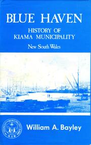


Search results from Open Library.
Recent natural events nearby
Ground air-quality sensors
Recently spotted species
Events
Gallery
Sources
- • Wikipedia
- • Wikidata
- • USGS Earthquake Catalog (global feed)
- • GBIF (Global Biodiversity Information Facility)
- • Open-Meteo / sunrise-sunset.org
- • Wikipedia Pageviews API
- • Open Library