Browse / Australia / South Australia / Waterloo
Waterloo
South Australiahamlet

Waterloo
Demographic figures from Australian Bureau of Statistics. Overview below cites Wikipedia and may reference a different year.
City facts
Overview
Waterloo is a settlement in South Australia, located just off the Barrier Highway between Manoora and Black Springs, approximately 121 kilometres (75 mi) north-east of the state capital of Adelaide.
Read more on WikipediaHistory & geography
History
The township of Waterloo was surveyed and established in 1865 in the Hundred of Waterloo, County of Light. It derives its name from the famous battle of the Napoleonic Wars. Waterloo is situated in a valley on the head of the Light River. Located about midway between Kapunda and Burra, it is not to be confused with Waterloo Corner on the Adelaide Plains. In 1866 a petition was signed by 233 of the inhabitants and settlers for the establishment of a police station and courthouse. The government rejected this, as the township then comprised not more than six houses, a flourmill, and a hotel. The locality is the birthplace of Tom Kruse, the Australian outback mailman who worked on the Birdsville Track in the border area between South Australia and Queensland.
Excerpted from the corresponding Wikipedia article (CC BY-SA).
Geography
Coordinates & boundaries from the US Census TIGER/Line shapefiles.
Climate
Air quality
Walkability
Amenities nearby
Wildlife & biodiversity
Most-observed species
- GalahEolophus roseicapilla (Vieillot, 1817) · Aves400
- Australian MagpieGymnorhina tibicen (Latham, 1802) · Aves361
- Crimson RosellaPlatycercus elegans (Gmelin, 1788) · Aves326
- Little RavenCorvus mellori Mathews, 1912 · Aves324
- Striated PardalotePardalotus striatus (Gmelin, 1789) · Aves317
- Gray ShrikethrushColluricincla harmonica (Latham, 1802) · Aves230
- Willie-wagtailRhipidura leucophrys (Latham, 1802) · Aves219
- Red WattlebirdAnthochaera carunculata (Shaw, 1790) · Aves218
Citizen-science & research observations from the Global Biodiversity Information Facility (GBIF).
Earthquake history
Most recent
- M 4.3 — 2024-04-178 km ENE of Jamestown, Australia
- M 4.4 — 2020-05-1415 km WSW of Burra, Australia
- M 3.1 — 2008-12-0417 km ESE of Crystal Brook, Australia
- M 2.7 — 2007-08-0323 km SSE of Burra, Australia
- M 2.5 — 2007-06-1226 km E of Angaston, Australia
- M 2.7 — 2006-08-2641 km NE of Kapunda, Australia
Events from the USGS Earthquake Catalog (global) (FDSN Event Web Service).
Photos
Sights & places nearby
Notable people from here
Nearby places in South Australia
- Manoora3.6 mi away · pop. 71
- Black Springs6.5 mi away
- Hampden14.7 mi away
- Hamilton15.8 mi away · pop. 23
- Hanson16.6 mi away
- Eudunda17.2 mi away · pop. 601
- Hoyleton18.4 mi away · pop. 46
- Clare18.8 mi away · pop. 3,379
- Kybunga22 mi away
- Burra22.3 mi away · pop. 922
- Alma Vale23.4 mi away
- Kapunda24.1 mi away · pop. 2,633
Geography & sun
Elevation, sunrise/sunset and daylight from Open-Meteo. Solar climatology from NASA POWER.
Nearby airports
Public attention
Pageview totals from the Wikimedia Pageviews API.
Books about Waterloo

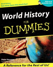
Search results from Open Library.
Recent natural events nearby
Ground air-quality sensors
Recently spotted species
Events
Gallery
Geotagged photos within ~6 miles of Waterloo, from Wikimedia Commons contributors.


Photos via Wikimedia Commons — see each image page for license & attribution.
Sources
- • Wikipedia
- • Wikimedia Commons
- • USGS Earthquake Catalog (global feed)
- • GBIF (Global Biodiversity Information Facility)
- • Open-Meteo / sunrise-sunset.org
- • Wikipedia Pageviews API
- • Open Library