Browse / United States / Arizona / Chino Valley
Chino Valley
Arizonatown

Chino Valley
Total population
13,602
Median home value
$394,700
Bachelor's+
Median income
$61,237
Founded
1970
Demographic figures from US Census Bureau · ACS 5-year estimates. Overview below cites Wikipedia and may reference a different year.
City facts
Facts from Wikidata (CC0).
Overview
Chino Valley is a town in Yavapai County, Arizona, United States. According to the 2020 United States census, the population of the town is 13,020.
Read more on WikipediaHistory & geography
History
Chino Valley is the site of the first Territorial Capital of Arizona. The capital moved to Prescott, away, in 1864. U.S. Army Cavalry Lt. Amiel W. Whipple, while traveling through the area in 1854, gave the community its name. "Chino" is the Spanish name for the abundant curly grama grass growing in the area. In 1895, a narrow gauge branch of the United Verde and Pacific Railroad to Jerome, joining the Santa Fe, Prescott, and Phoenix Railway, was completed, and Jerome Junction was established. In 1923, the activities of Jerome Junction were absorbed by Chino Valley. In 1960, Chino Valley's population was estimated as 50 residents. The town of Chino Valley was incorporated in 1970. The town is in north-central Arizona, on state Highway 89, north of Prescott and south of Ash Fork, which is on Interstate 40. Chino Valley is at an elevation of about .
Geography
Chino Valley is located adjacent the southeast terminus of Chino Valley, approximately south of Paulden. The smaller north-trending Little Chino Valley lies just east of the townsite. According to the United States Census Bureau, the town has a total area of , all land. Chino Valley has a cool semi-arid climate (Köppen BSk). Its high altitude and valley location nakes it both cooler and drier than other parts of Yavapai County.
Excerpted from the corresponding Wikipedia article (CC BY-SA).
Demographics & economy
Race & ethnicity
Source: US Census Bureau — American Community Survey, 5-year estimates.
Geography
Coordinates & boundaries from the US Census TIGER/Line shapefiles.
Climate
Current forecast
Forecast for Chino Valley, AZ from NOAA NWS API.
Air quality
Industrial & pollution facilities
Natural hazard risk
Health (adults)
Age-adjusted prevalence estimates from CDC PLACES (latest release).
Walkability
Amenities nearby
Wildlife & biodiversity
Schools
Largest nearby schools
- Chino Valley High SchoolHigh · CHINO VALLEY · 789 students · 27.2:1 ratio
- Territorial Early Childhood CenterElementary · CHINO VALLEY · 634 students · 21.9:1 ratio
- Coyote Springs Elementary SchoolElementary · Prescott Valley · 592 students · 18.5:1 ratio
- Heritage Middle SchoolMiddle · CHINO VALLEY · 536 students · 22.3:1 ratio
- Granville Elementary SchoolElementary · Prescott Valley · 514 students · 18.4:1 ratio
- Del Rio Elementary SchoolElementary · CHINO VALLEY · 479 students · 19.2:1 ratio
- Tri-City College PrepHigh · PRESCOTT · 256 students
- Mingus Springs Charter SchoolElementary · CHINO VALLEY · 156 students
Public K–12 schools within ~10 mi from Urban Institute Education Data Portal (NCES Common Core of Data, 2022).
Earthquake history
Photos
Sights & places nearby
Notable people from here
Nearby places in Arizona
Geography & sun
Elevation, sunrise/sunset and daylight from Open-Meteo. Solar climatology from NASA POWER.
Nearby airports
Public attention
Pageview totals from the Wikimedia Pageviews API.
Books about Chino Valley
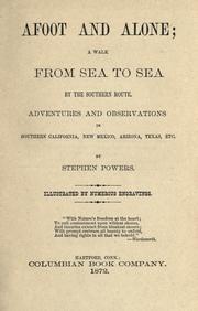

Search results from Open Library.
Recent natural events nearby
- Wildfire Campwood, Yavapai, ArizonaWildfires · 2026-08-23 · 40 mi
- Prescribed Fire D2 Vincent RX, Coconino, ArizonaWildfires · 2026-09-17 · 84 mi
- Prescribed Fire D2 Dye RX, Coconino, ArizonaWildfires · 2026-09-17 · 88 mi
- Prescribed Fire D7 Morgan Unit 5 RX, Navajo, ArizonaWildfires · 2026-09-14 · 135 mi
- Prescribed Fire D7 Apprentice RX, Apache, ArizonaWildfires · 2026-09-14 · 152 mi
- Prescribed Fire D7 Rhoton Seep RX, Apache, ArizonaWildfires · 2026-09-14 · 153 mi
- Prescribed Fire D7 Brushy Mtn South RX, Apache, ArizonaWildfires · 2026-09-14 · 154 mi
- Wildfire Butte, Gila, ArizonaWildfires · 2026-08-03 · 154 mi
Wildfires, storms and other events from NASA EONET (last 12 months, within 250 mi).
Ground air-quality sensors
Recently spotted species
Nearest stream gauge
Events
Gallery
Sources
- • Wikipedia
- • US Census Bureau (ACS 5-year estimates)
- • NOAA National Weather Service
- • Wikidata
- • NCES via Urban Institute Education Data Portal
- • CDC PLACES
- • Open-Meteo / sunrise-sunset.org
- • Wikipedia Pageviews API
- • Open Library
- • NASA EONET