Browse / United States / Arizona / Concho
Concho
ArizonaCDP

Concho
Total population
0
Median home value
$0
Median income
$0
Air quality index
Demographic figures from US Census Bureau · ACS 5-year estimates. Overview below cites Wikipedia and may reference a different year.
City facts
Facts from Wikidata (CC0).
Overview
Concho is an unincorporated community and census-designated place (CDP) in Apache County, Arizona, United States. Concho is located on Arizona State Route 61, 14 miles (23 km) west of St. Johns. As of the 2010 census, the Concho CDP had a population of 38.
Read more on WikipediaHistory & geography
History
Prior to the arrival of Europeans, the Concho area was home to Indigenous Ancestral Puebloan peoples; the ruins of their pueblos can still be seen all over the area to this day. Indigenous Athabaskan speakers – the ancestors of today's Apache and Navajo peoples, the largest Indigenous groups in northeastern Arizona – arrived in the region somewhere between the 1100s and 1400s CE, the earliest confirmed physical evidence of their presence being a Diné-style three-fork dwelling dated to about 1389 CE. The Concho area remained firmly in Apache control until the end of the Apache Wars in the late 19th century, following the surrender of Lozen and Goyaałé. The first permanent, non-Indigenous settlers of Concho were several Hispanic New Mexican families in the late 1800s. The exact date of Concho's founding is unknown, but likely occurred in the late 1850s or early 1860s. Don Manuel Antonio Candelaria, originally of Cubero, NM, is generally credited with being the first known settler of Concho: he first entered the area in the 1840s, when he was a child and an Apache captive. He was adopted by the tribe and lived among them as a full Apache tribal member for many years, until deciding to return to Cubero as a young man to reconnect with his birth family. After re-learning Spanish and eventually marrying Regina Baca, Candelaria returned to Concho with his family and 700 head of sheep and goats to permanently settle the area in 1861 (though he indicated that a scant handful of other Hispanic New Mexicans had also come to settle the area a few years prior). "The town was once the major population and financial center of the northeast quarter of what is now Arizona. It continued as a thriving small town for many years." Nevertheless, circumstances such as World War II caused…
Excerpted from the corresponding Wikipedia article (CC BY-SA).
Demographics & economy
Source: US Census Bureau — American Community Survey, 5-year estimates.
Geography
Coordinates & boundaries from the US Census TIGER/Line shapefiles.
Climate
Current forecast
Forecast for Concho, AZ from NOAA NWS API.
Air quality
Current readings from Open-Meteo Air Quality API (Copernicus CAMS European reanalysis).
Industrial & pollution facilities
Natural hazard risk
Health (adults)
Walkability
Amenities nearby
Wildlife & biodiversity
Most-observed species
- Common RavenCorvus corax Linnaeus, 1758 · Aves178
- MallardAnas platyrhynchos Linnaeus, 1758 · Aves129
- KilldeerCharadrius vociferus Linnaeus, 1758 · Aves128
- House FinchHaemorhous mexicanus (P.L.Statius Müller, 1776) · Aves123
- American RobinTurdus migratorius Linnaeus, 1766 · Aves121
- Mourning DoveZenaida macroura (Linnaeus, 1758) · Aves117
- Say's PhoebeSayornis saya (Bonaparte, 1825) · Aves96
- Great Blue/Cocoi HeronArdea herodias Linnaeus, 1758 · Aves96
Citizen-science & research observations from the Global Biodiversity Information Facility (GBIF).
Schools
Largest nearby schools
- Concho Elementary SchoolElementary · Concho · 183 students · 13.1:1 ratio
Public K–12 schools within ~10 mi from Urban Institute Education Data Portal (NCES Common Core of Data, 2022).
Earthquake history
Most recent
- M 3.2 — 2025-03-1813 km NNE of Clay Springs, Arizona
- M 3.1 — 2023-10-0415 km SSE of Escudilla Bonita, New Mexico
- M 3 — 2022-06-184 km SW of Clay Springs, Arizona
- M 3.1 — 2019-09-2322 km NNW of Saint Johns, Arizona
- M 2.6 — 2014-09-074 km WSW of Sun Valley, Arizona
- M 2.8 — 2013-09-237 km WSW of Pinedale, Arizona
Events from the USGS Earthquake Catalog (global) (FDSN Event Web Service).
Photos
Sights & places nearby
Notable people from here
Nearby places in Arizona
Geography & sun
Elevation, sunrise/sunset and daylight from Open-Meteo. Solar climatology from NASA POWER.
Nearby airports
Public attention
Pageview totals from the Wikimedia Pageviews API.
Books about Concho


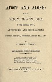
Search results from Open Library.
Recent natural events nearby
- Wildfire Paddy Creek, Apache, ArizonaWildfires · 2026-08-25 · 59 mi
- Wildfire Butte, Gila, ArizonaWildfires · 2026-08-03 · 74 mi
- Wildfire Campwood, Yavapai, ArizonaWildfires · 2026-08-23 · 199 mi
- Wildfire Frijoles, Santa Fe, New MexicoWildfires · 2026-08-05 · 234 mi
- Wildfire Rio Blanco, Archuleta, ColoradoWildfires · 2026-07-28 · 235 mi
Wildfires, storms and other events from NASA EONET (last 12 months, within 250 mi).
Ground air-quality sensors
Recently spotted species
Nearest stream gauge
Live readings from USGS NWIS · measured 2026-09-03 19:30 UTC.
Events
Gallery
Sources
- • Wikipedia
- • US Census Bureau (ACS 5-year estimates)
- • NOAA National Weather Service
- • Wikidata
- • Open-Meteo Air Quality (CAMS)
- • USGS Earthquake Catalog (global feed)
- • USGS NWIS (water data)
- • NCES via Urban Institute Education Data Portal
- • GBIF (Global Biodiversity Information Facility)
- • Open-Meteo / sunrise-sunset.org
- • Wikipedia Pageviews API
- • Open Library
- • NASA EONET