Browse / United States / Arizona / Wickenburg
Wickenburg
Arizonatown

Wickenburg
Total population
8,059
Founded
1863
Demographic figures from US Census Bureau · ACS 5-year estimates. Overview below cites Wikipedia and may reference a different year.
City facts
Facts from Wikidata (CC0).
Overview
Wickenburg is a town in Maricopa and Yavapai counties, Arizona, United States. The population was 7,474 at the 2020 census, and was estimated to be 7,920 in 2022.
Read more on WikipediaHistory & geography
History
The Wickenburg area, along with much of the Southwest, became part of the United States by the 1848 treaty that ended the Mexican–American War. An expedition into the area took place on January 7, 1860, when the Gila Rangers led by Jack Swilling, entered an unexplored part of central Arizona while pursuing Tonto Apache raiders who had stolen stock from miners and the Overland Mail Company. In 1862, a gold strike on the Colorado River near present-day Yuma brought American prospectors, who searched for minerals throughout central Arizona. Many of the geographic landmarks now bear the names of these pioneers, including the Weaver Mountains, named after mountain man Pauline Weaver, and Peeples Valley, named after a settler. A German named Henry Wickenburg was one of the first prospectors. His efforts were rewarded with the discovery of the Vulture Mine, from which more than $30 million worth of gold has been dug. Ranchers and farmers soon built homes along the fertile plain of the Hassayampa River. Together with the miners, they founded the town of Wickenburg in 1863. Wickenburg was also the home of Jack Swilling, who prospected in the Salt River Valley in 1867. Swilling conducted irrigation efforts in that area and helped found the city of Phoenix. Wickenburg was supplied from the Colorado River, by steamboat, then over the La Paz–Wikenburg Road by wagons and pack mules. Wickenburg in turn became a supply point for the mines and army posts in the interior of Arizona Territory. In those years, the rapidly growing town had even once been viewed as a possible candidate for territorial capital and lost the opportunity in 1866 by just two votes in the newly-established legislature. As the town grew, conflicts developed with the Yavapai people, who rejected a treaty signed…
Geography
Wickenburg is located in northwestern Maricopa County. The town limits extend north into the southwestern part of Yavapai County. Via U.S. Route 60, Phoenix is to the southeast, and Blythe, California, on the Colorado River, is to the west-southwest. U.S. Route 93 has its southern terminus in Wickenburg and leads northwest to Kingman. According to the United States Census Bureau, the town has a total area of , of which, are land and , or 0.02%, is water. |date=June 2013 }}
Excerpted from the corresponding Wikipedia article (CC BY-SA).
Demographics & economy
Geography
Coordinates & boundaries from the US Census TIGER/Line shapefiles.
Climate
Current forecast
Forecast for Wickenburg, AZ from NOAA NWS API.
Air quality
Industrial & pollution facilities
Natural hazard risk
Health (adults)
Age-adjusted prevalence estimates from CDC PLACES (latest release).
Walkability
Amenities nearby
Wildlife & biodiversity
Schools
Largest nearby schools
- Wickenburg High SchoolHigh · WICKENBURG · 460 students · 17.7:1 ratio
- Hassayampa Elementary SchoolElementary · WICKENBURG · 284 students · 18.9:1 ratio
- Vulture Peak Middle SchoolMiddle · Wickenburg · 162 students · 18:1 ratio
- Wickenburg Virtual AcademyOther · Wickenburg · 78 students · 26:1 ratio
- West-MEC - Wickenburg High SchoolHigh · WICKENBURG · 3 students
Public K–12 schools within ~10 mi from Urban Institute Education Data Portal (NCES Common Core of Data, 2022).
Earthquake history
Photos
Sights & places nearby
Notable people from here
Nearby places in Arizona
- Circle City16.1 mi away · pop. 1,089
- Wittmann20.3 mi away · pop. 631
- Black Canyon City36.8 mi away
- El Mirage37.4 mi away · pop. 35,805
- Youngtown38.5 mi away · pop. 7,015
- Litchfield Park41.1 mi away · pop. 6,916
- Prescott45 mi away · pop. 45,827
- Arlington45.6 mi away · pop. 37
- Alamo Lake46.1 mi away
- Dewey-Humboldt46.4 mi away
- Bagdad46.8 mi away
- Williamson50.9 mi away · pop. 6,310
Geography & sun
Elevation, sunrise/sunset and daylight from Open-Meteo. Solar climatology from NASA POWER.
Nearby airports
Public attention
Pageview totals from the Wikimedia Pageviews API.
Books about Wickenburg

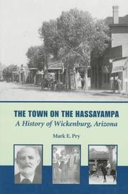
Search results from Open Library.
Recent natural events nearby
- Wildfire Campwood, Yavapai, ArizonaWildfires · 2026-08-23 · 48 mi
- Prescribed Fire McCRAKEN RX-WRD CY26, Coconino, ArizonaWildfires · 2026-10-01 · 82 mi
- Prescribed Fire Walker Hill Piles RX, Coconino, ArizonaWildfires · 2026-09-28 · 103 mi
- Prescribed Fire D2 Vincent RX, Coconino, ArizonaWildfires · 2026-09-17 · 107 mi
- Prescribed Fire KENDRICK RX-WRD CY26, Coconino, ArizonaWildfires · 2026-10-01 · 109 mi
- Prescribed Fire D2 Dye RX, Coconino, ArizonaWildfires · 2026-09-17 · 110 mi
- Cyclone RachelSevere Storms · 2026-10-11 · 152 mi
- Prescribed Fire D7 Morgan Unit 5 RX, Navajo, ArizonaWildfires · 2026-09-14 · 152 mi
Wildfires, storms and other events from NASA EONET (last 12 months, within 250 mi).
Ground air-quality sensors
Recently spotted species
Nearest stream gauge
Events
Gallery
Sources
- • Wikipedia
- • NOAA National Weather Service
- • Wikidata
- • NCES via Urban Institute Education Data Portal
- • CDC PLACES
- • Open-Meteo / sunrise-sunset.org
- • Wikipedia Pageviews API
- • Open Library
- • NASA EONET