Browse / Brazil / Goiás / Itapirapuã
Itapirapuã
Goiásvillage

Itapirapuã
Total population
8,007
Demographic figures from IBGE. Overview below cites Wikipedia and may reference a different year.
City facts
Sister cities
Facts from Wikidata (CC0).
Overview
Itapirapuã is a municipality in the state of Goiás in Brazil. The population is 4,685 in an area of 2,044 km2. Itapirapuã is a large producer of cattle.
Read more on WikipediaHistory & geography
History
Settlement began in 1892 with the building of an army telegraph line and station between the city of Goiás (then the state capital) and Mato Grosso, breaking the isolation of the area. The name chosen was Itapirapuã, meaning "white stone from the pool of the fish", because it was near a deep pool in the river where a whirlpool was formed around a white stone. After half a century of stagnation the settlement received a push forward with the selling by the local government of lots to new settlers. In 1953 it became a district of Goiás, and in 1959 it separated from Goiás and became an independent municipality.
Excerpted from the corresponding Wikipedia article (CC BY-SA).
Geography
Coordinates & boundaries from the US Census TIGER/Line shapefiles.
Climate
Air quality
Walkability
Amenities nearby
Wildlife & biodiversity
Earthquake history
Photos
Sights & places nearby
Notable people from here
Nearby places in Goiás
Geography & sun
Nearby airports
Public attention
Books about this place
Recent natural events nearby
Ground air-quality sensors
Recently spotted species




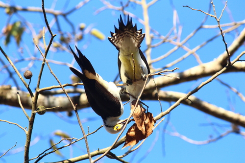
Research-grade observations from iNaturalist (within ~15 mi).
Events
Gallery
Official Identifiers
IBGE — Brazilian Institute of Geography and Statistics
- IBGE code
- 5211008
- UF
- GO
- Mesorregião
- Noroeste Goiano
- Microrregião
- Rio Vermelho
servicodados.ibge.gov.br
Sources
- • Wikipedia
- • Wikidata
- • iNaturalist
- • IBGE — Brazilian national statistics, via servicodados.ibge.gov.br (official municipal code, UF, mesorregião, microrregião, region)
- • IBGE — Brazilian Institute of Geography and Statistics — servicodados.ibge.gov.br