Browse / United States / California / Clovis
Clovis
Californiacity

Clovis
Total population
127,994
Median home value
$503,700
Bachelor's+
Median income
$92,949
Founded
1890
Demographic figures from US Census Bureau · ACS 5-year estimates. Overview below cites Wikipedia and may reference a different year.
City facts
Facts from Wikidata (CC0).
Overview
Clovis is a city in Fresno County, California, United States. It was established in 1890 as a freight stop for the San Joaquin Valley Railroad by a group of Fresno businessmen and Michigan railroad speculator Marcus Pollasky. The railroad bought the land from two farmers and named the station after one of them, Clovis Cole. Pollasky then developed a town on the site, also named Clovis.
Read more on WikipediaHistory & geography
History
The city of Clovis began as a freight stop along the San Joaquin Valley Railroad. Organized on January 15, 1890, by Fresno businessmen Thomas E. Hughes, Fulton Berry, Gilbert R. Osmun, H.D. Colson, John D. Gray, and William M. Williams, in partnership with Michigan railroad speculator Marcus Pollasky, the SJVRR began construction in Fresno on July 4, 1891, and reached the farmlands of Clovis M. Cole and George Owen by October of that year. The railroad purchased right-of-way from both farmers, half from each – the east side from Cole and the west side from Owen – and ran tracks up the borderline between the two properties. The railroad agreed to establish a station on the west side of the tracks and to call it "Clovis." The Clovis station, which was named after Clovis Cole, was positioned on the Owen side of the track. Cole and Owen later sold land to Marcus Pollasky for the development of a townsite. Fresno civil engineer Ingvart Tielman mapped the townsite on behalf of Pollasky on December 29, 1891. The original townsite featured streets named for the officers and principal investors of the railroad: (Benjamin) Woodworth, (Marcus) Pollasky, Fulton (Berry), (Thomas) Hughes, (Gerald) Osmun, and (O. D.) Baron. The townsite, named "Clovis" after Clovis Station by Pollasky, was laid out on what was originally Owen's land. The railroad was completed as far as the town of Hamptonville (now Friant) on the banks of the San Joaquin River, just from its point of origin in Fresno. Articles of Incorporation for the San Joaquin Valley Railroad indicate that the corporation intended to build of track, including sidings and spurs, through the agricultural acreage east of Fresno, then north to the timber and mineral resources of the Sierra foothills. At the time, Hamptonville was…
Geography
According to the United States Census Bureau, the city has a total area of 23.28 square miles (60.29 km2), all of it land. Clovis is situated midway between Los Angeles and San Francisco, bordering Fresno, in the agriculturally rich San Joaquin Valley. Lying at the foot of the Sierra Nevada Mountain Range, which includes Yosemite, Kings Canyon, and Sequoia National Parks, Clovis has been known as "Gateway to the Sierras" since its incorporation in 1912. The formation of alluvial fans in this part of the San Joaquin Valley has led to a rather flat regional geography. The Clovis area has active and potentially active seismic fault zones. The elevation of Clovis is approximately above mean sea datum According to the Flood Hazard Boundary Map produced by the U.S. Department of Housing and Urban Development, part of Clovis is within the 100-year flood zone, such as some of the area near the Clovis Towne Center. The groundwater flow in Clovis is generally to the southwest.
Excerpted from the corresponding Wikipedia article (CC BY-SA).
Demographics & economy
Race & ethnicity
Source: US Census Bureau — American Community Survey, 5-year estimates.
Geography
Coordinates & boundaries from the US Census TIGER/Line shapefiles.
Climate
Current forecast
Forecast for Clovis, CA from NOAA NWS API.
Air quality
Industrial & pollution facilities
Natural hazard risk
Health (adults)
Walkability
Amenities nearby
Wildlife & biodiversity
Most-observed species
- California/Woodhouse's Scrub-JayAphelocoma californica (Vigors, 1839) · Aves7,163
- Mourning DoveZenaida macroura (Linnaeus, 1758) · Aves7,080
- House FinchHaemorhous mexicanus (P.L.Statius Müller, 1776) · Aves5,861
- Black PhoebeSayornis nigricans (Swainson, 1827) · Aves5,628
- Canada Goose (canadensis Group)Branta canadensis (Linnaeus, 1758) · Aves5,565
- Northern MockingbirdMimus polyglottos (Linnaeus, 1758) · Aves5,466
- Anna's HummingbirdCalypte anna (R.Lesson, 1829) · Aves5,130
- MallardAnas platyrhynchos Linnaeus, 1758 · Aves4,929
Citizen-science & research observations from the Global Biodiversity Information Facility (GBIF).
Schools
Earthquake history
Photos
Sights & places nearby
Notable people from here


People born within ~10 km, from Wikidata (CC0). Click any name for their Wikipedia article.
Nearby places in California
- Mayfair5.9 mi away · pop. 5,044
- Old Fig Garden7 mi away
- Malaga10.5 mi away
- Parlier17.1 mi away
- Biola18.7 mi away · pop. 1,070
- Reedley20.7 mi away · pop. 25,609
- Parkwood21.2 mi away
- La Vina24 mi away · pop. 789
- El Monte Mobile Village24.2 mi away
- Orange Cove24.8 mi away
- Dinuba25.2 mi away · pop. 25,475
- Delft Colony25.5 mi away
Geography & sun
Elevation, sunrise/sunset and daylight from Open-Meteo. Solar climatology from NASA POWER.
Nearby airports
Public attention
Pageview totals from the Wikimedia Pageviews API.
Books about Clovis

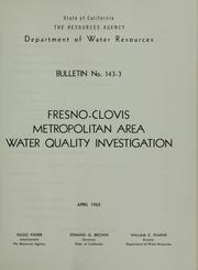

Search results from Open Library.
Recent natural events nearby
- Prescribed Fire CRAWFORD CORRAL RX, Tulare, CaliforniaWildfires · 2026-09-19 · 42 mi
- Wildfire DOME, Mariposa, CaliforniaWildfires · 2026-09-15 · 51 mi
- Wildfire PLAINS, San Luis Obispo, CaliforniaWildfires · 2026-08-12 · 99 mi
- Wildfire CYRUS, Kern, CaliforniaWildfires · 2026-10-09 · 105 mi
- Wildfire GANN, Calaveras, CaliforniaWildfires · 2026-08-03 · 107 mi
- Wildfire Plaskett, Monterey, CaliforniaWildfires · 2026-08-26 · 115 mi
- Wildfire Timber, Monterey, CaliforniaWildfires · 2026-08-09 · 121 mi
- Wildfire BUZZARD, Kern, CaliforniaWildfires · 2026-08-05 · 140 mi
Wildfires, storms and other events from NASA EONET (last 12 months, within 250 mi).
Ground air-quality sensors
Recently spotted species
Nearest stream gauge
Events
Gallery
Sources
- • Wikipedia
- • US Census Bureau (ACS 5-year estimates)
- • NOAA National Weather Service
- • Wikidata
- • GBIF (Global Biodiversity Information Facility)
- • Open-Meteo / sunrise-sunset.org
- • Wikipedia Pageviews API
- • Open Library
- • NASA EONET