Browse / United States / California / Colma
Colma
Californiatown

Colma
Total population
1,636
Median home value
$1,062,000
Bachelor's+
Median income
$148,295
Founded
1924
Demographic figures from US Census Bureau · ACS 5-year estimates. Overview below cites Wikipedia and may reference a different year.
- Coastal Flood Advisory · MinorCoastal Flood Advisory issued October 1 at 12:20PM PDT until October 2 at 6:00PM PDT by NWS San Francisco CA
- Heat Advisory · ModerateHeat Advisory issued October 1 at 9:43AM PDT until October 4 at 10:00PM PDT by NWS San Francisco CA
Source: NOAA National Weather Service.
City facts
Facts from Wikidata (CC0).
Overview
Colma is a small incorporated town in San Mateo County, California, United States, on the San Francisco Peninsula in the San Francisco Bay Area. The population was 1,507 at the 2020 census. The town was founded as a necropolis in 1924.
Read more on WikipediaHistory & geography
History
The community of Colma was formed in the 19th century as a collection of homes and small businesses along El Camino Real and the adjacent San Francisco and San Jose Railroad line. Several churches, including Holy Angels Catholic Church, were founded in these early years. The community founded its own fire district, which serves the unincorporated area of Colma north of the town limits, as well as the area that became a town in 1924. Heinrich (Henry) von Kempf moved his wholesale nursery here in the early part of the 20th century, from the land where the Palace of Fine Arts currently sits. The business was growing, and thus required more space for von Kempf's plants and trees. Von Kempf then began petitioning to turn the Colma community into an agricultural township. He succeeded and became the town of Colma's first treasurer. In the early 20th century, Colma was the site of many major boxing events. Middleweight world champion Stanley Ketchel fought six bouts at the Mission Street Arena in Colma, including two world middleweight title bouts against Billy Papke and a world heavyweight title bout against Jack Johnson. Colma became the site for numerous cemeteries after San Francisco outlawed new interments within its city limits in 1900, then evicted most existing cemeteries in 1912. In the 1910s, many of the roads to Colma were not maintained. Bodies were transported by street cars in San Francisco down Valencia Street in the Mission District; which resulted in many mortuaries and funeral homes in this location for quick access to Colma. The Town of Lawndale was incorporated in 1924, primarily at the behest of the cemetery owners with the cooperation of the handful of residents who lived closest to the cemeteries. The residential and business areas immediately to the…
Excerpted from the corresponding Wikipedia article (CC BY-SA).
Demographics & economy
Race & ethnicity
Source: US Census Bureau — American Community Survey, 5-year estimates.
Geography
Coordinates & boundaries from the US Census TIGER/Line shapefiles.
Climate
Current forecast
Forecast for Colma, CA from NOAA NWS API.
Air quality
Industrial & pollution facilities
Natural hazard risk
Health (adults)
Age-adjusted prevalence estimates from CDC PLACES (latest release).
Walkability
Amenities nearby
Wildlife & biodiversity
Schools
Largest nearby schools
- San Mateo HighHigh · San Mateo · 1,613 students · 19.2:1 ratio
- Burlingame HighHigh · Burlingame · 1,519 students · 21.1:1 ratio
- Westmoor HighHigh · Daly City · 1,302 students · 22.4:1 ratio
- South San Francisco HighHigh · South San Francisco · 1,280 students · 19.4:1 ratio
- El Camino HighHigh · South San Francisco · 1,173 students · 18.9:1 ratio
- Jefferson HighHigh · Daly City · 1,159 students · 21.1:1 ratio
- Mills HighHigh · Millbrae · 1,141 students · 21.5:1 ratio
- Capuchino HighHigh · San Bruno · 1,091 students · 17.9:1 ratio
Public K–12 schools within ~10 mi from Urban Institute Education Data Portal (NCES Common Core of Data, 2022).
Earthquake history
Photos
Sights & places nearby
Notable people from here


People born within ~10 km, from Wikidata (CC0). Click any name for their Wikipedia article.
Nearby places in California
- Broadmoor1.9 mi away
- Burlingame7.7 mi away · pop. 31,386
- El Granada11.2 mi away
- Baywood Park11.9 mi away
- Highlands12.3 mi away
- Foster City13.5 mi away · pop. 33,805
- Belvedere13.6 mi away
- Emeryville13.9 mi away
- Alto16.2 mi away
- Albany16.5 mi away · pop. 20,271
- Emerald Lake Hills17.8 mi away
- Corte Madera17.9 mi away
Geography & sun
Elevation, sunrise/sunset and daylight from Open-Meteo. Solar climatology from NASA POWER.
Nearby airports
Public attention
Pageview totals from the Wikimedia Pageviews API.
Books about Colma
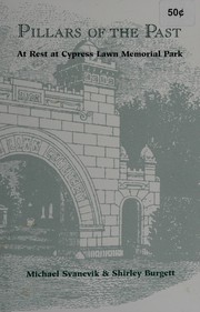


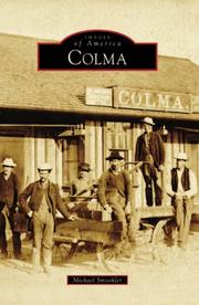

Search results from Open Library.
Recent natural events nearby
- Wildfire GANN, Calaveras, CaliforniaWildfires · 2026-08-03 · 96 mi
- Wildfire FELIZ, Mendocino, CaliforniaWildfires · 2026-08-01 · 99 mi
- Wildfire Timber, Monterey, CaliforniaWildfires · 2026-08-09 · 109 mi
- Wildfire LUCAS, Lake, CaliforniaWildfires · 2026-09-10 · 111 mi
- Wildfire LUCAS, Lake, CaliforniaWildfires · 2026-09-10 · 112 mi
- Wildfire Plaskett, Monterey, CaliforniaWildfires · 2026-08-26 · 135 mi
- Wildfire DOME, Mariposa, CaliforniaWildfires · 2026-09-15 · 155 mi
- Wildfire FLORISTON, Nevada, CaliforniaWildfires · 2026-09-16 · 177 mi
Wildfires, storms and other events from NASA EONET (last 12 months, within 250 mi).
Ground air-quality sensors
Recently spotted species
Nearest stream gauge
Events
Gallery
Sources
- • Wikipedia
- • US Census Bureau (ACS 5-year estimates)
- • NOAA National Weather Service
- • Wikidata
- • NCES via Urban Institute Education Data Portal
- • CDC PLACES
- • Open-Meteo / sunrise-sunset.org
- • Wikipedia Pageviews API
- • Open Library
- • NASA EONET