Browse / United States / California / El Sobrante
El Sobrante
CaliforniaCDP
Total population
13,129
Median home value
$836,300
Bachelor's+
Median income
$165,682
Air quality index
Demographic figures from US Census Bureau · ACS 5-year estimates. Overview below cites Wikipedia and may reference a different year.
- Extreme Heat Warning · SevereExtreme Heat Warning issued October 5 at 11:29AM PDT until October 8 at 8:00PM PDT by NWS San Diego CA
Source: NOAA National Weather Service.
City facts
Overview
El Sobrante is a small census-designated community in California, United States. Coordinates of 33.872°, -117.463° situate El Sobrante in the warm-temperate zone of the northern hemisphere. Around 13,129 people are recorded as living there in the most recent open data. Solar-resource estimates put the area at about 1,979 kWh/m² of solar irradiance per year with sunshine for roughly 77% of daylight hours. The census-designated community extends across about 18.7 km². Climatically, locations at this latitude tend to experience warm summers and cool winters. At 702 people per km², the census-designated community shows an average residential density. Open-data panels below dive into population trends, climate normals, environmental indicators and nearby places.
Summary composed automatically from structured open data on this page. See our Terms for details.
History & geography
Demographics & economy
Race & ethnicity
Source: US Census Bureau — American Community Survey, 5-year estimates.
Geography
Coordinates & boundaries from the US Census TIGER/Line shapefiles.
Climate
Current forecast
Forecast for El Sobrante, CA from NOAA NWS API.
Air quality
Current readings from Open-Meteo Air Quality API (Copernicus CAMS European reanalysis).
Industrial & pollution facilities
Natural hazard risk
Health (adults)
Age-adjusted prevalence estimates from CDC PLACES (latest release).
Walkability
Amenities nearby
Wildlife & biodiversity
Most-observed species
- House FinchHaemorhous mexicanus (P.L.Statius Müller, 1776) · Aves13,665
- Lesser GoldfinchSpinus psaltria (Say, 1822) · Aves11,074
- Mourning DoveZenaida macroura (Linnaeus, 1758) · Aves10,161
- Anna's HummingbirdCalypte anna (R.Lesson, 1829) · Aves10,151
- Black PhoebeSayornis nigricans (Swainson, 1827) · Aves9,351
- California TowheeMelozone crissalis (Vigors, 1839) · Aves9,153
- American CrowCorvus brachyrhynchos C.L.Brehm, 1822 · Aves8,877
- Common RavenCorvus corax Linnaeus, 1758 · Aves8,402
Citizen-science & research observations from the Global Biodiversity Information Facility (GBIF).
Schools
Largest nearby schools
- Eleanor Roosevelt HighHigh · Eastvale · 4,566 students · 25.8:1 ratio
- Santiago HighHigh · Corona · 3,460 students · 25.8:1 ratio
- Centennial HighHigh · Corona · 3,037 students · 25.1:1 ratio
- Martin Luther King Jr. HighHigh · Riverside · 2,901 students · 25.4:1 ratio
- Polytechnic HighHigh · Riverside · 2,660 students · 25.8:1 ratio
- Patriot HighHigh · Jurupa Valley · 2,532 students · 23.2:1 ratio
- Corona HighHigh · Corona · 2,251 students · 23.9:1 ratio
- Ramona HighHigh · Riverside · 2,220 students · 23.9:1 ratio
Public K–12 schools within ~10 mi from Urban Institute Education Data Portal (NCES Common Core of Data, 2022).
Earthquake history
Most recent
- M 2.81 — 2026-10-0532 km SW of Dana Point, CA
- M 3.48 — 2026-10-0531 km SW of Dana Point, CA
- M 3.55404092525043 — 2026-09-277 km WSW of Hermosa Beach, CA
- M 2.63 — 2026-09-239 km WNW of Anza, CA
- M 2.94 — 2026-09-174 km SSE of Compton, CA
- M 2.65 — 2026-09-124 km E of Lennox, CA
Events from the USGS Earthquake Catalog (global) (FDSN Event Web Service).
Photos
Sights & places nearby
Notable people from here


People born within ~10 km, from Wikidata (CC0). Click any name for their Wikipedia article.
Nearby places in California
- Bloomington13.4 mi away · pop. 25,698
- Grand Terrace13.9 mi away · pop. 13,078
- Modjeska14.8 mi away · pop. 714
- Loma Linda17 mi away · pop. 25,122
- North Tustin20.5 mi away
- Muscoy20.6 mi away
- Las Flores22 mi away · pop. 5,513
- San Antonio Heights22.6 mi away
- Laguna Woods23.7 mi away · pop. 17,289
- Mentone23.8 mi away · pop. 9,514
- Rowland Heights25.5 mi away · pop. 45,911
- San Dimas25.6 mi away · pop. 33,789
Geography & sun
Elevation, sunrise/sunset and daylight from Open-Meteo. Solar climatology from NASA POWER.
Nearby airports
Public attention
Books about El Sobrante
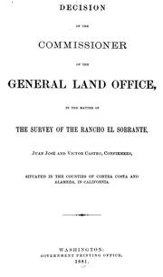
Search results from Open Library.
Recent natural events nearby
Ground air-quality sensors
Recently spotted species
Nearest stream gauge
Events
Gallery
Sources
- • US Census Bureau (ACS 5-year estimates)
- • NOAA National Weather Service
- • Wikidata
- • Open-Meteo Air Quality (CAMS)
- • USGS Earthquake Catalog (global feed)
- • NCES via Urban Institute Education Data Portal
- • GBIF (Global Biodiversity Information Facility)
- • CDC PLACES
- • Open-Meteo / sunrise-sunset.org
- • Open Library