Browse / United States / California / Hanford
Hanford
Californiacity

Hanford
Total population
59,754
Median home value
$349,400
Bachelor's+
Median income
$76,461
Demographic figures from US Census Bureau · ACS 5-year estimates. Overview below cites Wikipedia and may reference a different year.
- Heat Advisory · ModerateHeat Advisory issued October 1 at 9:30AM PDT until October 4 at 10:00PM PDT by NWS Hanford CA
Source: NOAA National Weather Service.
City facts
Sister cities
Facts from Wikidata (CC0).
Overview
Hanford is the most populous city in and is the county seat of Kings County, California, United States, located in the San Joaquin Valley region of the greater Central Valley. The population was 57,990 at the 2020 census.
Read more on WikipediaHistory & geography
History
Hanford was once north of Tulare Lake, historically the largest body of fresh water west of the Mississippi River. The area was inhabited by the Tachi Yokuts Indians for several thousand years prior to Euro-American contact. They occupied locations along watercourses such as creeks, springs and seep areas (such as sloughs), along perennial and seasonal drainages, as well as flat ridges and terraces. Since the annexation of California after the Mexican-American War, the locality was settled by Americans and immigrants as farmland, broadly referred to as "Mussel Slough". The earliest dated grave in the area was that of a young Alice Spangler who was initially buried in the Kings River Cemetery just north of her family's farm in 1860. As the settlement grew, Tulare Lake's feeding rivers were diverted for agricultural irrigation, causing it to gradually shrink and, over the 19th and 20th centuries, dry up. From the mid-to-late 1870s, the Southern Pacific Railroad planned to lay tracks towards the developing farmland west of Visalia, spurring a growth in labor and population. Hanford's namesake was James Madison Hanford, an executive for the company. The earliest known document labeling the settlement as "Hanford" is an 1876 map of Tulare County which once included the territory of present-day Kings County. Tracks were laid through a sheep camp in 1877. According to History of Kings County: "It was but a short step from sheep-camp to village and with the railroad as an attraction the village flourished and became a town within a few historic months." Many of those working on the tracks were Chinese immigrants. In 1877, Hanford began to appear in state newspapers, giving details of events in the town's early days. In 1878, Hanford began running their own newspaper service…
Geography
Hanford is situated in the south-central portion of California's San Joaquin Valley, south-southeast of the city of Fresno and west of the city of Visalia. The city is above sea level and has a flat terrain. According to the United States Census Bureau, the city has a total area of , all land. Hanford's land was once a drainage basin for Tulare Lake. Hanford has a cool semi-arid climate (Köppen BSk) typical of the San Joaquin Valley floor with sweltering, dry summers and cool winters characterized by dense tule fog. The wetter season occurs from November through March. The average annual rainfall over the ten years from 1997/98 through 2006/07 was , although the wettest "rain year" from July 1968 to June 1969 totalled and the driest from July 2013 to June 2014 only . The wettest month has been January 1969 with , and the wettest day February 24, 2023 with . Hanford falls within USDA plant hardiness zones 9a () and 9b (). The coldest temperature on record has been on January 6 and January 7, 1913. ;Notes:
Excerpted from the corresponding Wikipedia article (CC BY-SA).
Demographics & economy
Race & ethnicity
Source: US Census Bureau — American Community Survey, 5-year estimates.
Geography
Coordinates & boundaries from the US Census TIGER/Line shapefiles.
Climate
Current forecast
Forecast for Hanford, CA from NOAA NWS API.
Air quality
Industrial & pollution facilities
Natural hazard risk
Health (adults)
Age-adjusted prevalence estimates from CDC PLACES (latest release).
Walkability
Amenities nearby
Wildlife & biodiversity
Most-observed species
- Northern MockingbirdMimus polyglottos (Linnaeus, 1758) · Aves961
- House FinchHaemorhous mexicanus (P.L.Statius Müller, 1776) · Aves915
- European StarlingSturnus vulgaris Linnaeus, 1758 · Aves854
- House SparrowPasser domesticus (Linnaeus, 1758) · Aves824
- Eurasian Collared-DoveStreptopelia decaocto (Frivaldszky, 1838) · Aves821
- American CrowCorvus brachyrhynchos C.L.Brehm, 1822 · Aves815
- California/Woodhouse's Scrub-JayAphelocoma californica (Vigors, 1839) · Aves764
- Black PhoebeSayornis nigricans (Swainson, 1827) · Aves731
Citizen-science & research observations from the Global Biodiversity Information Facility (GBIF).
Schools
Earthquake history
Most recent
- M 2.55 — 2026-10-049 km WSW of Corcoran, CA
- M 2.51 — 2026-09-244 km ENE of Orange Cove, CA
- M 2.6 — 2026-08-2611 km NNW of Corcoran, CA
- M 2.75 — 2026-08-234 km NW of Parkfield, CA
- M 2.85 — 2026-08-218 km WNW of Corcoran, CA
- M 3.34 — 2026-08-0410 km NNE of Kettleman City, CA
Events from the USGS Earthquake Catalog (global) (FDSN Event Web Service).
Photos
Sights & places nearby
Notable people from here


People born within ~10 km, from Wikidata (CC0). Click any name for their Wikipedia article.
Nearby places in California
- Home Garden2 mi away
- Delft Colony17.3 mi away
- El Monte Mobile Village19.8 mi away
- Matheny20.1 mi away · pop. 572
- Patterson Tract20.3 mi away
- Parlier20.4 mi away
- Dinuba20.7 mi away · pop. 25,475
- Reedley22 mi away · pop. 25,609
- East Tulare Villa22.5 mi away
- Cutler24.5 mi away · pop. 4,361
- Malaga24.8 mi away
- Orosi25.1 mi away
Geography & sun
Elevation, sunrise/sunset and daylight from Open-Meteo. Solar climatology from NASA POWER.
Nearby airports
Public attention
Pageview totals from the Wikimedia Pageviews API.
Books about Hanford

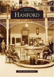
Search results from Open Library.
Recent natural events nearby
- Prescribed Fire CRAWFORD CORRAL RX, Tulare, CaliforniaWildfires · 2026-09-19 · 42 mi
- Wildfire PLAINS, San Luis Obispo, CaliforniaWildfires · 2026-08-12 · 66 mi
- Wildfire DOME, Mariposa, CaliforniaWildfires · 2026-09-15 · 86 mi
- Wildfire Plaskett, Monterey, CaliforniaWildfires · 2026-08-26 · 102 mi
- Wildfire BUZZARD, Kern, CaliforniaWildfires · 2026-08-05 · 107 mi
- Wildfire Timber, Monterey, CaliforniaWildfires · 2026-08-09 · 115 mi
- Wildfire RIDGE, Los Angeles, CaliforniaWildfires · 2026-08-07 · 116 mi
- Wildfire GANN, Calaveras, CaliforniaWildfires · 2026-08-03 · 138 mi
Wildfires, storms and other events from NASA EONET (last 12 months, within 250 mi).
Ground air-quality sensors
Recently spotted species
Nearest stream gauge
Events
Gallery
Sources
- • Wikipedia
- • US Census Bureau (ACS 5-year estimates)
- • NOAA National Weather Service
- • Wikidata
- • USGS Earthquake Catalog (global feed)
- • GBIF (Global Biodiversity Information Facility)
- • CDC PLACES
- • Open-Meteo / sunrise-sunset.org
- • Wikipedia Pageviews API
- • Open Library
- • NASA EONET