Browse / Canada / Ontario / Smiths Falls
Smiths Falls
Ontariotown

Smiths Falls
Total population
9,254
Founded
1854
Demographic figures from Statistics Canada. Overview below cites Wikipedia and may reference a different year.
City facts
Sister cities
Facts from Wikidata (CC0).
Overview
Smiths Falls is a town in Eastern Ontario, Canada, 78 kilometres (48 mi) southwest of Ottawa. As of the 2021 census it has a population of 9,254. It is in the Census division for Lanark County, but is administratively separated from the county. The Rideau Canal waterway passes through the town, with four separate locks in three locations and a combined lift of over 15 metres (49.2 ft).
Read more on WikipediaHistory & geography
History
Smiths Falls was incorporated first as a village in 1854, and then as a town in 1882. It is named after Thomas Smyth, an Irish born United Empire Loyalist (abt. 1758-1832) who in 1786 was granted in what is present-day Smiths Falls. He served as Lieutenant in Sir John Johnson’s King's Royal Regiment of New York and later as Major in the Leeds Militia. The Heritage House Museum (c. 1862), also known as the Ward House, was designated under the Ontario Heritage Act in 1977. In about 1920, the town council voted to change the name from Smith's Falls to Smiths Falls, and this spelling entered general use, but in 1967 the Ontario Municipal Board stated that it was not official and the town's legal documents must use the spelling Smith's Falls found in the 1882 order-in-council of incorporation. The town then applied to the provincial government for an official change to Smiths Falls, and in 1968 the legislature granted the change by private bill. At the time of construction of the Rideau Canal a small settlement had been established around a mill operated by Abel Russell Ward, who had bought Smyth's land. Colonel By ordered the removal of Ward's mill to make way for the canal. He settled with Ward for £1,500, one of the largest claims made by mill owners on the canal. The disruption of industry caused by the building of the canal was only temporary, and Smiths Falls grew rapidly following construction. An article in Smith's Gazetteer in 1846 described the town as a "flourishing little village pleasantly situated on the Rideau River and on the Canal, from Perth. It contains about 700 inhabitants. There are fifty dwellings, two grist mills (one with four run of stones), two sawmills, one carding and fulling mill, seven stores, six groceries, one axe factory, six…
Excerpted from the corresponding Wikipedia article (CC BY-SA).
Geography
Coordinates & boundaries from the US Census TIGER/Line shapefiles.
Climate
Air quality
Walkability
Amenities nearby
Wildlife & biodiversity
Earthquake history
Photos
Sights & places nearby
Notable people from here


People born within ~10 km, from Wikidata (CC0). Click any name for their Wikipedia article.
Nearby places in Ontario
Geography & sun
Elevation, sunrise/sunset and daylight from Open-Meteo. Solar climatology from NASA POWER.
Nearby airports
Public attention
Pageview totals from the Wikimedia Pageviews API.
Books about Smiths Falls

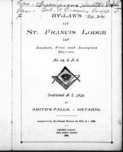

Search results from Open Library.
Recent natural events nearby
Ground air-quality sensors
Recently spotted species
Events
Gallery
Official Identifiers
StatCan — Statistics Canada
- SGC code
- 3509004
- Population (Wikidata)
- 8,780
- Wikidata
- Q1938153
Standard Geographical Classification (SGC) via Wikidata P3012
Sources
- • Wikipedia
- • Wikidata
- • Open-Meteo / sunrise-sunset.org
- • Wikipedia Pageviews API
- • Open Library
- • StatCan — Statistics Canada — Standard Geographical Classification (SGC) via Wikidata P3012