Browse / United States / Colorado / Golden
Golden
Coloradocity

Golden
Total population
20,417
Median home value
$837,700
Bachelor's+
Median income
$98,582
Founded
1859
Demographic figures from US Census Bureau · ACS 5-year estimates. Overview below cites Wikipedia and may reference a different year.
City facts
Sister cities
Facts from Wikidata (CC0).
Overview
Golden is a home rule city that is the county seat of Jefferson County, Colorado, United States. The city population was 20,399 at the 2020 United States census. Golden lies along Clear Creek at the base of the Front Range of the Rocky Mountains. Founded during the Pike's Peak gold rush on June 16, 1859, the mining camp was originally named Golden City in honor of Thomas L. Golden. Golden City served as the capital of the provisional Territory of Jefferson from 1860 to 1861, and capital of the official Territory of Colorado from 1862 to 1867. In 1867, the territorial capital was moved about 12 miles (19 km) east to Denver City. Golden is now a part of the Denver-Aurora-Centennial, CO Metropolitan Statistical Area and the Front Range Urban Corridor.
Read more on WikipediaHistory & geography
History
Established during the Pike's Peak Gold Rush, Golden City quickly became a leading economic and political center of the region. Its geographic location made it a center of trade between the gold fields to the west and settlements to the east. Golden City was established on June 16, 1859, along Clear Creek west of Denver. The city is named after Thomas L. Golden. Other important businessmen and prospectors like William A.H. Loveland and George West were among the first people to settle in Golden. By the end of 1860, Golden City had been popularly elected the seat of Jefferson County and was capital of the provisional Jefferson Territory. As drafted in the territorial constitution, the capital of the Jefferson Territory was initially proposed to be Golden, then with a population of 700, as a result of its proximity to mountain mining towns, and greater ability to hold a congressional quorum than had Denver. Golden City was temporarily removed from the status of territory capital as a result of an act passed on November 5, 1861, by the territorial government. Colorado City, a small town to the south of Denver, became the new temporary territorial capital, but saw only one short event at this location. This status was quickly revoked, however, as on August 4, 1862, the territorial government voted formally to move back to Golden. While the town lost much of its populace and leading citizenry during the Civil War for several reasons (ranging from military to economic), Golden City became capital of the federally recognized Colorado Territory on August 2, 1862, continuing as such until 1867. Between 1862 and the early 1870s a fierce railroad competition developed between Denver, to the east, and Golden. By the mid-1860s, Golden held a functionally honorific status as…
Geography
Golden lies just north of I-70 and west of Denver at the foot of the Rocky Mountains. It is situated between Lookout Mountain and the two Table Mountains, within a sheltered valley fed by Clear Creek. Clear Creek flows through town from the west, out of its canyon shared by US 6, and exits the valley it carved between North Table Mountain and South Table Mountain and in which is located the Coors Brewery. At the 2020 United States census, the city had a total area of including of water.
Excerpted from the corresponding Wikipedia article (CC BY-SA).
Demographics & economy
Race & ethnicity
Source: US Census Bureau — American Community Survey, 5-year estimates.
Geography
Coordinates & boundaries from the US Census TIGER/Line shapefiles.
Climate
Current forecast
Forecast for Golden, CO from NOAA NWS API.
Air quality
Industrial & pollution facilities
Natural hazard risk
Health (adults)
Age-adjusted prevalence estimates from CDC PLACES (latest release).
Walkability
Amenities nearby
Wildlife & biodiversity
Most-observed species
- House FinchHaemorhous mexicanus (P.L.Statius Müller, 1776) · Aves69,776
- Black-capped ChickadeePoecile atricapillus (Linnaeus, 1766) · Aves60,111
- Northern FlickerColaptes auratus (Linnaeus, 1758) · Aves58,148
- American RobinTurdus migratorius Linnaeus, 1766 · Aves48,016
- MallardAnas platyrhynchos Linnaeus, 1758 · Aves47,376
- Black-billed MagpiePica hudsonia (Sabine, 1823) · Aves43,661
- Canada Goose (canadensis Group)Branta canadensis (Linnaeus, 1758) · Aves41,737
- American CrowCorvus brachyrhynchos C.L.Brehm, 1822 · Aves41,604
Citizen-science & research observations from the Global Biodiversity Information Facility (GBIF).
Schools
Earthquake history
Most recent
- M 3 — 2025-10-1711 km NNE of Black Forest, Colorado
- M 2.7 — 2025-06-137 km SE of Erie, Colorado
- M 2.5 — 2020-10-242 km ESE of Georgetown, Colorado
- M 2.9 — 2019-03-307 km NE of Greeley, Colorado
- M 3 — 2016-11-068 km ENE of Greeley, Colorado
- M 2.7 — 2016-11-068 km ENE of Greeley, Colorado
Events from the USGS Earthquake Catalog (global) (FDSN Event Web Service).
Photos
Sights & places nearby
Notable people from here


People born within ~10 km, from Wikidata (CC0). Click any name for their Wikipedia article.
Nearby places in Colorado
- Idledale5.4 mi away
- Indian Hills8 mi away · pop. 986
- Evergreen10 mi away · pop. 8,602
- Pine Valley11.3 mi away · pop. 392
- Bow Mar11.7 mi away
- Sheridan12.2 mi away
- Ken Caryl12.6 mi away
- Upper Witter Gulch12.8 mi away
- Superior13.3 mi away · pop. 13,305
- Eldorado Springs13.7 mi away
- Aspen Park14.5 mi away
- Glendale14.8 mi away · pop. 4,531
Geography & sun
Elevation, sunrise/sunset and daylight from Open-Meteo. Solar climatology from NASA POWER.
Nearby airports
Public attention
Pageview totals from the Wikimedia Pageviews API.
Books about Golden
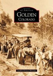

Search results from Open Library.
Recent natural events nearby
- Wildfire 310, Garfield, ColoradoWildfires · 2026-08-06 · 149 mi
- Wildfire Moonshine, Albany, WyomingWildfires · 2026-09-07 · 153 mi
- Wildfire Post, Las Animas, ColoradoWildfires · 2026-08-11 · 189 mi
- Wildfire Rio Blanco, Archuleta, ColoradoWildfires · 2026-07-28 · 205 mi
- Wildfire Cold Springs, Converse, WyomingWildfires · 2026-08-10 · 207 mi
- Wildfire Sheep Pen, Las Animas, ColoradoWildfires · 2026-08-12 · 212 mi
- Wildfire LAUGHLIN, Colfax, New MexicoWildfires · 2026-08-25 · 226 mi
- Wildfire Rayado Mesa, Colfax, New MexicoWildfires · 2026-07-27 · 237 mi
Wildfires, storms and other events from NASA EONET (last 12 months, within 250 mi).
Ground air-quality sensors
Recently spotted species
Nearest stream gauge
Live readings from USGS NWIS · measured 2026-09-11 03:45 UTC.
Events
Gallery
Sources
- • Wikipedia
- • US Census Bureau (ACS 5-year estimates)
- • NOAA National Weather Service
- • Wikidata
- • USGS Earthquake Catalog (global feed)
- • USGS NWIS (water data)
- • GBIF (Global Biodiversity Information Facility)
- • CDC PLACES
- • Open-Meteo / sunrise-sunset.org
- • Wikipedia Pageviews API
- • Open Library
- • NASA EONET