Browse / United States / Connecticut / Groton
Groton
Connecticutcity

Groton
Total population
9,490
Median home value
$306,600
Bachelor's+
Median income
$79,577
Founded
1705
Air quality index
Demographic figures from US Census Bureau · ACS 5-year estimates. Overview below cites Wikipedia and may reference a different year.
City facts
Facts from Wikidata (CC0).
Overview
Groton is a town in New London County, Connecticut, located on the Thames River. It is the home of General Dynamics Electric Boat, which is the major contractor for submarine work for the United States Navy. The Naval Submarine Base New London is located in Groton, and the pharmaceutical company Pfizer is also a major employer. Avery Point in Groton is home to a regional campus of the University of Connecticut. The town is part of the Southeastern Connecticut Planning Region. The population was 38,411 at the 2020 census.
Read more on WikipediaHistory & geography
History
Groton was established in 1705 when it separated from New London. The town was named after Groton, Suffolk in England. A hundred years before it was established, the Niantic people settled in the area between the Thames River and Pawcatuck River, but they eventually settled in Westerly, Rhode Island. The newcomers to the land were the Pequots, an Algonquian people who moved into the Connecticut River Valley. The summer of 1614 was the first time that the Pequots encountered white settlers. They started trading furs for the settlers' goods, such as steel knives, needles, and boots. In 1633, the Dutch bought land from them and opened a fur trading post. Meanwhile, the English bought land for settlement from the local tribes. The land was poor for farming, but access to the region's waterways left room for commerce and trade, and Groton became a town of ocean-going settlers. Most of the community began to build ships, and soon traders made their way to Massachusetts Bay Colony and Plymouth Colony to trade for food, tools, weapons, and clothing. John Leeds was the earliest shipbuilder, coming as a sea captain from Kent, England. He built a 20-ton brigantine, a two-masted sailing ship with square-rigged sails on the foremast and fore-and-aft sails on the mainmast. Thomas Starr built a 67-ton square-sterned vessel, and Thomas Latham launched a 100-ton brig on the Groton bank with mast standing and fully rigged. The sturdy ships built in Groton engaged in highly profitable trade with the islands of the Caribbean. The Battle of Groton Heights was fought on September 6, 1781, between American troops led by Colonel William Ledyard and British forces led by Benedict Arnold. At sunrise, a force of 1,700 British regulars landed at the mouth of the Thames River in New London and…
Geography
According to the United States Census Bureau, the town has a total area of , of which is land and , or 31.47%, is water. * Burnett's Corner—historic district located along Packer Road south of Route 184 * Center Groton * City of Groton—located along the Thames River ** Groton Heights or Groton Bank—historic district in the northern part of the city area * Groton Long Point * Long Hill * Mystic (06355)—a village within both the town of Stonington and the Town of Groton * Noank * Old Mystic * Poquonnock Bridge ** Fort Hill * Submarine Base area (Census designation: "Conning Towers-Nautilus Park") Other minor communities and geographic features are Bluff Point, Eastern Point, Esker Point, Jupiter Point, Mumford Cove, and West Pleasant Valley. Groton has a humid continental climate (Dfa) that closely borders a humid subtropical climate (Dfa).
Excerpted from the corresponding Wikipedia article (CC BY-SA).
Demographics & economy
Race & ethnicity
Source: US Census Bureau — American Community Survey, 5-year estimates.
Geography
Coordinates & boundaries from the US Census TIGER/Line shapefiles.
Climate
Current forecast
Forecast for Groton, CT from NOAA NWS API.
Air quality
Current readings from Open-Meteo Air Quality API (Copernicus CAMS European reanalysis).
Industrial & pollution facilities
Natural hazard risk
Health (adults)
Age-adjusted prevalence estimates from CDC PLACES (latest release).
Walkability
Amenities nearby
Wildlife & biodiversity
Most-observed species
- American herring gull, Smithsonian GullLarus smithsonianus Coues, 1862 · Aves16,299
- Song SparrowMelospiza melodia (A.Wilson, 1810) · Aves14,403
- Northern CardinalCardinalis cardinalis (Linnaeus, 1758) · Aves12,242
- American CrowCorvus brachyrhynchos C.L.Brehm, 1822 · Aves11,729
- Black-capped ChickadeePoecile atricapillus (Linnaeus, 1766) · Aves11,718
- Carolina WrenThryothorus ludovicianus (Latham, 1790) · Aves11,664
- Blue JayCyanocitta cristata (Linnaeus, 1758) · Aves11,403
- Tufted TitmouseBaeolophus bicolor (Linnaeus, 1766) · Aves11,062
Citizen-science & research observations from the Global Biodiversity Information Facility (GBIF).
Schools
Largest nearby schools
- Robert E. Fitch High SchoolHigh · Groton · 1,005 students · 10.6:1 ratio
- East Lyme High SchoolHigh · East Lyme · 966 students · 10.6:1 ratio
- Groton Middle SchoolMiddle · Groton · 907 students · 11.8:1 ratio
- Ledyard High SchoolHigh · Ledyard · 743 students · 11.8:1 ratio
- Waterford High SchoolHigh · Waterford · 735 students · 11.3:1 ratio
- East Lyme Middle SchoolMiddle · Niantic · 715 students · 11.2:1 ratio
- Ella T. Grasso Technical High SchoolHigh · Groton · 654 students · 13.6:1 ratio
- Gallup Hill SchoolElementary · Ledyard · 618 students · 13.4:1 ratio
Public K–12 schools within ~10 mi from Urban Institute Education Data Portal (NCES Common Core of Data, 2022).
Earthquake history
Most recent
- M 3.6 — 2020-11-0810 km S of Bliss Corner, Massachusetts
- M 2.6 — 2015-01-132 km E of Wauregan, Connecticut
- M 3.3 — 2015-01-120 km NE of Wauregan, Connecticut
- M 2.66 — 2014-08-146 km SW of Deep River Center, Connecticut
Events from the USGS Earthquake Catalog (global) (FDSN Event Web Service).
Photos
Sights & places nearby
Notable people from here


People born within ~10 km, from Wikidata (CC0). Click any name for their Wikipedia article.
Nearby places in Connecticut
- Long Hill1.9 mi away
- Poquonock Bridge2.9 mi away
- Groton Long Point3 mi away
- Conning Towers-Nautilus Park4.4 mi away
- Old Mystic5.8 mi away
- Mystic6.1 mi away · pop. 4,483
- Gales Ferry6.7 mi away
- Oxoboxo River8.8 mi away
- Mashantucket10.8 mi away
- Pawcatuck11.4 mi away
- Essex Village17.1 mi away
- Deep River Center19.7 mi away · pop. 2,407
Geography & sun
Elevation, sunrise/sunset and daylight from Open-Meteo. Solar climatology from NASA POWER.
Nearby airports
Public attention
Pageview totals from the Wikimedia Pageviews API.
Books about Groton
Search results from Open Library.
Recent natural events nearby
Ground air-quality sensors
Recently spotted species


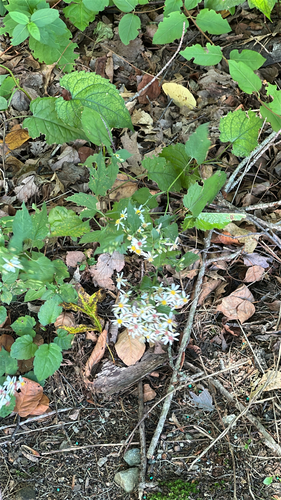

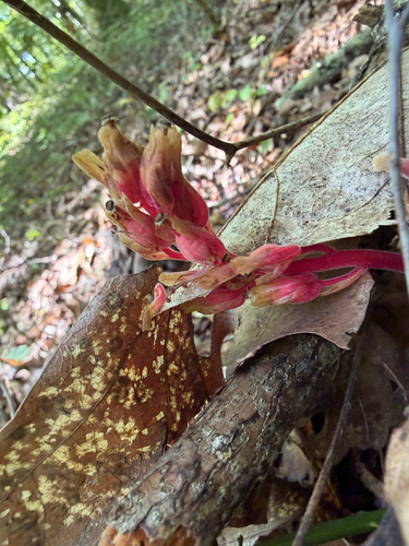
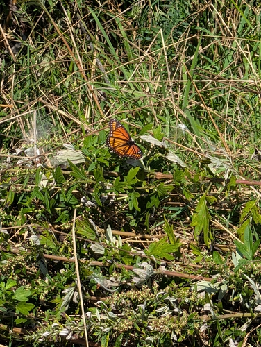


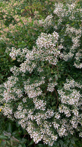
Research-grade observations from iNaturalist (within ~15 mi).
Nearest stream gauge
Live readings from USGS NWIS · measured 2026-09-21 20:30 UTC.
Events
Gallery
Sources
- • Wikipedia
- • US Census Bureau (ACS 5-year estimates)
- • NOAA National Weather Service
- • Wikidata
- • Open-Meteo Air Quality (CAMS)
- • USGS Earthquake Catalog (global feed)
- • USGS NWIS (water data)
- • NCES via Urban Institute Education Data Portal
- • GBIF (Global Biodiversity Information Facility)
- • iNaturalist
- • CDC PLACES
- • Open-Elevation
- • Open-Meteo / sunrise-sunset.org
- • Wikipedia Pageviews API
- • Open Library