Browse / United States / Connecticut / New London
New London
Connecticutcity

New London
Total population
27,625
Median home value
$253,300
Bachelor's+
Median income
$59,098
Founded
1646
Demographic figures from US Census Bureau · ACS 5-year estimates. Overview below cites Wikipedia and may reference a different year.
- Gale Warning · ModerateGale Warning issued September 24 at 2:39AM EDT until September 25 at 6:00PM EDT by NWS Upton NY
- Small Craft Advisory · MinorSmall Craft Advisory issued September 24 at 2:39AM EDT until September 25 at 8:00AM EDT by NWS Upton NY
Source: NOAA National Weather Service.
City facts
Facts from Wikidata (CC0).
Overview
New London is a seaport city and a port of entry on the northeast coast of the United States, located at the outlet of the Thames River in New London County, Connecticut, which empties into Long Island Sound. The city is part of the Southeastern Connecticut Planning Region.
Read more on WikipediaHistory & geography
History
The area was called Nameaug by the Pequot Indians. John Winthrop, Jr. founded the first English settlement here in 1646, making it about the 13th town settled in Connecticut. Inhabitants referred to it informally as Nameaug or as Pequot after the tribe. In the 1650s, the colonists wanted to give the town the official name of London after London, England, but the Connecticut General Assembly wanted to name it Faire Harbour. The citizens protested, declaring that they would prefer it to be called Nameaug if it could not be officially named London. The legislature relented, and the town was officially named New London on March 24, 1658. and consequently New London became a base of American naval operations during the American Revolutionary War and privateers where it has been said no port took more prizes than New London with between 400–800 being credited to New London privateers including the 1781 taking of supply ship Hannah, the largest prize taken during the war. Famous New Londoners during the American Revolution include Nathan Hale, William Coit, Richard Douglass, Thomas and Nathaniel Shaw, Gen. Samuel Parsons, printer Timothy Green, and Bishop Samuel Seabury. New London was raided and much of it burned to the ground on September 6, 1781, in the Battle of Groton Heights by Norwich native Benedict Arnold in an attempt to destroy the Patriot privateer fleet and supplies of goods and naval stores within the city. It is often noted that this raid on New London and Groton was intended to divert General George Washington and the French Army under Rochambeau from their march on Yorktown, Virginia. The main defensive fort for New London was Fort Griswold, located across the Thames River in Groton. It was well known to Arnold, who had already informed the British of this…
Geography
In terms of land area, New London is one of the smallest cities in Connecticut. Of the whole , nearly half is water; is land. The town and city of New London are coextensive. Sections of the original town were ceded to form newer towns between 1705 and 1801. The towns of Groton, Ledyard, Montville, and Waterford, and portions of Salem and East Lyme, now occupy what had earlier been the outlying area of New London. New London is bounded on the west and north by the town of Waterford on the east by the Thames River and Groton and on the south by Long Island Sound. *Downtown New London *Ocean Beach Other minor communities and geographic features include Bates Woods Park, Fort Trumbull, Glenwood Park, Green's Harbor Beach, Mitchell's Woods, Pequot Colony, Riverside Park, Old Town Mill. New London originally had a larger land area when it was established. Towns set off since include: * Stonington in 1649 ** This large area ran from the Mystic River to the Pawcatuck River, including Pawcatuck, Wequetequock, and the easterly half of Mystic. It stretched inland from Long Island Sound to Lantern Hill. ** North Stonington was created from the northern half of Stonington in 1807. * Groton in 1705 ** Ledyard (originally North Groton) created from a part of Groton in 1836. * Montville in 1786. ** Salem created from parts of Montville, Colchester, and Lyme in 1819 * Waterford in 1801. ** East Lyme created from parts of Waterford and Lyme in 1839. * Fishers Island officially left Connecticut and became part of New York in 1879. Using the Köppen climate classification New London has a warm temperate climate. This zone is defined as having a monthly mean temperature above 26.4 °F (−3 C) but below 64.4 °F (18 C) in the coldest month. The city experiences long, hot and…
Excerpted from the corresponding Wikipedia article (CC BY-SA).
Demographics & economy
Race & ethnicity
Source: US Census Bureau — American Community Survey, 5-year estimates.
Geography
Coordinates & boundaries from the US Census TIGER/Line shapefiles.
Climate
Current forecast
Forecast for New London, CT from NOAA NWS API.
Air quality
Industrial & pollution facilities
Natural hazard risk
Health (adults)
Age-adjusted prevalence estimates from CDC PLACES (latest release).
Walkability
Amenities nearby
Wildlife & biodiversity
Schools
Largest nearby schools
- Robert E. Fitch High SchoolHigh · Groton · 1,005 students · 10.6:1 ratio
- East Lyme High SchoolHigh · East Lyme · 966 students · 10.6:1 ratio
- Groton Middle SchoolMiddle · Groton · 907 students · 11.8:1 ratio
- Ledyard High SchoolHigh · Ledyard · 743 students · 11.8:1 ratio
- Waterford High SchoolHigh · Waterford · 735 students · 11.3:1 ratio
- East Lyme Middle SchoolMiddle · Niantic · 715 students · 11.2:1 ratio
- Ella T. Grasso Technical High SchoolHigh · Groton · 654 students · 13.6:1 ratio
- Gallup Hill SchoolElementary · Ledyard · 618 students · 13.4:1 ratio
Public K–12 schools within ~10 mi from Urban Institute Education Data Portal (NCES Common Core of Data, 2022).
Earthquake history
Photos
Sights & places nearby
Notable people from here


People born within ~10 km, from Wikidata (CC0). Click any name for their Wikipedia article.
Nearby places in Connecticut
- Long Hill2.6 mi away
- Conning Towers-Nautilus Park4.2 mi away
- Poquonock Bridge4.4 mi away
- Groton Long Point4.6 mi away
- Gales Ferry6.2 mi away
- Old Mystic6.7 mi away
- Mystic7.4 mi away · pop. 4,483
- Oxoboxo River7.9 mi away
- Mashantucket11.1 mi away
- Pawcatuck12.8 mi away
- Essex Village15.5 mi away
- Deep River Center18.1 mi away · pop. 2,407
Geography & sun
Elevation, sunrise/sunset and daylight from Open-Meteo. Solar climatology from NASA POWER.
Nearby airports
Public attention
Pageview totals from the Wikimedia Pageviews API.
Books about New London


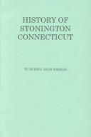


Search results from Open Library.
Recent natural events nearby
Ground air-quality sensors
Recently spotted species
Nearest stream gauge
Events
Gallery
Sources
- • Wikipedia
- • US Census Bureau (ACS 5-year estimates)
- • NOAA National Weather Service
- • Wikidata
- • NCES via Urban Institute Education Data Portal
- • CDC PLACES
- • Open-Meteo / sunrise-sunset.org
- • Wikipedia Pageviews API
- • Open Library